185.26.136.25 - IP Lookup: Free IP Address Lookup, Postal Code Lookup, IP Location Lookup, IP ASN, Public IP
Country:
Region:
City:
Location:
Time Zone:
Postal Code:
ISP:
ASN:
language:
User-Agent:
Proxy IP:
Blacklist:
IP information under different IP Channel
ip-api
Country
Region
City
ASN
Time Zone
ISP
Blacklist
Proxy
Latitude
Longitude
Postal
Route
db-ip
Country
Region
City
ASN
Time Zone
ISP
Blacklist
Proxy
Latitude
Longitude
Postal
Route
IPinfo
Country
Region
City
ASN
Time Zone
ISP
Blacklist
Proxy
Latitude
Longitude
Postal
Route
IP2Location
185.26.136.25Country
Region
catalunya
City
mont-roig del camp
Time Zone
Europe/Madrid
ISP
Language
User-Agent
Latitude
Longitude
Postal
ipdata
Country
Region
City
ASN
Time Zone
ISP
Blacklist
Proxy
Latitude
Longitude
Postal
Route
Popular places and events near this IP address
Agramunt
Municipality in Catalonia, Spain
Distance: Approx. 7849 meters
Latitude and longitude: 41.78333333,1.1
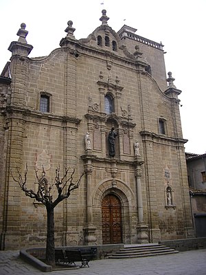
Agramunt (Catalan pronunciation: [aɣɾaˈmun]) is a municipality (municipi) in the comarca of the Urgell in Catalonia. It is situated in the north of the comarca, near the border with the Noguera. The town centre is protected as a historic-artistic monument, especially the Roman church of Santa Maria which dates from the 12th-13th centuries.

Guissona
Municipality in Catalunya, Spain
Distance: Approx. 9767 meters
Latitude and longitude: 41.78694444,1.29
Guissona (Catalan pronunciation: [giˈsona]) is a town and municipality located in the north of the comarca (county) of Segarra, in the Province of Lleida, Catalonia, Spain. With 6,862 inhabitants (2015 census) Guissona (5,170 inhabitants in 2010) is the principal municipality in the northern half of Segarra and the second most populated in the county after Cervera (9,328 inhabitants in 2009). In addition to the populated place of Guissona, the municipality integrates the smaller place of Guarda-si-venes (31 inhabitants in 2007).

Ribera Alta del Ebro
Comarca in Aragon, Spain
Distance: Approx. 4250 meters
Latitude and longitude: 41.78333333,1.15833333
Ribera Alta del Ebro is a comarca in Aragon, Spain. It is located in Zaragoza Province. The capital of Ribera Alta del Ebro is Alagón.

Catalan Central Depression
Depression in Catalonia
Distance: Approx. 9277 meters
Latitude and longitude: 41.83333333,1.18333333
The Catalan Central Depression (Catalan: Depressió Central Catalana) is a natural depression between the Pre-Pyrenees and the Catalan Pre-Coastal Range in Spain. It widens towards the west, linking with the Ebro Depression, Catalan: Depressió de l'Ebre, of which it could be considered an eastern extension. The Catalan Central Depression is about 180 km long with an average width of 50 km.
Ossó de Sió
Municipality in Catalonia, Spain
Distance: Approx. 1381 meters
Latitude and longitude: 41.75,1.16666667
Ossó de Sió is a village in the province of Lleida and autonomous community of Catalonia, Spain.
Els Plans de Sió
Municipality in Catalonia, Spain
Distance: Approx. 2002 meters
Latitude and longitude: 41.76388889,1.19861111
Els Plans de Sió (Catalan pronunciation: [els ˈplanz ðe siˈo]) is a municipality in the province of Lleida and autonomous community of Catalonia, Spain.
Puigverd d'Agramunt
Municipality in Catalonia, Spain
Distance: Approx. 5978 meters
Latitude and longitude: 41.77972222,1.12333333
Puigverd d'Agramunt is a village in the province of Lleida and autonomous community of Catalonia, Spain.

Tarroja de Segarra
Municipality in Catalonia, Spain
Distance: Approx. 8011 meters
Latitude and longitude: 41.73277778,1.27694444
Tarroja de Segarra (Catalan pronunciation: [taˈrɔʒa ðe seˈɣara]) is a village in the province of Lleida and autonomous community of Catalonia, Spain.

Torrefeta i Florejacs
Municipality in Catalonia, Spain
Distance: Approx. 7643 meters
Latitude and longitude: 41.75583333,1.275
Torrefeta i Florejacs (Catalan pronunciation: [ˌtoreˈfetaj floɾeˈʒaks]) is a municipality in the province of Lleida and autonomous community of Catalonia, Spain. The municipality is split into two parts, separated by the municipality of Sanaüja. The bigger southern part contains nearly all the population.

Conill (Tàrrega)
Abandoned village in Catalonia, Spain
Distance: Approx. 5258 meters
Latitude and longitude: 41.7092,1.1514
Conill (Catalan pronunciation: [kuˈniʎ], sometimes spelled Cunill) is a small abandoned village near the town of Tàrrega in Catalonia, Spain.
Weather in this IP's area
clear sky
6 Celsius
2 Celsius
6 Celsius
6 Celsius
1012 hPa
70 %
1012 hPa
960 hPa
10000 meters
6.43 m/s
13.98 m/s
262 degree
6 %


