Country:
Region:
City:
Latitude and Longitude:
Time Zone:
Postal Code:
IP information under different IP Channel
ip-api
Country
Region
City
ASN
Time Zone
ISP
Blacklist
Proxy
Latitude
Longitude
Postal
Route
Luminati
Country
Region
ib
City
mariadelasalut
ASN
Time Zone
Europe/Madrid
ISP
Em Sistemas Informaticos Y Telecomunicaciones De Mallorca Sl
Latitude
Longitude
Postal
IPinfo
Country
Region
City
ASN
Time Zone
ISP
Blacklist
Proxy
Latitude
Longitude
Postal
Route
db-ip
Country
Region
City
ASN
Time Zone
ISP
Blacklist
Proxy
Latitude
Longitude
Postal
Route
ipdata
Country
Region
City
ASN
Time Zone
ISP
Blacklist
Proxy
Latitude
Longitude
Postal
Route
Popular places and events near this IP address

Mallorca
Island in the Mediterranean Sea
Distance: Approx. 9315 meters
Latitude and longitude: 39.61666667,2.98333333
Mallorca, or Majorca, is the largest of the Balearic Islands, which are part of Spain, and the seventh largest island in the Mediterranean Sea. The capital of the island, Palma, is also the capital of the autonomous community of the Balearic Islands. The Balearic Islands have been an autonomous region of Spain since 1983.

Petra, Spain
Municipality and town in Balearic Islands, Spain
Distance: Approx. 6515 meters
Latitude and longitude: 39.61368889,3.11299444
Petra (Balearic Catalan: [ˈpetɾə]) is a town and municipality on the Mediterranean island of Majorca, in the Spanish autonomous community of the Balearic Islands. "Petra" means "rock" in Latin. Petra is the birthplace of St.

Ariany, Spain
Municipality and town in Balearic Islands, Spain
Distance: Approx. 2744 meters
Latitude and longitude: 39.65,3.1
Ariany (Catalan pronunciation: [əɾiˈaɲ]) is a small municipality on Majorca, one of the Balearic Islands, Spain. It has an area of 22.72 km ² with 839 inhabitants in 2008, 763 of which lived in the main town. In 2006, the foreign population of the municipality was 10.4% (80 people).
Llubí
Municipality in Balearic Islands, Spain
Distance: Approx. 7474 meters
Latitude and longitude: 39.7,3
Llubí (Catalan pronunciation: [ʎuˈbi]) is a small municipality on Majorca, one of the Balearic Islands, Spain. It has population of 1,800 inhabitants. It is located approximately 28 mi (45 km) from the capital city Palma de Mallorca.

Muro, Mallorca
Municipality in Balearic Islands, Spain
Distance: Approx. 7992 meters
Latitude and longitude: 39.734,3.055
Muro (Catalan pronunciation: [ˈmu.ɾo]) is a small municipality on Majorca, one of the Balearic Islands, which is a part of Spain. It is located in the north-east of the island.

Santa Margalida
Municipality in Balearic Islands, Spain
Distance: Approx. 5129 meters
Latitude and longitude: 39.70333333,3.10361111
Santa Margalida (Catalan pronunciation: [səntə məɾɣəˈli.ðə]) is a municipality with a population of 10,204 located in the northeast of the Spanish Balearic Island Majorca. The residents are divided over three settlement areas, the principal one being Santa Margalida, 10 kilometres (6.2 mi) inland from the coast. The other areas are primarily Tourist resorts, Can Picafort and Son Serra de Marina on the coast at the bay of Alcúdia.

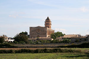
Maria de la Salut
Municipality in Balearic Islands, Spain
Distance: Approx. 154 meters
Latitude and longitude: 39.66444444,3.07472222
Maria de la Salut (Catalan pronunciation: [məˈɾi.ə ðə lə səˈlut]) is a small town and municipality located in the center of the island in the district of es pla on Majorca and in the northeast of the capital, one of the Balearic Islands, Spain. It borders on the municipalities of Llubí, Santa Margalida, Ariany and Sineu.
Sineu
Municipality in Balearic Islands, Spain
Distance: Approx. 6462 meters
Latitude and longitude: 39.65,3
Sineu (Catalan pronunciation: [siˈnew]) is a municipality in central Mallorca, one of the Balearic Islands, Spain. Olympic cyclist Francisco Tortellá was born here.

Pla de Mallorca
Distance: Approx. 6902 meters
Latitude and longitude: 39.60472222,3.04805556
Pla de Mallorca (Catalan pronunciation: [ˈpla ðə məˈʎɔɾkə], Catalan for "plain of Mallorca") is a comarca (county) in the middle of the Majorca island, Balearic Islands, Spain.
Weather in this IP's area
few clouds
18 Celsius
17 Celsius
17 Celsius
19 Celsius
1023 hPa
73 %
1023 hPa
1010 hPa
10000 meters
4.5 m/s
4.56 m/s
72 degree
18 %
07:32:31
17:32:26

