Country:
Region:
City:
Latitude and Longitude:
Time Zone:
Postal Code:
IP information under different IP Channel
ip-api
Country
Region
City
ASN
Time Zone
ISP
Blacklist
Proxy
Latitude
Longitude
Postal
Route
Luminati
Country
Region
34
City
istanbul
ASN
Time Zone
Europe/Istanbul
ISP
Vayfi Bilgi Teknolojileri A.S.
Latitude
Longitude
Postal
IPinfo
Country
Region
City
ASN
Time Zone
ISP
Blacklist
Proxy
Latitude
Longitude
Postal
Route
db-ip
Country
Region
City
ASN
Time Zone
ISP
Blacklist
Proxy
Latitude
Longitude
Postal
Route
ipdata
Country
Region
City
ASN
Time Zone
ISP
Blacklist
Proxy
Latitude
Longitude
Postal
Route
Popular places and events near this IP address

Battle of Pelekanon
1329 battle of the Byzantine-Ottoman Wars
Distance: Approx. 1033 meters
Latitude and longitude: 41.01,29.15027778
The Battle of Pelekanon, also known by its Latinised form Battle of Pelecanum, occurred on June 10–11, 1329 between an expeditionary force by the Byzantines led by Andronikos IIl and an Ottoman army led by Orhan I. The Byzantine army was defeated, with no further attempt made at relieving the cities in Anatolia under Ottoman siege.
Dudullu Spor
Football club
Distance: Approx. 365 meters
Latitude and longitude: 41.01416667,29.16138889
Dudullu Spor Women's Football (Turkish: Dudullu Spor Kadın Futbol Takımı) is a women's football team based at Yukarı Dudullu neighborhood of Ümraniye district in Istanbul Province, Turkey playing in the Turkish Women's First Football League. It was formed in 2014 as part of the 1985-established Dudullu Football Club. The club's current chairman is Ali Yazlı.
Altınşehir (Istanbul Metro)
Metro station in Istanbul, Turkey
Distance: Approx. 1992 meters
Latitude and longitude: 41.0164599,29.1399199
Altınşehir is an underground station on the M5 line of the Istanbul Metro in Ümraniye. The station is located on Alemdağ Street in the Cemil Meriç neighborhood of Ümraniye. Connection to city buses is available at street level.
İmam Hatip Lisesi (Istanbul Metro)
Metro station in Istanbul, Turkey
Distance: Approx. 1181 meters
Latitude and longitude: 41.015861,29.15
İmam Hatip Lisesi is an underground station on the M5 line of the Istanbul Metro in Ümraniye. The station is located on Alemdağ Street in the Adem Yavuz neighborhood of Ümraniye. Connection to IETT city buses is available at street level.

Dudullu (Istanbul Metro)
Metro station in Istanbul, Turkey
Distance: Approx. 1158 meters
Latitude and longitude: 41.021398,29.162036
Dudullu is an underground station on the M5 and M8 lines of the Istanbul Metro in Ümraniye. The station is located on Alemdağ Street in the Yukarı Dudullu neighborhood of Ümraniye. Connection to IETT city buses is available at street level.

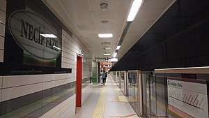
Necip Fazıl (Istanbul Metro)
Metro station in Istanbul, Turkey
Distance: Approx. 1531 meters
Latitude and longitude: 41.01639,29.179267
Necip Fazıl is an underground station on the M5 line of the Istanbul Metro in Ümraniye. The station is located on Alemdağ Street in the Necip Fazıl neighborhood of Ümraniye. Connection to IETT city buses is available at street level.

Çekmeköy (Istanbul Metro)
Metro station in Istanbul, Turkey
Distance: Approx. 2306 meters
Latitude and longitude: 41.014537,29.189545
Çekmeköy is an underground station on the M5 line of the Istanbul Metro in Çekmeköy. The station is located on Şile Highway in the Mehmet Akif neighborhood of Çekmeköy. Connection to IETT city buses is available at street level.

Mevlana (Istanbul Metro)
Station of the Istanbul Metro
Distance: Approx. 2220 meters
Latitude and longitude: 40.992222,29.153611
Mevlana is an underground station on the M8 line of the Istanbul Metro. It is located on Necip Fazıl Boulevard in the Mevlana neighbourhood of Ataşehir. It was opened on 6 January 2023.

İMES
Station of the Istanbul Metro
Distance: Approx. 1337 meters
Latitude and longitude: 41,29.156111
İMES is an underground station on the M8 line of the Istanbul Metro. It is located on Necip Fazıl Boulevard at the İMES East Gate in the Esenşehir neighbourhood of Ümraniye. It was opened on 6 January 2023.

MODOKO–KEYAP
Station of the Istanbul Metro
Distance: Approx. 421 meters
Latitude and longitude: 41.007222,29.162222
MODOKO-KEYAP is an underground station on the M8 line of the Istanbul Metro. It is located at the intersection of Necip Fazıl Boulevard and Nato Yolu Street in the Esenşehir neighbourhood of Ümraniye. It was opened on 6 January 2023.

Huzur (Istanbul Metro)
Station of the Istanbul Metro
Distance: Approx. 1332 meters
Latitude and longitude: 41.022778,29.159722
Huzur is an underground station on the M8 line of the Istanbul Metro. It is located on Eski Üsküdar Yolu Street in the Adem Yavuz neighbourhood of Ümraniye. It was opened on 6 January 2023.

Parseller (Istanbul Metro)
Station of the Istanbul Metro
Distance: Approx. 2412 meters
Latitude and longitude: 41.031389,29.152778
Parseller is an underground station on the M8 line of the Istanbul Metro. It is located on Kesikkaya Street in the Parseller neighbourhood of Ümraniye. It was opened on 6 January 2023, and is the northern terminus of the line.
Weather in this IP's area
few clouds
17 Celsius
17 Celsius
16 Celsius
18 Celsius
1028 hPa
52 %
1028 hPa
1009 hPa
10000 meters
7.2 m/s
50 degree
20 %
07:42:46
17:51:31