Country:
 Czech Republic
Region:
City:
Latitude and Longitude:
Time Zone:
Postal Code:
IP information under different IP Channel
ip-api
Country
Region
City
ASN
Time Zone
ISP
Blacklist
Proxy
Latitude
Longitude
Postal
Route
IPinfo
Country
Region
City
ASN
Time Zone
ISP
Blacklist
Proxy
Latitude
Longitude
Postal
Route
MaxMind
Country
Region
City
ASN
Time Zone
ISP
Blacklist
Proxy
Latitude
Longitude
Postal
Route
Luminati
Country
CZRegion
80
City
krnov
ASN
Time Zone
Europe/Prague
ISP
TKC system s.r.o.
Latitude
Longitude
Postal
db-ip
Country
Region
City
ASN
Time Zone
ISP
Blacklist
Proxy
Latitude
Longitude
Postal
Route
ipdata
Country
Region
City
ASN
Time Zone
ISP
Blacklist
Proxy
Latitude
Longitude
Postal
Route
Popular places and events near this IP address

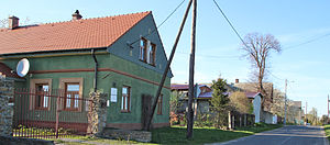
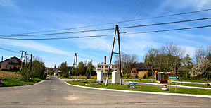
Krnov
Town in the Czech Republic
Distance: Approx. 1954 meters
Latitude and longitude: 50.09055556,17.69861111
Krnov (Czech pronunciation: [ˈkr̩nof]; ‹See Tfd›German: Jägerndorf, Polish: Karniów or Krnów) is a town in Bruntál District in the Moravian-Silesian Region of the Czech Republic. It has about 23,000 inhabitants.

Ciermięcice
Place in Opole Voivodeship, Poland
Distance: Approx. 1482 meters
Latitude and longitude: 50.11194444,17.71777778
Ciermięcice [t͡ɕɛrmjɛnˈt͡ɕit͡sɛ] (formerly Tirmanz) is a village located in Poland, in the Opole Voivodeship, Głubczyce County and Gmina Głubczyce. Potok Ciermięcicki, the left tributary of the Opava river, flows through the village.

Pietrowice, Opole Voivodeship
Place in Opole Voivodeship, Poland
Distance: Approx. 3939 meters
Latitude and longitude: 50.12805556,17.69111111
Pietrowice or Pietrowice Głubczyckie [pjɛtrɔˈvit͡sɛ] is a village located in Poland, in the Opole Voivodeship, Głubczyce County and Gmina Głubczyce. It lies approximately 13 kilometres (8 mi) south-west of Głubczyce and 63 km (39 mi) south of the regional capital Opole.
Braciszów
Place in Opole Voivodeship, Poland
Distance: Approx. 3845 meters
Latitude and longitude: 50.13333333,17.71666667
Braciszów [braˈt͡ɕiʂuf] is a village located in Poland, in the Opole Voivodeship, Głubczyce County and Gmina Głubczyce. The region is called Województwo opolskie.

Chomiąża, Opole Voivodeship
Place in Opole Voivodeship, Poland
Distance: Approx. 4419 meters
Latitude and longitude: 50.10916667,17.66277778
Chomiąża [xɔˈmjɔ̃ʐa] is a village located in Poland, in the Opole Voivodeship, Głubczyce County and Gmina Głubczyce.

Chróstno
Place in Opole Voivodeship, Poland
Distance: Approx. 2846 meters
Latitude and longitude: 50.12083333,17.74333333
Chróstno [ˈxrustnɔ] (formerly Zalesie) is a village located in Poland, in the Opole Voivodeship, Głubczyce County and Gmina Głubczyce.

Mokre-Kolonia
Place in Opole Voivodeship, Poland
Distance: Approx. 5170 meters
Latitude and longitude: 50.1425,17.69722222
Mokre-Kolonia [ˈmɔkrɛ kɔˈlɔɲja] is a village located in Poland, in the Opole Voivodeship, Głubczyce County and Gmina Głubczyce. It lies approximately 12 kilometres (7 mi) south-west of Głubczyce and 61 km (38 mi) south of the regional capital Opole.

Bliszczyce
Village in Opole Voivodeship, Poland
Distance: Approx. 2621 meters
Latitude and longitude: 50.08333333,17.75
Bliszczyce [bliʂˈt͡ʂɨt͡sɛ] is a village in the administrative district of Gmina Branice, within Głubczyce County, Opole Voivodeship, in south-western Poland, close to the Czech border. It lies approximately 5 kilometres (3 mi) north-west of Branice, 15 km (9 mi) south-west of Głubczyce, and 67 km (42 mi) south of the regional capital Opole. In the village, there is a hill Barania Kopa (411.3 metres) which is part of the tourist route Bronisław Juzwiszyn.
Lewice, Opole Voivodeship
Village in Opole Voivodeship, Poland
Distance: Approx. 4338 meters
Latitude and longitude: 50.1,17.78333333
Lewice [lɛˈvit͡sɛ] (German Löwitz) is a village in the administrative district of Gmina Branice, within Głubczyce County, Opole Voivodeship, in south-western Poland, close to the Czech border. It lies approximately 6 kilometres (4 mi) north of Branice, 12 km (7 mi) south of Głubczyce, and 64 km (40 mi) south of the regional capital Opole.

Michałkowice, Opole Voivodeship
Village in Opole Voivodeship, Poland
Distance: Approx. 5685 meters
Latitude and longitude: 50.07777778,17.795
Michałkowice [mixau̯kɔˈvit͡sɛ] is a village in the administrative district of Gmina Branice, within Głubczyce County, Opole Voivodeship, in south-western Poland, close to the Czech border. It lies approximately 3 kilometres (2 mi) north of Branice, 14 km (9 mi) south of Głubczyce, and 67 km (42 mi) south of the regional capital Opole.
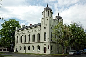
Krnov Synagogue
Synagogue in Krnov, Czech Republic
Distance: Approx. 1493 meters
Latitude and longitude: 50.08972222,17.7075
The Krnov Synagogue (Czech: Synagoga v Krnově) is a former Jewish synagogue, located on Soukenická Street in Krnov, in the Czech Republic. Completed in 1871, the former synagogue is one of only three surviving synagogue buildings in the Moravian-Silesian Region (the others are at Nový Jičín and Český Těšín). Whilst the synagogue building remains, since 2003 it has been used as an exhibition and concert hall and was substantially restored by 2014.

Duchy of Krnov
Silesian duchy (1377–1849)
Distance: Approx. 2252 meters
Latitude and longitude: 50.09006,17.694319
The Duchy of Krnov (Latin: Ducatus Carnoviensis, Czech: Krnovské knížectví, Polish: Księstwo Karniowskie) or Duchy of Jägerndorf (‹See Tfd›German: Herzogtum Jägerndorf) was one of the Duchies of Silesia, which in 1377 emerged from the Duchy of Troppau (Opava), itself a fief of the Bohemian Crown. Its capital was at Krnov in the present-day Czech Republic.
Weather in this IP's area
clear sky
3 Celsius
3 Celsius
3 Celsius
8 Celsius
1021 hPa
73 %
1021 hPa
980 hPa
10000 meters
0.87 m/s
1.18 m/s
222 degree
5 %
06:49:23
18:27:49