185.252.236.130 - IP Lookup: Free IP Address Lookup, Postal Code Lookup, IP Location Lookup, IP ASN, Public IP
Country:
Region:
City:
Location:
Time Zone:
Postal Code:
ISP:
ASN:
language:
User-Agent:
Proxy IP:
Blacklist:
IP information under different IP Channel
ip-api
Country
Region
City
ASN
Time Zone
ISP
Blacklist
Proxy
Latitude
Longitude
Postal
Route
db-ip
Country
Region
City
ASN
Time Zone
ISP
Blacklist
Proxy
Latitude
Longitude
Postal
Route
IPinfo
Country
Region
City
ASN
Time Zone
ISP
Blacklist
Proxy
Latitude
Longitude
Postal
Route
IP2Location
185.252.236.130Country
Region
auvergne-rhone-alpes
City
annecy
Time Zone
Europe/Paris
ISP
Language
User-Agent
Latitude
Longitude
Postal
ipdata
Country
Region
City
ASN
Time Zone
ISP
Blacklist
Proxy
Latitude
Longitude
Postal
Route
Popular places and events near this IP address

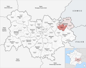
Arrondissement of Annecy
Arrondissement in Auvergne-Rhône-Alpes, France
Distance: Approx. 827 meters
Latitude and longitude: 45.89666667,6.12611111
The arrondissement of Annecy is an arrondissement of France in the Haute-Savoie department in the Auvergne-Rhône-Alpes region. It has 77 communes. Its population is 293,040 (2021), and its area is 1,253.9 km2 (484.1 sq mi).

Annecy Cathedral
Distance: Approx. 706 meters
Latitude and longitude: 45.89916667,6.12555556
Annecy Cathedral (French: Cathédrale Saint-Pierre d'Annecy) is a Roman Catholic church located in Annecy, France. The cathedral is a national monument. The church was erected at the beginning of the 16th century by Jacques Rossel as a chapel for a Franciscan priory.

Château d'Annecy
Distance: Approx. 791 meters
Latitude and longitude: 45.8975,6.12611111
The Château d'Annecy is a restored castle which dominates the old French town of Annecy in the Haute-Savoie département. It was bought by the town, restored and transformed into a museum, le musée-château d'Annecy. The castle is listed as a monument historique by the French Ministry of Culture since 1959.

Roman Catholic Diocese of Annecy
Catholic diocese in France
Distance: Approx. 1136 meters
Latitude and longitude: 45.89361111,6.12805556
The Diocese of Annecy (Latin: Dioecesis Anneciensis; French: Diocèse d'Annecy) is a Latin Church diocese of the Catholic Church in France, located 26 miles (42km) south of Geneva. Saint-Gingolph VS, a town in the Swiss canton of Valais, is also part of the diocese. Originally erected in 1822, after the Concordat as a suffragan (ecclesiastical subordinate) of the archdiocese of Chambéry, the diocese of Annecy is composed of the entirety of the department of Haute-Savoie in the Region of Rhône-Alpes.

Mandallaz Mountain
Mountain in Rhône-Alpes, France
Distance: Approx. 314 meters
Latitude and longitude: 45.898779,6.112776
Geographically, the Mandallaz Mountain is a small pre-Alpine massif 8 kilometres (5.0 mi) long by 3–4 km (1.9–2.5 mi) wide, between 500 metres (1,600 ft) and 929 metres (3,048 ft) high (the top is called "The Head"), north-west of Annecy in the Haute-Savoie department in the Rhône-Alpes region in south-eastern France. The Mandallaz has a mirror break, which provoked an earthquake in 1996.
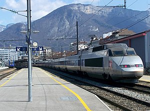
Annecy station
Railway station in Annecy, France
Distance: Approx. 476 meters
Latitude and longitude: 45.90222222,6.12166667
Annecy station (French: Gare d'Annecy) is a railway station located in Annecy, Haute-Savoie, south-eastern France. The station was opened in 1866 and is located on the Aix-les-Bains–Annemasse railway and the now closed Annecy-Albertville railway. The trains serving this station are operated by SNCF. In December 2012 a new multimodal interchange between bus routes and the train station was opened.
Community of Greater Annecy
Distance: Approx. 851 meters
Latitude and longitude: 45.8979,6.1271
The Community of Greater Annecy is a former intercommunality of the Haute-Savoie department in the Rhône-Alpes region of eastern France. It was formed in January 2001 by ten communes. In January 2002 a further three communes joined.
Église Saint-Maurice, Annecy
Distance: Approx. 877 meters
Latitude and longitude: 45.89916667,6.12777778
Église Saint-Maurice (in English, St. Maurice Church) is a Roman Catholic church in Annecy, France. It is the oldest church in Annecy.

Communauté d'agglomération du Grand Annecy
Communauté d'agglomération in Auvergne-Rhône-Alpes, France
Distance: Approx. 271 meters
Latitude and longitude: 45.9,6.12
Communauté d'agglomération du Grand Annecy is the communauté d'agglomération, an intercommunal structure, centred on the city of Annecy. It is located in the Haute-Savoie department, in the Auvergne-Rhône-Alpes region, southeastern France. It was created in January 2017 by the merger of the former communauté de l'agglomération d'Annecy and four communautés de communes.
Canton of Annecy-1
Distance: Approx. 1157 meters
Latitude and longitude: 45.91,6.12
The canton of Annecy-1 is an administrative division of the Haute-Savoie department, southeastern France. It was created at the French canton reorganisation which came into effect in March 2015. Its seat is in Annecy.
Canton of Annecy-2
Distance: Approx. 1046 meters
Latitude and longitude: 45.9,6.13
The canton of Annecy-2 is an administrative division of the Haute-Savoie department, southeastern France. It was created at the French canton reorganisation which came into effect in March 2015. Its seat is in Annecy.

Hôtel de Ville, Annecy
Town hall in Annecy, France
Distance: Approx. 994 meters
Latitude and longitude: 45.8993,6.1293
The Hôtel de Ville (French pronunciation: [otɛl də vil], City Hall) is a municipal building in Annecy, Haute-Savoie, southeastern France, standing on the Esplanade de l'Hôtel de Ville.
Weather in this IP's area
mist
9 Celsius
6 Celsius
9 Celsius
9 Celsius
1001 hPa
93 %
1001 hPa
914 hPa
4400 meters
6.17 m/s
11.83 m/s
320 degree
75 %

