185.249.146.61 - IP Lookup: Free IP Address Lookup, Postal Code Lookup, IP Location Lookup, IP ASN, Public IP
Country:
Region:
City:
Location:
Time Zone:
Postal Code:
ISP:
ASN:
language:
User-Agent:
Proxy IP:
Blacklist:
IP information under different IP Channel
ip-api
Country
Region
City
ASN
Time Zone
ISP
Blacklist
Proxy
Latitude
Longitude
Postal
Route
db-ip
Country
Region
City
ASN
Time Zone
ISP
Blacklist
Proxy
Latitude
Longitude
Postal
Route
IPinfo
Country
Region
City
ASN
Time Zone
ISP
Blacklist
Proxy
Latitude
Longitude
Postal
Route
IP2Location
185.249.146.61Country
Region
bacs-kiskun
City
dunavecse
Time Zone
Europe/Budapest
ISP
Language
User-Agent
Latitude
Longitude
Postal
ipdata
Country
Region
City
ASN
Time Zone
ISP
Blacklist
Proxy
Latitude
Longitude
Postal
Route
Popular places and events near this IP address

Dunavecse
Town in Bács-Kiskun, Hungary
Distance: Approx. 744 meters
Latitude and longitude: 46.91666667,18.98333333
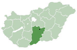
Dunavecse is a town and municipality in Bács-Kiskun County in southern Hungary. Croats in Hungary call this town Večica.

Apostag
Place in Southern Great Plain, Hungary
Distance: Approx. 3866 meters
Latitude and longitude: 46.88083333,18.95972222
Apostag is a village and municipality in Bács-Kiskun county, in the Southern Great Plain region of southern Hungary. Croats in Hungary call this village Štagara.

Szalkszentmárton
Place in Bács-Kiskun, Hungary
Distance: Approx. 6679 meters
Latitude and longitude: 46.96666667,19.01666667
Szalkszentmárton is a village and municipality in Bács-Kiskun county, in the Southern Great Plain region of southern Hungary.
Kisapostag
Place in Central Transdanubia, Hungary
Distance: Approx. 3950 meters
Latitude and longitude: 46.8938,18.9317
Kisapostag is a village in Fejér county, Hungary. As of 2012, it had a population of 1,414, living in 508 houses. About 8 kilometers (5.0 mi) away is the nearby city of Dunaújváros.
Baracs
Place in Central Transdanubia, Hungary
Distance: Approx. 8215 meters
Latitude and longitude: 46.9105,18.8664
Baracs is a village in Fejér county, Hungary.
Dunaújvárosi Stadion
Distance: Approx. 5075 meters
Latitude and longitude: 46.95583333,18.94741667
Dunaújvárosi Stadion also known as the Eszperantó úti Stadion is a multi-use stadium in Dunaújváros, Fejér, Hungary, with a capacity of 12,000. It is currently used mostly for football matches and is the home of football club Dunaújváros Pálhalma.
Dunaújváros Power Plant
Power station in Dunaújváros, Fejér, Hungary
Distance: Approx. 2752 meters
Latitude and longitude: 46.92138889,18.93972222
The Dunaújváros Power Plant, located close to Dunaújváros city, is one of Hungary's largest biomass power plants, with an installed heat capacity of 160 MW and electric capacity of 50 MW. The plant construction had commenced in 2014 and it was commissioned in 2016.

Pentele Bridge (Hungary)
Bridge in Between Dunaújváros and Dunavecse
Distance: Approx. 1765 meters
Latitude and longitude: 46.90314722,18.95752222
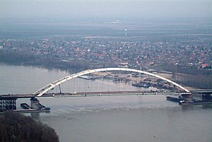
The Pentele Bridge or M8 Danube Bridge is a highway bridge spanning river Danube between Dunavecse and Dunaújváros. Construction was completed on 13 March 2007. The Pentele Bridge got her name after the village Dunapentele (now part of Dunaújváros).
Dunasor
Distance: Approx. 5773 meters
Latitude and longitude: 46.96194444,18.945
Dunasor is a district of Dunaújváros, Hungary. It is located between Városháza tér and the hospital. It is bordered by Streets Kossuth Lajos utca Vasmű, Kohász, Duna sor and Panoráma.
University of Dunaújváros
University
Distance: Approx. 6019 meters
Latitude and longitude: 46.9606,18.9339
University of Dunaújváros (before 2016: College of Dunaújváros) is located in Hungary. Education center in Dunaújváros offers bachelor course Computer Engineer BSc, Engineering Business Management BSc, Communication and Media BA, Business Administration BA, Material Engineering BSc, Mechanical Engineer BSc, and master course Teacher of Engineering degrees.

Ice Hockey Stadium of Dunaújváros
Ice hockey venue in Hungary
Distance: Approx. 4905 meters
Latitude and longitude: 46.9544,18.9482
Ice Hockey Stadium of Dunaújváros is located in Barátság District, Eszperanto Street, at the Sport Center Complex of Dunaújváros City, Hungary. Dunaújváros is 75 km (47 mi) from Budapest near the Danube river. Stadium has built among the Football Stadium of Dunaújváros and the Handball Gymnasium of Dunaújváros.

Dunaújváros District
Districts of Hungary in Fejér
Distance: Approx. 6119 meters
Latitude and longitude: 46.96,18.93
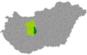
Dunaújváros (Hungarian: Dunaújvárosi járás) is a district in south-eastern part of Fejér County. Dunaújváros is also the name of the town where the district seat is found. The district is located in the Central Transdanubia Statistical Region.
Weather in this IP's area
clear sky
-1 Celsius
-3 Celsius
-1 Celsius
-1 Celsius
1018 hPa
95 %
1018 hPa
1004 hPa
10000 meters
1.79 m/s
4.02 m/s
181 degree
6 %

