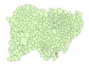
Country:
Region:
City:
Latitude and Longitude:
Time Zone:
Postal Code:
IP information under different IP Channel
ip-api
Country
Region
City
ASN
Time Zone
ISP
Blacklist
Proxy
Latitude
Longitude
Postal
Route
Luminati
Country
Region
cl
City
mamblas
ASN
Time Zone
Europe/Madrid
ISP
Gestioniza Infraestructuras S.L.
Latitude
Longitude
Postal
IPinfo
Country
Region
City
ASN
Time Zone
ISP
Blacklist
Proxy
Latitude
Longitude
Postal
Route
db-ip
Country
Region
City
ASN
Time Zone
ISP
Blacklist
Proxy
Latitude
Longitude
Postal
Route
ipdata
Country
Region
City
ASN
Time Zone
ISP
Blacklist
Proxy
Latitude
Longitude
Postal
Route
Popular places and events near this IP address

Béjar
Municipality in Castile and León, Spain
Distance: Approx. 439 meters
Latitude and longitude: 40.38333333,-5.76666667
Béjar (Spanish pronunciation: [ˈbexaɾ]) is a town and municipality of Spain located in the province of Salamanca, autonomous community of Castile and León. As of 2018, it had a population of 12,961. The historical development of the town has been linked to its once thriving textile manufacturing industry.

Cantagallo, Spain
Municipality in Castile and León, Spain
Distance: Approx. 5001 meters
Latitude and longitude: 40.37305556,-5.81972222
Cantagallo is a village and municipality in the province of Salamanca, western Spain, part of the autonomous community of Castile-Leon. It is located 90 kilometres (56 mi) from the city of Salamanca and as of 2016 has a population of 263 people. The municipality covers an area of 87.51 km2 (33.79 sq mi), and lies 932 metres (3,058 ft) above sea level.

La Calzada de Béjar
Municipality in Castile and León, Spain
Distance: Approx. 5359 meters
Latitude and longitude: 40.41166667,-5.81722222
La Calzada de Béjar is a village and municipality in the province of Salamanca, western Spain, part of the autonomous community of Castile and León. It is located 90 kilometres (56 mi) from the provincial capital city of Salamanca and has a population of 86 people.

La Hoya, Salamanca
Municipality in Castile and León, Spain
Distance: Approx. 5907 meters
Latitude and longitude: 40.40694444,-5.69916667
La Hoya is a municipality located in the province of Salamanca, Castile and León, Spain. As of 2016 the municipality has a population of 42 inhabitants.

Navacarros
Municipality in Castile and León, Spain
Distance: Approx. 4241 meters
Latitude and longitude: 40.39416667,-5.71444444
Navacarros is a municipality located in the province of Salamanca, Castile and León, Spain. As of 2016 the municipality has a population of 106 inhabitants.

Navalmoral de Béjar
Municipality in Castile and León, Spain
Distance: Approx. 4126 meters
Latitude and longitude: 40.42194444,-5.77722222
Navalmoral de Béjar is a municipality located in the province of Salamanca, Castile and León, As of 2016, the municipality has a population of 66 inhabitants.

Puerto de Béjar
Municipality in Castile and León, Spain
Distance: Approx. 7394 meters
Latitude and longitude: 40.35138889,-5.8375
Puerto de Béjar is a municipality located in the province of Salamanca, Castile and León, Spain. As of 2016 the municipality has a population of 380 inhabitants.

Sanchotello
Municipality in Castile and León, Spain
Distance: Approx. 5820 meters
Latitude and longitude: 40.43805556,-5.75277778
Sanchotello is a municipality located in the province of Salamanca, Castile and León, Spain. As of 2016 the municipality has a population of 227 inhabitants.

Vallejera de Riofrío
Municipality in Castile and León, Spain
Distance: Approx. 4372 meters
Latitude and longitude: 40.40916667,-5.72138889
Vallejera de Riofrío is a municipality located in the province of Salamanca, Castile and León, Spain. As of 2016 the municipality has a population of 67 inhabitants.
Palomares de Béjar
Distance: Approx. 2298 meters
Latitude and longitude: 40.38972222,-5.73666667
Palomares de Béjar is a neighborhood of Béjar, part of the autonomous community of Castile and León, in the province of Salamanca, western Spain. Palomares was an independent village until 1970 when it became part of Béjar.

Candelario
Municipality in Castile and León, Spain
Distance: Approx. 2599 meters
Latitude and longitude: 40.36805556,-5.74444444
Candelario is a municipality located in the province of Salamanca, Castile and León, Spain.
La Covatilla
Distance: Approx. 7182 meters
Latitude and longitude: 40.3541,-5.6901
La Covatilla is a ski resort in the Central System of the Province of Salamanca, in Castile and León, Spain. The resort is in the municipality of La Hoya.
Weather in this IP's area
light rain
11 Celsius
10 Celsius
11 Celsius
11 Celsius
1017 hPa
91 %
1017 hPa
911 hPa
10000 meters
2.35 m/s
2.76 m/s
98 degree
100 %
08:09:34
18:06:06