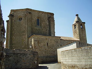
Country:
Region:
City:
Latitude and Longitude:
Time Zone:
Postal Code:
IP information under different IP Channel
ip-api
Country
Region
City
ASN
Time Zone
ISP
Blacklist
Proxy
Latitude
Longitude
Postal
Route
Luminati
Country
Region
cl
City
mamblas
ASN
Time Zone
Europe/Madrid
ISP
Gestioniza Infraestructuras S.L.
Latitude
Longitude
Postal
IPinfo
Country
Region
City
ASN
Time Zone
ISP
Blacklist
Proxy
Latitude
Longitude
Postal
Route
db-ip
Country
Region
City
ASN
Time Zone
ISP
Blacklist
Proxy
Latitude
Longitude
Postal
Route
ipdata
Country
Region
City
ASN
Time Zone
ISP
Blacklist
Proxy
Latitude
Longitude
Postal
Route
Popular places and events near this IP address
Benquerencia
Municipality in Extremadura, Spain
Distance: Approx. 8592 meters
Latitude and longitude: 39.31055556,-6.08444444
Benquerencia (Spanish pronunciation: [beŋkeˈɾenθja]) is a municipality located in the province of Cáceres, Extremadura, Spain. According to the 2006 census (INE), the municipality has a population of 98 inhabitants.
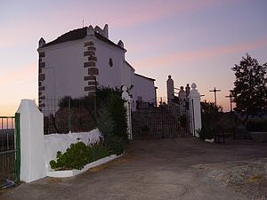
Torreorgaz
Municipality in Extremadura, Spain
Distance: Approx. 7002 meters
Latitude and longitude: 39.36666667,-6.25
Torreorgaz is a municipality in the province of Cáceres, Extremadura, Spain. According to the 2017 census (INE), the municipality has a population of 1669 inhabitants.
Torrequemada
Place in Extremadura, Spain
Distance: Approx. 4405 meters
Latitude and longitude: 39.36666667,-6.21666667
Torrequemada is a municipality located in the province of Cáceres, in the autonomous community of Extremadura, Spain. The name Torrequemada is derived from the Spanish words torre meaning "tower" and quemada meaning "burnt." In 1594 it was part of the Cáceres district in the province of Trujillo.
Valdefuentes, Cáceres
Municipality in Extremadura, Spain
Distance: Approx. 8478 meters
Latitude and longitude: 39.28333333,-6.11666667
Valdefuentes is a municipality located in the province of Cáceres, Extremadura, Spain. According to the 2006 census (INE), the municipality has a population of 1489 inhabitants.

Botija
Caribbean musical instrument made up of Clay
Distance: Approx. 9286 meters
Latitude and longitude: 39.33333333,-6.06666667
The botija (botijuela; bunga) is a Caribbean musical instrument of the aerophone type. It is a potbellied earthenware jug or jar with two openings and was used in the early son sextetos in Cuba as a bass instrument.
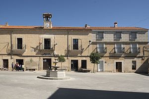
Torremocha, Cáceres
Municipality in Extremadura, Spain
Distance: Approx. 756 meters
Latitude and longitude: 39.35,-6.16666667
Torremocha is a municipality located in the province of Cáceres, in the autonomous community of Extremadura, Spain. The municipality covers an area of 63.83 square kilometres (24.64 sq mi) and as of 2011 had a population of 992 people.
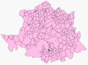
Botija, Cáceres
Municipality in Extremadura, Spain
Distance: Approx. 8634 meters
Latitude and longitude: 39.34527778,-6.07305556
Botija is a municipality located in the province of Cáceres, Extremadura, Spain. According to the 2013 census (INE), the municipality has a population of 193 inhabitants.

Jarilla, Cáceres
Municipality in Cáceres province, Extremadura, Spain
Distance: Approx. 8634 meters
Latitude and longitude: 39.34527778,-6.07305556
Jarilla is a municipality located in the province of Cáceres, Extremadura, Spain. According to the 2013 census (INE), the municipality has a population of 152 inhabitants.
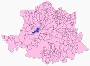
Portezuelo, Cáceres
Municipality in Extremadura, Spain
Distance: Approx. 8634 meters
Latitude and longitude: 39.34527778,-6.07305556
Portezuelo is a municipality located in the province of Cáceres, Extremadura, Spain. According to the 2013 census (INE), the municipality has a population of 262 inhabitants.
Weather in this IP's area
light rain
12 Celsius
12 Celsius
12 Celsius
12 Celsius
1016 hPa
90 %
1016 hPa
964 hPa
10000 meters
2.29 m/s
5.54 m/s
108 degree
100 %
08:08:49
18:10:07
