185.248.43.84 - IP Lookup: Free IP Address Lookup, Postal Code Lookup, IP Location Lookup, IP ASN, Public IP
Country:
Region:
City:
Location:
Time Zone:
Postal Code:
ISP:
ASN:
language:
User-Agent:
Proxy IP:
Blacklist:
IP information under different IP Channel
ip-api
Country
Region
City
ASN
Time Zone
ISP
Blacklist
Proxy
Latitude
Longitude
Postal
Route
db-ip
Country
Region
City
ASN
Time Zone
ISP
Blacklist
Proxy
Latitude
Longitude
Postal
Route
IPinfo
Country
Region
City
ASN
Time Zone
ISP
Blacklist
Proxy
Latitude
Longitude
Postal
Route
IP2Location
185.248.43.84Country
Region
antwerpen
City
mechelen
Time Zone
Europe/Brussels
ISP
Language
User-Agent
Latitude
Longitude
Postal
ipdata
Country
Region
City
ASN
Time Zone
ISP
Blacklist
Proxy
Latitude
Longitude
Postal
Route
Popular places and events near this IP address

Mechelen
City in Antwerp Province, Belgium
Distance: Approx. 310 meters
Latitude and longitude: 51.02777778,4.48055556
Mechelen (Dutch pronunciation: [ˈmɛxələ(n)] ; French: Malines [malin] ; historically known as Mechlin in English) is a city and municipality in the province of Antwerp in the Flemish Region of Belgium. The municipality comprises the city of Mechelen proper, some quarters at its outskirts, the hamlets of Nekkerspoel (adjacent) and Battel (a few kilometers away), as well as the villages of Walem, Heffen, Leest, Hombeek, and Muizen. The river Dyle (Dijle) flows through the city, hence it is often referred to as the Dijlestad ("City on the Dyle").

St. Rumbold's Cathedral
Cathedral in Mechelen, Belgium
Distance: Approx. 359 meters
Latitude and longitude: 51.02888889,4.47833333
St. Rumbold's Cathedral (Dutch: Sint-Romboutskathedraal; French: Cathédrale Saint-Rombaut) is the Roman Catholic metropolitan archiepiscopal cathedral in Mechelen, Belgium, dedicated to Saint Rumbold, Christian missionary and martyr who founded an abbey nearby. His remains are rumoured to be buried inside the cathedral.
List of archbishops of Mechelen-Brussels
Distance: Approx. 499 meters
Latitude and longitude: 51.030121,4.478819
The archbishop of Mechelen-Brussels is the head of the Archbishopric of Mechelen-Brussels of the Catholic Church in Belgium. It currently encompasses all of Belgium, making them the head of the Roman Catholic faith in the country. The current archbishop is Jozef De Kesel.

Brusselpoort
Former city gate in Mechelen, Belgium
Distance: Approx. 529 meters
Latitude and longitude: 51.02166667,4.47361111
The Brusselpoort (English: Brussels Gate) is the sole remaining city gate of the original twelve gates of Mechelen, Belgium. This imposing structure dates from the 13th century. Because of its exceptional height, towering above the other gates, it was also called the Overste Poort ("Superior Gate").

Royal Carillon School "Jef Denyn"
Music school in Mechelen, Belgium
Distance: Approx. 231 meters
Latitude and longitude: 51.02611111,4.48083333
The Royal Carillon School "Jef Denyn" (Dutch: Koninklijke Beiaardschool "Jef Denyn"; informally also the Mechelen carillon school) is a music school in Mechelen, Belgium, that specializes in the carillon. It is the first and largest carillon school in the world. The Belgian government defines it as an "International Higher Institute for the Carillon Arts under the High Protection of Her Majesty Queen Fabiola".

Hof van Savoye
Palace in Mechelen
Distance: Approx. 690 meters
Latitude and longitude: 51.02861111,4.48630556
The Hof van Savoye (Court of Savoy) or Palace of Margaret of Austria is an early 16th-century building in Mechelen, Belgium. It was one of the first Renaissance buildings in Northern Europe. Margaret of Austria, Duchess of Savoy, Governor of the Netherlands, was granted a house located in the Korte Maagdenstraat (Virgins Short Street), but she found it too small and started an ambitious expansion campaign in 1507.

Basilica of Our Lady of Hanswijk
Distance: Approx. 662 meters
Latitude and longitude: 51.02222222,4.48527778
The Basilica of Our Lady of Hanswijk (Dutch: Onze-Lieve-Vrouw van Hanswijkis) is a Roman Catholic basilica in Mechelen, Belgium.

English Fury at Mechelen
Distance: Approx. 310 meters
Latitude and longitude: 51.02777778,4.48055556
The English Fury at Mechelen or the Capture of Mechelen was an event in the Eighty Years' War and the Anglo–Spanish War on April 9, 1580. The city of Mechelen (known as Malines in French and historically in English) was conquered by Calvinist rebel forces from Brussels, which included a large contingent of English mercenaries. The city was sacked and many of its religious treasures destroyed or plundered.

Roman Catholic Archdiocese of Mechelen–Brussels
Latin Catholic ecclesiastical territory in Belgium
Distance: Approx. 498 meters
Latitude and longitude: 51.03011111,4.47877778
The Archdiocese of Mechelen–Brussels (Latin: Archidioecesis Mechliniensis–Bruxellensis) is a Latin Church ecclesiastical territory or archdiocese of the Catholic Church in Belgium. It is the primatial see of Belgium and the centre of the ecclesiastical province governed by the Archbishop of Mechelen–Brussels, which covers the whole of Belgium. It was formed in 1559 and the bishop has a seat in two cathedrals, St.

Scheppersinstituut Mechelen
Distance: Approx. 378 meters
Latitude and longitude: 51.0286,4.4748
The Scheppersinstituut Mechelen is a primary and secondary school in the city of Mechelen in Belgium. The school was founded in 1851 by Mechlinian priest Victor Scheppers in what until 1783 had been Mount Thabor Convent. Parts of the building are protected as a heritage site.

Botanical Garden of Mechelen
Distance: Approx. 565 meters
Latitude and longitude: 51.0234,4.4848
The Botanical Garden of Mechelen (Kruidtuin Mechelen) is the largest public park within the historic city centre of Mechelen, Belgium. It is located on the north bank of the River Dijle and is surrounded by educational establishments (two secondary-school campuses to the east and west, and the Kruidtuin campus of Thomas More University College to the north). Entrances are in the Bruul, the Pitzemburgstraat, and via a footpath from the Zandpoortvest.

Schepenhuis, Mechelen
Distance: Approx. 246 meters
Latitude and longitude: 51.02762,4.47934
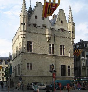
The Schepenhuis (Aldermen's House) of Mechelen, Flemish Brabant, Belgium, is a building where the city's aldermen held their meetings in the Middle Ages. It is located on the edge of the Grote Markt (main square), between the latter and the IJzerenleen and is considered the first stone 'town hall' of Flanders.
Weather in this IP's area
few clouds
11 Celsius
10 Celsius
11 Celsius
12 Celsius
991 hPa
68 %
991 hPa
989 hPa
10000 meters
9.26 m/s
15.43 m/s
230 degree
20 %