Country:
Region:
City:
Latitude and Longitude:
Time Zone:
Postal Code:
IP information under different IP Channel
ip-api
Country
Region
City
ASN
Time Zone
ISP
Blacklist
Proxy
Latitude
Longitude
Postal
Route
Luminati
Country
ASN
Time Zone
Europe/Madrid
ISP
NIXVAL
Latitude
Longitude
Postal
IPinfo
Country
Region
City
ASN
Time Zone
ISP
Blacklist
Proxy
Latitude
Longitude
Postal
Route
db-ip
Country
Region
City
ASN
Time Zone
ISP
Blacklist
Proxy
Latitude
Longitude
Postal
Route
ipdata
Country
Region
City
ASN
Time Zone
ISP
Blacklist
Proxy
Latitude
Longitude
Postal
Route
Popular places and events near this IP address

Turia (river)
River in Spain
Distance: Approx. 2876 meters
Latitude and longitude: 39.56553611,-0.59261667
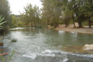
The Turia or Túria is a river in Spain, which has its source in the Montes Universales in the mountain ranges of the northwesternmost end of the Sistema Ibérico, Teruel province. From its source to roughly the city of Teruel, it is called Guadalaviar river. It runs through the provinces of Teruel, Cuenca and Valencia, and discharges into the Mediterranean Sea near the city of Valencia.

Circuit Ricardo Tormo
Race track in Valencia, Spain
Distance: Approx. 8247 meters
Latitude and longitude: 39.48583333,-0.62805556
Circuit Ricardo Tormo, also known as Circuit de Valencia and officially named Circuit de la Comunitat Valenciana Ricardo Tormo, is a 4.005 km (2.489 mi) motorsport race track located in Cheste (Valencian Community, Spain) and built in 1999. The track is named after Spanish, two-time world champion Grand Prix motorcycle racer Ricardo Tormo (1952–1998), who died in 1998 of leukemia. It has a capacity of 165,000 and a main straight of 0.876 km (0.544 mi).

Camp de Túria
Comarca in Valencian Community, Spain
Distance: Approx. 9070 meters
Latitude and longitude: 39.625,-0.595
Camp de Túria (Valencian: [ˈkamb de ˈtuɾia]; Spanish: Campo de Turia [ˈkampo ðe ˈtuɾja]) is a comarca in the province of Valencia, Valencian Community, Spain.

Valencian Community motorcycle Grand Prix
Motorcycle race held in Spain
Distance: Approx. 8247 meters
Latitude and longitude: 39.48583333,-0.62805556
The Valencian Community motorcycle Grand Prix is a motorcycling event that is part of the FIM Grand Prix motorcycle racing season. The event takes place at the Circuit Ricardo Tormo (also known as Circuit de Valencia). Between 2022 and 2026, Circuit Ricardo Tormo is due to host at least three Grands Prix.

Benaguasil
Municipality in Valencian Community, Spain
Distance: Approx. 5469 meters
Latitude and longitude: 39.59333333,-0.58638889
Benaguasil is a municipality in the Valencian Community, Spain, situated in the Camp de Túria comarca.
Benissanó
Municipality in Valencian Community, Spain
Distance: Approx. 7591 meters
Latitude and longitude: 39.61361111,-0.57777778
Benissanó is a municipality in the comarca of Camp de Túria in the Valencian Community, Spain.
L'Eliana
Municipality in Valencian Community, Spain
Distance: Approx. 4358 meters
Latitude and longitude: 39.56611111,-0.52805556
L'Eliana (Spanish: La Eliana) is a municipality in the comarca of Camp de Túria in the Valencian Community, Spain.
Loriguilla
Municipality in Valencian Community, Spain
Distance: Approx. 6160 meters
Latitude and longitude: 39.49026389,-0.57043056
Loriguilla is a municipality in the comarca of Camp de Túria in the Valencian Community, Spain.
Riba-roja de Túria
Municipality in Valencian Community, Spain
Distance: Approx. 331 meters
Latitude and longitude: 39.5475,-0.56833333
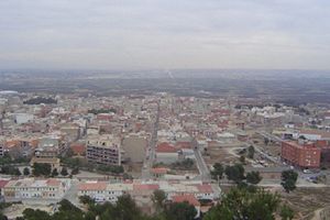
Riba-roja de Túria (Spanish: Ribarroja del Turia) is a municipality in the comarca of Camp de Túria in the Valencian Community, Spain. Its population is of 21 992 inhabitants (INE 2018). Riba-roja is located to the side of the river Turia.

San Antonio de Benagéber
Municipality
Distance: Approx. 6376 meters
Latitude and longitude: 39.56166667,-0.5
San Antonio de Benagéber, Valencian: Sant Antoni de Benaixeve, is a municipality in the comarca of Camp de Túria in the Valencian Community, Spain.
Vilamarxant
Municipality in Valencian Community, Spain
Distance: Approx. 4959 meters
Latitude and longitude: 39.56888889,-0.62055556
Vilamarxant (Spanish: Villamarchante) is a municipality in the comarca of Camp de Túria in the Valencian Community, Spain.

Lloma de Betxí
Distance: Approx. 5683 meters
Latitude and longitude: 39.5269,-0.5097
The Lloma de Betxí is a Bronze Age archaeological site in the municipality of Paterna (Valencian Community (Spain). It is on the top of a hill at 99m over the sea level and 30m over the surroundings. It is in the county of Paterna, nearby the Turia river, close to Valencia city.
Weather in this IP's area
broken clouds
16 Celsius
15 Celsius
15 Celsius
17 Celsius
1022 hPa
85 %
1022 hPa
1010 hPa
10000 meters
3.09 m/s
20 degree
75 %
07:46:50
17:47:16
