185.246.44.87 - IP Lookup: Free IP Address Lookup, Postal Code Lookup, IP Location Lookup, IP ASN, Public IP
Country:
Region:
City:
Location:
Time Zone:
Postal Code:
ISP:
ASN:
language:
User-Agent:
Proxy IP:
Blacklist:
IP information under different IP Channel
ip-api
Country
Region
City
ASN
Time Zone
ISP
Blacklist
Proxy
Latitude
Longitude
Postal
Route
db-ip
Country
Region
City
ASN
Time Zone
ISP
Blacklist
Proxy
Latitude
Longitude
Postal
Route
IPinfo
Country
Region
City
ASN
Time Zone
ISP
Blacklist
Proxy
Latitude
Longitude
Postal
Route
IP2Location
185.246.44.87Country
Region
auvergne-rhone-alpes
City
clermont-ferrand
Time Zone
Europe/Paris
ISP
Language
User-Agent
Latitude
Longitude
Postal
ipdata
Country
Region
City
ASN
Time Zone
ISP
Blacklist
Proxy
Latitude
Longitude
Postal
Route
Popular places and events near this IP address

Clermont-Ferrand
Prefecture and commune in Auvergne-Rhône-Alpes, France
Distance: Approx. 475 meters
Latitude and longitude: 45.7831,3.0824
Clermont-Ferrand (UK: , US: , French: [klɛʁmɔ̃ fɛʁɑ̃] ; Auvergnat: Clarmont-Ferrand or simply Clarmont [çɒʁˈmu]; Latin: Augustonemetum) is a city and commune of France, in the Auvergne-Rhône-Alpes region, with a population of 147,284 (2020). Its metropolitan area (aire d'attraction) had 504,157 inhabitants at the 2018 census. It is the prefecture (capital) of the Puy-de-Dôme département.

Clermont-Ferrand Cathedral
Cathedral in Clermont-Ferrand, Auvergne, France
Distance: Approx. 111 meters
Latitude and longitude: 45.778727,3.085766
Clermont-Ferrand Cathedral, or the Cathedral of Our Lady of the Assumption of Clermont-Ferrand (French: Cathédrale Notre-Dame-de-l'Assomption de Clermont-Ferrand), is a Gothic cathedral and French national monument located in the city of Clermont-Ferrand in the Auvergne. It is the seat of the Archbishops of Clermont (bishops until 2002). It is built entirely in black lava stone, which makes it highly distinctive, and visible from a great distance.

Roman Catholic Archdiocese of Clermont
Catholic archdiocese in France
Distance: Approx. 305 meters
Latitude and longitude: 45.78,3.09
The Archdiocese of Clermont (Latin: Archidioecesis Claromontana; French: Archidiocèse de Clermont) is a Latin archdiocese of the Roman Catholic Church in France. The diocese comprises the department of Puy-de-Dôme, in the Region of Auvergne. The Archbishop's seat is Clermont-Ferrand Cathedral.
Basilica of Notre-Dame du Port
Distance: Approx. 282 meters
Latitude and longitude: 45.78069444,3.08944444
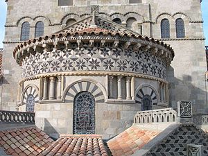
The Basilica of Notre-Dame du Port is a Romanesque basilica, formerly a collegiate church, in the Port quarter of Clermont-Ferrand, between Place Delille and the cathedral. From the 10th century to the French Revolution it was served by a community of canons, regular until the 13th century, and thereafter secular.

Jardin botanique d'Auvergne
Distance: Approx. 145 meters
Latitude and longitude: 45.78055556,3.0875
The Jardin botanique d'Auvergne (9 hectares), also known as the Jardin botanique d'essais de Royat-Charade, is a botanical garden located in Charade, Royat, Puy-de-Dôme, Auvergne, France. The garden was established in 2007 as a joint undertaking between the Jardin en Herbes association and the town of Royat. It has been planted with more than 150 types of local flora, and in 2008 began a collaboration with the Conservatoire botanique national du Massif central.
Place de Jaude
Public square in Auvergne, France
Distance: Approx. 467 meters
Latitude and longitude: 45.77659,3.08206
Jaude Square (French: Place de Jaude) is a major city square and meeting place in the centre of Clermont-Ferrand, France. It is bordered by Rue Blatin on the North and Avenue Julien on the south. The square is home to many attractions, such as the Opera Theatre, the Jaude Shopping Mall and Saint-Pierre-des-Minimes Church.

Hôtel Cote-Blatin
Hôtel particulier in Clermont-Ferrand, France
Distance: Approx. 449 meters
Latitude and longitude: 45.777,3.0904
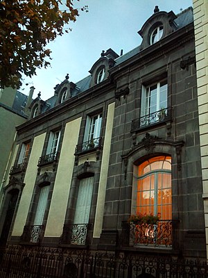
The Hôtel Cote-Blatin is a historic hôtel particulier in Clermont-Ferrand, France. It was built in 1897 for Joseph Cote, a physician. It was designed by architect Émile Camut.
Hôtel d'Aubière
Hôtel particulier in Clermont-Ferrand, France
Distance: Approx. 173 meters
Latitude and longitude: 45.77926,3.08824
The Hôtel d'Aubière is a historic hôtel particulier in Clermont-Ferrand, France. It was built in the 15th century, with extensions in the 18th century. It has been listed as an official historical monument since September 1, 1967.
ESC Clermont Business School
Distance: Approx. 425 meters
Latitude and longitude: 45.778,3.091
ESC Clermont Business School is a business school located in city of Clermont-Ferrand, France. Established in 1919, the school of management is a Grande Ecole recognized by the French Ministry of Higher Education and Research. The business school holds AACSB accreditation since 2005 and its Bachelor programme received EPAS accreditation in 2018.
Cantons of Clermont-Ferrand
Distance: Approx. 475 meters
Latitude and longitude: 45.78,3.08
The cantons of Clermont-Ferrand are administrative divisions of the Puy-de-Dôme department, in central France. Since the French canton reorganisation which came into effect in March 2015, the city of Clermont-Ferrand is subdivided into 6 cantons. Their seat is in Clermont-Ferrand.

Clermont Auvergne Métropole
Métropole in Auvergne-Rhône-Alpes, France
Distance: Approx. 475 meters
Latitude and longitude: 45.78,3.08
Clermont Auvergne Métropole (French pronunciation: [klɛʁmɔ̃ ovɛʁɲ metʁɔpɔl]) is the métropole, an intercommunal structure, centred on the city of Clermont-Ferrand. It is located in the Puy-de-Dôme department, in the Auvergne-Rhône-Alpes region, central France. It was created in January 2018, replacing the communauté urbaine that had replaced the previous communauté d'agglomération Clermont-Communauté in January 2017.
Hôtel de Ville, Clermont-Ferrand
Town hall in Clermont-Ferrand, France
Distance: Approx. 31 meters
Latitude and longitude: 45.7797,3.0865
The Hôtel de Ville (French pronunciation: [otɛl də vil], City Hall) is a historic building in Clermont-Ferrand, Puy-de-Dôme, central France, standing on the Rue Philippe Marcombes.
Weather in this IP's area
overcast clouds
8 Celsius
6 Celsius
6 Celsius
8 Celsius
1008 hPa
81 %
1008 hPa
929 hPa
10000 meters
4.12 m/s
210 degree
100 %


