Country:
Region:
City:
Latitude and Longitude:
Time Zone:
Postal Code:
IP information under different IP Channel
ip-api
Country
Region
City
ASN
Time Zone
ISP
Blacklist
Proxy
Latitude
Longitude
Postal
Route
Luminati
Country
Region
idf
City
paris
ASN
Time Zone
Europe/Paris
ISP
Flex Network Sarl
Latitude
Longitude
Postal
IPinfo
Country
Region
City
ASN
Time Zone
ISP
Blacklist
Proxy
Latitude
Longitude
Postal
Route
db-ip
Country
Region
City
ASN
Time Zone
ISP
Blacklist
Proxy
Latitude
Longitude
Postal
Route
ipdata
Country
Region
City
ASN
Time Zone
ISP
Blacklist
Proxy
Latitude
Longitude
Postal
Route
Popular places and events near this IP address

Saint-Denis-Université station
Paris Métro station
Distance: Approx. 1633 meters
Latitude and longitude: 48.94583,2.36361
Saint-Denis–Université (French pronunciation: [sɛ̃ dəni ynivɛʁsite]) is the terminus of the northeastern branch of Line 13 of the Paris Métro, located in the suburban town of Saint-Denis. It is the most northerly station on the Paris Métro system. It serves the University of Paris 8 Vincennes-Saint-Denis, as well as the new facility of the National Archives, which is located in Pierrefitte-sur-Seine, next to the metro station and bus station.

Basilique de Saint-Denis station
Metro station in Paris, France
Distance: Approx. 2107 meters
Latitude and longitude: 48.93806,2.36083
Basilique de Saint-Denis (French pronunciation: [bazilik də sɛ̃ dəni]) is a Paris Métro station on line 13 in the town centre of Saint-Denis, north of Paris. It connects with tram line 1 at two nearby stops at Basilique de Saint-Denis and Marché de Saint-Denis.

Paris 8 University Vincennes-Saint-Denis
Public university in Paris, France
Distance: Approx. 1671 meters
Latitude and longitude: 48.94472222,2.36333333
Paris 8 University Vincennes-Saint-Denis (French: Université Paris 8 Vincennes-Saint-Denis), or usually the University of Vincennes in Saint-Denis, Paris 8, or historically the University of Paris in Vincennes is a public university in the Greater Paris, France. Once part of the historic University of Paris, it is now an autonomous public institution. It is based on several campuses, mainly in Saint-Denis, as well as in Aubervilliers and the north of Paris on the Condorcet Campus, which it has initiated with nine other universities and public institutions since 2008 and which will be inaugurated in 2019.
La Courneuve
Commune in Île-de-France, France
Distance: Approx. 1880 meters
Latitude and longitude: 48.9322,2.3967
La Courneuve (French pronunciation: [la kuʁnœv] ) is a commune in Seine-Saint-Denis, France. It is located 8.3 km (5.2 mi) from the center of Paris.
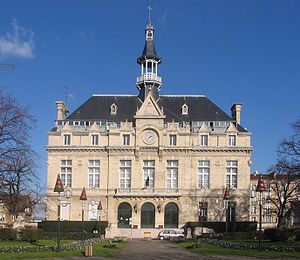
Stains, Seine-Saint-Denis
Commune in Île-de-France, France
Distance: Approx. 333 meters
Latitude and longitude: 48.95,2.3833
Stains (French pronunciation: [stɛ̃] ) is a commune in the Seine-Saint-Denis department, in the northern suburbs of Paris, France. It is located 11.6 km (7.2 mi) from the center of Paris.
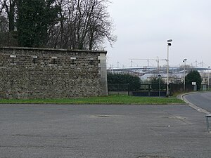
Fort de l'Est
Distance: Approx. 2132 meters
Latitude and longitude: 48.93055556,2.37222222
Fort de l'Est is a military strong point designed to protect Paris. It was built between 1841 and 1843 in Saint-Denis at the direction of French prime minister Adolphe Thiers, and was part of an immense defensive belt comprising 17 detached forts and the Thiers Wall surrounding Paris. The evolution of artillery quickly made these fortifications obsolete.

Pierrefitte–Stains station
Distance: Approx. 2060 meters
Latitude and longitude: 48.9636,2.3719
Pierrefitte–Stains is an RER station in Pierrefitte-sur-Seine and near to Stains in the northern suburbs of Paris, in Seine-Saint-Denis department. The station is in Zone 4 of the Carte orange. It is situated on the RER D suburban railway line and The T11 Express.

Lycée Robert Schuman (Dugny)
Public high school
Distance: Approx. 2166 meters
Latitude and longitude: 48.9493,2.4153
Lycée Robert Schuman is a Catholic private senior high school/sixth-form college in Dugny, Seine-Saint-Denis, France, in the Paris metropolitan area. Christian engineers established the school in 1920.

Lycée Paul Éluard (Saint-Denis, Seine-Saint-Denis)
Public high school
Distance: Approx. 1671 meters
Latitude and longitude: 48.9424,2.3643
Lycée Paul Éluard is a senior high school/sixth-form college in Saint-Denis, Seine-Saint-Denis, France, in the Paris metropolitan area. As of 2016 the school has fewer than 300 employees, including about 200 teachers, and about 1,700 students.
Canton of La Courneuve
Distance: Approx. 2208 meters
Latitude and longitude: 48.93,2.4
The canton of La Courneuve is an administrative division of the Seine-Saint-Denis department, Île-de-France region, northern France. Its borders were modified at the French canton reorganisation which came into effect in March 2015. Its seat is in La Courneuve.
Canton of Saint-Denis-2, Seine-Saint-Denis
Distance: Approx. 2063 meters
Latitude and longitude: 48.94,2.36
The canton of Saint-Denis-2 is an administrative division of the Seine-Saint-Denis department in the Île-de-France region, northern France. It was created at the French canton reorganisation which came into effect in March 2015. Its seat is in Saint-Denis.

Church of Our Lady of the Assumption, Stains
Roman Catholic church in Stains, Seine-Saint-Denis, France
Distance: Approx. 1083 meters
Latitude and longitude: 48.95694444,2.38222222
The Church of Our Lady of the Assumption (French: Église Notre-Dame-de-l'Assomption) is a Roman Catholic church in Stains in the department of Seine-Saint-Denis, France. It is dedicated to the Assumption of the Virgin Mary and listed as a Historic Monument.
Weather in this IP's area
light intensity drizzle
9 Celsius
8 Celsius
8 Celsius
11 Celsius
1022 hPa
96 %
1022 hPa
1019 hPa
8000 meters
2.57 m/s
100 degree
100 %
07:49:13
17:19:18


