185.245.61.196 - IP Lookup: Free IP Address Lookup, Postal Code Lookup, IP Location Lookup, IP ASN, Public IP
Country:
Region:
City:
Location:
Time Zone:
Postal Code:
ISP:
ASN:
language:
User-Agent:
Proxy IP:
Blacklist:
IP information under different IP Channel
ip-api
Country
Region
City
ASN
Time Zone
ISP
Blacklist
Proxy
Latitude
Longitude
Postal
Route
db-ip
Country
Region
City
ASN
Time Zone
ISP
Blacklist
Proxy
Latitude
Longitude
Postal
Route
IPinfo
Country
Region
City
ASN
Time Zone
ISP
Blacklist
Proxy
Latitude
Longitude
Postal
Route
IP2Location
185.245.61.196Country
Region
thuringen
City
koblenz
Time Zone
Europe/Berlin
ISP
Language
User-Agent
Latitude
Longitude
Postal
ipdata
Country
Region
City
ASN
Time Zone
ISP
Blacklist
Proxy
Latitude
Longitude
Postal
Route
Popular places and events near this IP address

Meerane
Town in Saxony, Germany
Distance: Approx. 4641 meters
Latitude and longitude: 50.85194444,12.46361111
Meerane (German: [meˈʁaːnə] ) is a town in the Zwickau district of Saxony, Germany. It lies midway between the towns of Altenburg and Zwickau, west of Chemnitz. As of 31 December 2015, there were 14,851 inhabitants.

Schmölln
Town in Thuringia, Germany
Distance: Approx. 8197 meters
Latitude and longitude: 50.895,12.35638889
Schmölln (German pronunciation: [ʃmœln]) is a town in Thuringia, Germany, landkreis of Altenburger Land. It lies on the river Sprotte.
Saara, Altenburger Land
Ortsteil of Nobitz in Thuringia, Germany
Distance: Approx. 5756 meters
Latitude and longitude: 50.93361111,12.42194444
Saara is a village and a former municipality in the district of Altenburger Land, Thuringia, Germany.

Gößnitz
Town in Thuringia, Germany
Distance: Approx. 2850 meters
Latitude and longitude: 50.89027778,12.43277778
Gößnitz (German pronunciation: [ˈɡœsnɪt͡s] ) is a town in the Altenburger Land district, in Thuringia, Germany. It is situated on the river Pleiße, 12 km south of Altenburg, and 20 km northwest of Zwickau. Gößnitz received its town charter in 1718.

Oberwiera
Municipality in Saxony, Germany
Distance: Approx. 4507 meters
Latitude and longitude: 50.89138889,12.53722222
Oberwiera is a municipality in the district of Zwickau in Saxony in Germany. Oberwiera has the following districts: Harthau, Neukirchen, Niederwiera, Oberwiera, Röhrsdorf and Wickersdorf. Around half of the population lives in the main district of Oberwiera.

Schönberg, Saxony
Municipality in Saxony, Germany
Distance: Approx. 3506 meters
Latitude and longitude: 50.86666667,12.5
Schönberg is a municipality in the district of Zwickau in Saxony in Germany.

Ponitz
Municipality in Thuringia, Germany
Distance: Approx. 7563 meters
Latitude and longitude: 50.83333333,12.42222222
Ponitz is a municipality in the district Altenburger Land, in Thuringia, Germany. It is particularly famous for its Baroque organ by Gottfried Silbermann and for its spectacularly-eccentric Renaissance manor house. Districts of Ponitz are Zschöpel, Merlach, Guteborn and Grünberg.
Ziegelheim
Ortsteil of Nobitz in Thuringia, Germany
Distance: Approx. 6702 meters
Latitude and longitude: 50.92583333,12.55333333
Ziegelheim is a village and a former municipality in the district Altenburger Land, in Thuringia, Germany. Since July 2018, it is part of the municipality Nobitz.
Zschöpel
Village in Thuringia, Germany
Distance: Approx. 5077 meters
Latitude and longitude: 50.86861111,12.41222222
Zschöpel is a farming village in the Altenburger Land in Thuringia, Germany. It is part of the municipality Ponitz. The village has a population of 129 people.
Gößnitz station
Railway station in Gößnitz, Germany
Distance: Approx. 3046 meters
Latitude and longitude: 50.892778,12.429722
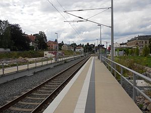
Gößnitz station is a railway station on the Leipzig–Hof railway, the Glauchau–Gößnitz railway and the Gößnitz–Gera (Mid-Germany Railway) in Gößnitz in the German state of Thuringia. The station was opened on 15 March 1844 with the Altenburg–Crimmitschau section by the Saxon-Bavarian Railway Company (Sächsisch-Baiersche Eisenbahn-Compagnie).
Meerane station
Railway station in Meerane, Germany
Distance: Approx. 4833 meters
Latitude and longitude: 50.85091921,12.45748758
Meerane station is a railway station on the Glauchau–Gößnitz railway. Meerane station is the only station in the town of Meerane in the German state of Saxony. The station is now served by Regionalbahn and Regional-Express services on the Mid-Germany Connection (Mitte-Deutschland-Verbindung).

Frankenhausen Abbey
Former Cistercian abbey in Saxony
Distance: Approx. 7920 meters
Latitude and longitude: 50.8422,12.3945
Frankenhausen Abbey (German: Zisterzienserinnenkloster Frankenhausen) was a Cistercian nunnery which existed between the 13th and the 16th centuries, located initially in Grünberg in Ponitz, Thuringia, and then from 1292 in Frankenhausen in Crimmitschau, Saxony, Germany.
Weather in this IP's area
clear sky
5 Celsius
3 Celsius
5 Celsius
7 Celsius
1019 hPa
73 %
1019 hPa
989 hPa
10000 meters
3.02 m/s
4.73 m/s
203 degree


