185.243.61.251 - IP Lookup: Free IP Address Lookup, Postal Code Lookup, IP Location Lookup, IP ASN, Public IP
Country:
Region:
City:
Location:
Time Zone:
Postal Code:
IP information under different IP Channel
ip-api
Country
Region
City
ASN
Time Zone
ISP
Blacklist
Proxy
Latitude
Longitude
Postal
Route
Luminati
Country
Region
eng
City
seaham
ASN
Time Zone
Europe/London
ISP
Daisy Corporate Services Trading Ltd
Latitude
Longitude
Postal
IPinfo
Country
Region
City
ASN
Time Zone
ISP
Blacklist
Proxy
Latitude
Longitude
Postal
Route
IP2Location
185.243.61.251Country
Region
england
City
polruan
Time Zone
ISP
Language
User-Agent
Latitude
Longitude
Postal
db-ip
Country
Region
City
ASN
Time Zone
ISP
Blacklist
Proxy
Latitude
Longitude
Postal
Route
ipdata
Country
Region
City
ASN
Time Zone
ISP
Blacklist
Proxy
Latitude
Longitude
Postal
Route
Popular places and events near this IP address
Polruan
Human settlement in England
Distance: Approx. 142 meters
Latitude and longitude: 50.3273,-4.6333
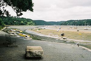
Polruan (Cornish: Porthruwan) is a coastal village in the parish of Lanteglos-by-Fowey in Cornwall, England, United Kingdom. It is bounded on three sides by water: to the north by Pont Creek, to the west by the River Fowey and to the south by the English Channel and neighbours village Bodinnick to the north, connected by a 4-mile walk along the hill tops. Polruan is very steep and well protected from the prevailing winds and Polruan Pool is a haven for small boats.

River Fowey
River in Cornwall, England
Distance: Approx. 736 meters
Latitude and longitude: 50.32777778,-4.64166667
The River Fowey ( FOY; Standard Written Form: Fowi) is a river in Cornwall, England, United Kingdom. Its source is at Fowey Well (originally Cornish: Fenten Fowi, meaning spring of the river Fowey) about 1 mile (1.6 km) north-west of Brown Willy on Bodmin Moor, not far from one of its tributaries rising at Dozmary Pool and Colliford Lake, passes Lanhydrock House, Restormel Castle and Lostwithiel, then broadens below Milltown before joining the English Channel at Fowey. The estuary is called Uzell (Cornish: Usel, meaning howling place).

Fowey
Town in Cornwall, England
Distance: Approx. 1020 meters
Latitude and longitude: 50.33527778,-4.63722222
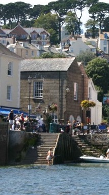
Fowey ( FOY; Cornish: Fowydh, meaning 'Beech Trees') is a port town and civil parish at the mouth of the River Fowey in south Cornwall, England, United Kingdom. The town has been in existence since well before the Norman invasion, with the local church first established some time in the 7th century; the estuary of the River Fowey forms a natural harbour which enabled the town to become an important trading centre. Privateers also made use of the sheltered harbourage.

Royal Fowey Yacht Club
Distance: Approx. 898 meters
Latitude and longitude: 50.33441,-4.63603
The Royal Fowey Yacht Club is located in a waterfront setting at Fowey, on the south coast of Cornwall one of the UK's most secure harbours. Its antecedents can be traced back to 1880; its third Honorary Secretary, from 1893, was Arthur Quiller-Couch, who became Sir Arthur. The minutes and descriptions of Yacht races, up to 1897 are in his handwriting.

Readymoney Cove
Beach near the town of Fowey, United Kingdom
Distance: Approx. 1028 meters
Latitude and longitude: 50.3288,-4.64556
Readymoney Cove (Cornish: Porth Mundy, meaning mineral house cove) is a sandy beach to the south of the harbour town of Fowey, Cornwall, England, United Kingdom. It is sheltered by cliffs close to the mouth of the River Fowey estuary and bounded, on one side, by the medieval part of the town of Fowey and, on the other, by St Catherine's Castle. The beach can be covered during spring tides.

St Catherine's Castle
Castle in Cornwall, England
Distance: Approx. 939 meters
Latitude and longitude: 50.32822222,-4.64444444
St Catherine's Castle (Cornish: Kastel S. Kattrin) is a Henrician castle in Cornwall, England, built by Thomas Treffry between approximately 1538 and 1540, in response to fears of an invasion of England by France and the Holy Roman Empire. The D-shaped, stone fortification, equipped with five gun-ports for cannon, overlooked the mouth of the River Fowey in Cornwall. It was protected by a curtain wall and the surrounding cliffs.

Bodinnick
Human settlement in England
Distance: Approx. 1429 meters
Latitude and longitude: 50.3397,-4.6299
Bodinnick (Standard Written Form: Bosdinek, meaning fortified dwelling) is a riverside village in south-east Cornwall, in the United Kingdom. According to the Post Office the population of the 2011 Census was included in the civil parish of Lanteglos-by-Fowey. It is a fishing village situated on the east bank of the River Fowey opposite the town of Fowey, also on the banks of the Fowey River.

Pont Pill
River in Cornwall, England
Distance: Approx. 949 meters
Latitude and longitude: 50.334,-4.624
Pont Pill (Cornish: Pyll Por' Reun, meaning creek of seal cove), joins the River Fowey at Penleath Point just below the memorial to Sir Arthur Quiller-Couch at the north-east corner of Fowey harbour. Pont Pill is a tidal river and is only navigable at high water. Unspoiled by development, Pont Pill is popular with bird watchers, walkers, sailors and sport fishermen.
Fowey Lifeboat Station
Lifeboat Station in Passage Street, United Kingdom
Distance: Approx. 1361 meters
Latitude and longitude: 50.3391,-4.6326
Fowey Lifeboat Station is the base for Royal National Lifeboat Institution (RNLI) search and rescue operations at Fowey on the south coast of Cornwall in the United Kingdom. The first lifeboat was stationed in the area in 1859 and the present station was opened in 1997. It operates a Trent Class all weather boat (ALB) and a D class (IB1) inshore lifeboat (ILB).

Fowey River Academy
Academy in Fowey, Cornwall, England
Distance: Approx. 1222 meters
Latitude and longitude: 50.33464,-4.6436
Fowey River Academy is a co-educational secondary school with academy status (Learning Edge Academies Partnership), serving a large and diverse catchment area including Fowey, the nearby towns of St Blazey and Lostwithiel and surrounding villages.

Church of St Fimbarrus, Fowey
Distance: Approx. 990 meters
Latitude and longitude: 50.33536,-4.63569
The Church of St Fimbarrus is an Anglican parish church in Fowey, Cornwall, England. Also known as Fowey Parish Church, it is in the Church of England's Diocese of Truro. The church is a grade I listed building and dates from the 14th century.

Fowey Town Hall
Municipal building in Fowey, Cornwall, England
Distance: Approx. 941 meters
Latitude and longitude: 50.3351,-4.6346
Fowey Town Hall is a municipal building on the Town Quay in Fowey, Cornwall, England. The structure, which serves as meeting place of Fowey Town Council, is a Grade II listed building.
Weather in this IP's area
overcast clouds
9 Celsius
9 Celsius
8 Celsius
10 Celsius
1033 hPa
93 %
1033 hPa
1030 hPa
10000 meters
1.86 m/s
2.3 m/s
240 degree
100 %

