Country:
 Austria
Region:
City:
Latitude and Longitude:
Time Zone:
Postal Code:
IP information under different IP Channel
ip-api
Country
Region
City
ASN
Time Zone
ISP
Blacklist
Proxy
Latitude
Longitude
Postal
Route
IPinfo
Country
Region
City
ASN
Time Zone
ISP
Blacklist
Proxy
Latitude
Longitude
Postal
Route
MaxMind
Country
Region
City
ASN
Time Zone
ISP
Blacklist
Proxy
Latitude
Longitude
Postal
Route
Luminati
Country
ATRegion
3
City
walpersbach
ASN
Time Zone
Europe/Vienna
ISP
MMC GmbH
Latitude
Longitude
Postal
db-ip
Country
Region
City
ASN
Time Zone
ISP
Blacklist
Proxy
Latitude
Longitude
Postal
Route
ipdata
Country
Region
City
ASN
Time Zone
ISP
Blacklist
Proxy
Latitude
Longitude
Postal
Route
Popular places and events near this IP address

Lanzenkirchen
Place in Lower Austria, Austria
Distance: Approx. 3761 meters
Latitude and longitude: 47.74722222,16.24722222
Lanzenkirchen is a market town in the district of Wiener Neustadt-Land in the Austrian state of Lower Austria.

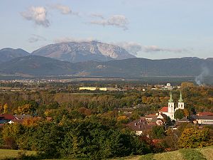
Breitenau, Lower Austria
Place in Lower Austria, Austria
Distance: Approx. 6183 meters
Latitude and longitude: 47.73333333,16.15
Breitenau is a town in the district of Neunkirchen in the Austrian state of Lower Austria.

Pitten
Place in Lower Austria, Austria
Distance: Approx. 4624 meters
Latitude and longitude: 47.71666667,16.16666667
Pitten is a Market Municipality in the district of Neunkirchen in the Austrian federal state of Lower Austria.
Schwarzau am Steinfeld
Place in Lower Austria, Austria
Distance: Approx. 4624 meters
Latitude and longitude: 47.71666667,16.16666667
Schwarzau am Steinfeld is a town in the district of Neunkirchen in the Austrian state of Lower Austria.
Seebenstein
Place in Lower Austria, Austria
Distance: Approx. 6233 meters
Latitude and longitude: 47.7,16.14861111
Seebenstein is a town in the district of Neunkirchen in the Austrian state of Lower Austria. It is often called the "Pearl of the Pitten valley" ("Perle des Pittentals") due to its preserved nature.

Bad Erlach
Place in Lower Austria, Austria
Distance: Approx. 2309 meters
Latitude and longitude: 47.73388889,16.21305556
Bad Erlach is a municipality in the district of Wiener Neustadt-Land in the Austrian state of Lower Austria.

Walpersbach
Place in Lower Austria, Austria
Distance: Approx. 379 meters
Latitude and longitude: 47.71666667,16.23333333
Walpersbach is a municipality in the district of Wiener Neustadt-Land in the Austrian state of Lower Austria.

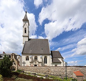
Schloss Frohsdorf
Distance: Approx. 3808 meters
Latitude and longitude: 47.74527778,16.25444444
Schloss Frohsdorf is a castle-like complex in Lanzenkirchen in Niederösterreich and was built 1547–50 out of the ruins of the so-called "Krotenhof". After similar devastation in the year 1683 it was largely altered and renovated in the style of Baroque architecture. Greatly damaged by the Second World War, the palace was restored between 1968 and 1971 by the Austrian postal service.

Battle of the Leitha River
Battle in 1246 in Europe
Distance: Approx. 2316 meters
Latitude and longitude: 47.73666667,16.23027778
The Battle of the Leitha River was fought on 15 June 1246 near the banks of the Leitha river between the forces of the King Béla IV of Hungary and Duke Frederick II of Austria. The Hungarian army was routed, but Duke Frederick was killed, ending Austrian claims to the western counties of Hungary. Its exact location is unknown; according to the description delivered by contemporary minnesinger Ulrich von Liechtenstein the battlefield may have been between the towns of Ebenfurth and Neufeld.

Schwarza (Leitha)
River in Lower Austria, Austria
Distance: Approx. 2162 meters
Latitude and longitude: 47.73515556,16.22464444
The Schwarza is a river in Lower Austria. It is the left headstream of the Leitha.
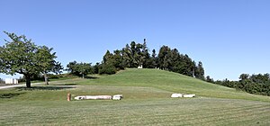
Heuberg (Rosalia Mountains)
Distance: Approx. 6211 meters
Latitude and longitude: 47.6975,16.30667
The Heuberg, also called Rosalia, is 748 m (AA) (2,454 ft), and thus the highest peak in the Rosalia Mountains.

Pitten (river)
River in Lower Austria, Austria
Distance: Approx. 2144 meters
Latitude and longitude: 47.735,16.2247
The Pitten is a river in Lower Austria. Its basin area is 413 km2 (159 sq mi). The source of the Pitten is the confluence of its two headstreams Feistritz and Großer Pestingbach, near Hinterleiten, Feistritz am Wechsel.
Weather in this IP's area
scattered clouds
13 Celsius
12 Celsius
12 Celsius
14 Celsius
1019 hPa
79 %
1019 hPa
976 hPa
10000 meters
3.71 m/s
9.81 m/s
170 degree
50 %
07:18:31
18:01:31