Country:
Region:
City:
Latitude and Longitude:
Time Zone:
Postal Code:
IP information under different IP Channel
ip-api
Country
Region
City
ASN
Time Zone
ISP
Blacklist
Proxy
Latitude
Longitude
Postal
Route
Luminati
Country
Region
14
City
ciechanow
ASN
Time Zone
Europe/Warsaw
ISP
Lcs Systemy Teleinformatyczne
Latitude
Longitude
Postal
IPinfo
Country
Region
City
ASN
Time Zone
ISP
Blacklist
Proxy
Latitude
Longitude
Postal
Route
db-ip
Country
Region
City
ASN
Time Zone
ISP
Blacklist
Proxy
Latitude
Longitude
Postal
Route
ipdata
Country
Region
City
ASN
Time Zone
ISP
Blacklist
Proxy
Latitude
Longitude
Postal
Route
Popular places and events near this IP address

Ciechanów Voivodeship
Former administrative division of Poland
Distance: Approx. 887 meters
Latitude and longitude: 52.881365,20.616324
Ciechanów Voivodeship (Polish: województwo ciechanowskie) was a unit of administrative division and local government in Poland in years 1975–1998, superseded by the Masovian Voivodeship. Its capital city was Ciechanów.

Ciechanów
Place in Masovian Voivodeship, Poland
Distance: Approx. 1691 meters
Latitude and longitude: 52.86666667,20.63333333
Ciechanów [t͡ɕeˈxanuf] (German: Zichenau) is a city in north-central Poland. From 1975 to 1998, it was the capital of the Ciechanów Voivodeship. Since 1999, it has been situated in the Masovian Voivodeship.

Ciechanów County
County in Masovian Voivodeship, Poland
Distance: Approx. 1691 meters
Latitude and longitude: 52.86666667,20.63333333
Ciechanów County (Polish: powiat ciechanowski) is a unit of territorial administration and local government (powiat) in Masovian Voivodeship, east-central Poland. It came into being on January 1, 1999, as a result of the Polish local government reforms passed in 1998. Its administrative seat and largest town is Ciechanów, which lies 77 kilometres (48 mi) north of Warsaw.
Gmina Ciechanów
Gmina in Masovian Voivodeship, Poland
Distance: Approx. 1691 meters
Latitude and longitude: 52.86666667,20.63333333
Gmina Ciechanów is a rural gmina (administrative district) in Ciechanów County, Masovian Voivodeship, in east-central Poland. Its seat is the town of Ciechanów, although the town is not part of the territory of the gmina. The gmina covers an area of 140.23 square kilometres (54.1 sq mi), and as of 2006 its total population is 5,938 (6,885 in 2013).
Kargoszyn
Village in Masovian Voivodeship, Poland
Distance: Approx. 2992 meters
Latitude and longitude: 52.9,20.6
Kargoszyn [karˈɡɔʂɨn] is a village within the administrative district of Gmina Ciechanów, in Ciechanów County, Masovian Voivodeship, Poland. It lies approximately 5 kilometres (3 mi) north-west of Ciechanów and 81 km (50 mi) north of Warsaw. In 1975-1998 village belonged to Ciechanów Voivodeship.
Niechodzin
Village in Masovian Voivodeship, Poland
Distance: Approx. 3267 meters
Latitude and longitude: 52.85,20.58333333
Niechodzin [ɲɛˈxɔd͡ʑin] is a village in the administrative district of Gmina Ciechanów, within Ciechanów County, Masovian Voivodeship, in east-central Poland. It lies approximately 4 kilometres (2 mi) south-west of Ciechanów and 76 km (47 mi) north of Warsaw.
Pęchcin
Village in Masovian Voivodeship, Poland
Distance: Approx. 3108 meters
Latitude and longitude: 52.86666667,20.56666667
Pęchcin [ˈpɛ̃xt͡ɕin] is a village in the administrative district of Gmina Ciechanów, within Ciechanów County, Masovian Voivodeship, in east-central Poland. It lies approximately 5 kilometres (3 mi) west of Ciechanów and 78 km (48 mi) north of Warsaw.
Chrzanówek
Village in Masovian Voivodeship, Poland
Distance: Approx. 3367 meters
Latitude and longitude: 52.87861111,20.66083333
Chrzanówek [xʂaˈnuvɛk] is a village in the administrative district of Gmina Opinogóra Górna, within Ciechanów County, Masovian Voivodeship, in east-central Poland. It lies approximately 5 kilometres (3 mi) south-west of Opinogóra Górna, 3 km (2 mi) north-east of Ciechanów, and 77 km (48 mi) north of Warsaw.
Chrzanowo, Ciechanów County
Village in Masovian Voivodeship, Poland
Distance: Approx. 3718 meters
Latitude and longitude: 52.87083333,20.66638889
Chrzanowo [xʂaˈnɔvɔ] is a village in the administrative district of Gmina Opinogóra Górna, within Ciechanów County, Masovian Voivodeship, in east-central Poland. It lies approximately 5 kilometres (3 mi) south-west of Opinogóra Górna, 3 km (2 mi) east of Ciechanów, and 77 km (48 mi) north of Warsaw.

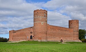
Ciechanów Castle
Castle in Poland
Distance: Approx. 1313 meters
Latitude and longitude: 52.88472222,20.61944444
Castle of the Masovian Dukes is a Brick Gothic castle built at the turn of the 14th and 15th centuries. It is situated in the town of Ciechanów, Masovian Voivodeship, in Poland.

Ciechanów Przemysłowy railway station
Railway station in Masovian, Poland
Distance: Approx. 1085 meters
Latitude and longitude: 52.8647243,20.6162524
Ciechanów Przemysłowy railway station is a railway station at Ciechanów Industrial Estate, Ciechanów, Masovian, Poland. It is served by Koleje Mazowieckie.

Ciechanów railway station
Railway station in Masovian, Poland
Distance: Approx. 1723 meters
Latitude and longitude: 52.8834873,20.5910289
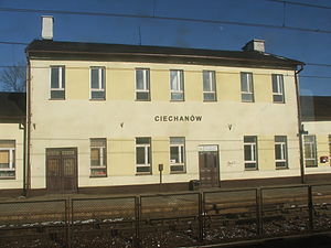
Ciechanów railway station is a railway station at Ciechanów, Ciechanów, Masovian, Poland. It is served by Koleje Mazowieckie.
Weather in this IP's area
overcast clouds
4 Celsius
-1 Celsius
4 Celsius
5 Celsius
1004 hPa
69 %
1004 hPa
990 hPa
10000 meters
7.52 m/s
11.9 m/s
243 degree
100 %
07:06:42
15:39:10