Country:
Region:
City:
Latitude and Longitude:
Time Zone:
Postal Code:
IP information under different IP Channel
ip-api
Country
Region
City
ASN
Time Zone
ISP
Blacklist
Proxy
Latitude
Longitude
Postal
Route
Luminati
Country
ASN
Time Zone
Europe/Amsterdam
ISP
Nextpertise B.V.
Latitude
Longitude
Postal
IPinfo
Country
Region
City
ASN
Time Zone
ISP
Blacklist
Proxy
Latitude
Longitude
Postal
Route
db-ip
Country
Region
City
ASN
Time Zone
ISP
Blacklist
Proxy
Latitude
Longitude
Postal
Route
ipdata
Country
Region
City
ASN
Time Zone
ISP
Blacklist
Proxy
Latitude
Longitude
Postal
Route
Popular places and events near this IP address

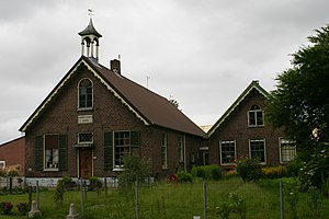
Lisse
Municipality in South Holland, Netherlands
Distance: Approx. 148 meters
Latitude and longitude: 52.25,4.55
Lisse (Dutch: [ˈlɪsə] ) is a town and municipality in the province of South Holland in the Western Netherlands. The municipality, which lies within the Duin- en Bollenstreek, covers an area of 16.05 km2 (6.20 sq mi) of which 0.36 km2 (0.14 sq mi) is water. Its population was 22,982 in 2021.

Noordwijkerhout
Town and former municipality in South Holland, Netherlands
Distance: Approx. 3998 meters
Latitude and longitude: 52.26666667,4.5
Noordwijkerhout (Dutch pronunciation: [ˌnoːrtʋɛikərˈɦʌut] ) is a town and former municipality in the western part of the Netherlands, in the province of South Holland. The town is currently part of the municipality of Noordwijk and lies in the bulb-growing region (the Duin- en Bollenstreek) of the Netherlands, which is famed for its tulips. The former municipality of Noordwijkerhout covered an area of 23.42 km2 (9.04 sq mi), of which 0.81 km2 (0.31 sq mi) was water, and had a population of data missing in 2021.

Sassenheim
Place in South Holland, Netherlands
Distance: Approx. 3382 meters
Latitude and longitude: 52.22583333,4.5225
Sassenheim (Dutch pronunciation: [ˈsɑsə(n)ɦɛim] ) is a town and former municipality in the western Netherlands, in the province of South Holland. The former municipality covered an area of 6.62 km2 (of which 0.23 km2 water) and had a population of 14,906 in 2005. Since 1 January 2006, it is part of the Teylingen municipality.

Ringvaart
Dutch circular canal
Distance: Approx. 2080 meters
Latitude and longitude: 52.2316,4.555
The Ringvaart (known in full as Ringvaart of the Haarlemmermeer Polder) is a canal in the province of North Holland, the Netherlands. The Ringvaart (Dutch meaning "ring canal") is a true circular canal surrounding the Haarlemmermeer polder and forms the boundary of the Haarlemmermeer municipality. Ringvaart is also the name of the dike bordering the canal.
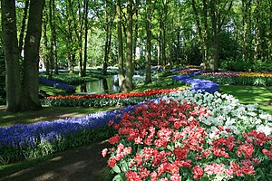
Keukenhof
Flower garden in the Netherlands
Distance: Approx. 2377 meters
Latitude and longitude: 52.271256,4.546365
Keukenhof (Dutch pronunciation: [ˈkøːkə(n)ˌɦɔf]; lit. 'Kitchen garden'), also known as the Garden of Europe, is one of the world's largest flower gardens, situated in the municipality of Lisse, in the Netherlands. According to the official website, Keukenhof Park covers an area of 32 hectares (79 acres) and approximately 7 million flower bulbs are planted in the gardens annually. While it is widely known for its tulips, Keukenhof also features numerous other flowers, including hyacinths, daffodils, lilies, roses, carnations and irises.
Kaag
Village in South Holland, Netherlands
Distance: Approx. 3736 meters
Latitude and longitude: 52.21666667,4.55
Kaag is a village in the Dutch province of South Holland. It is a part of the municipality of Kaag en Braassem, and lies about 8 kilometres (5.0 miles) northeast of Leiden. The village of Kaag lies on an island called Kagereiland in the Kager Lakes (Kagerplassen).

Abbenes
Village in North Holland, Netherlands
Distance: Approx. 3764 meters
Latitude and longitude: 52.23333333,4.6
Abbenes is a village in the Dutch province of North Holland. It is a part of the municipality of Haarlemmermeer, and is situated about 10 kilometres (6.2 mi) southwest of Hoofddorp. The village was first mentioned in 1867 as Abbenes, and is named after a lost island.

Buitenkaag
Village in North Holland, Netherlands
Distance: Approx. 3862 meters
Latitude and longitude: 52.21666667,4.56666667
Buitenkaag is a village in the Dutch province of North Holland. It is a part of the municipality of Haarlemmermeer, and lies about 8 km northeast of Leiden. The name Buitenkaag (Outer Kaag) refers to the town Kaag and the surrounding lake area, the Kagerplassen.
Lisserbroek
Village in North Holland, Netherlands
Distance: Approx. 990 meters
Latitude and longitude: 52.25,4.56666667
Lisserbroek is a village in the Dutch province of North Holland. It is a part of the municipality of Haarlemmermeer, and lies about 10 km southwest of Hoofddorp. It is located along the Ringvaart opposite the town of Lisse in the area called the "Dune and Bulb Region" (Duin- en Bollenstreek).

Sassenheim railway station
Railway station in the Netherlands
Distance: Approx. 4077 meters
Latitude and longitude: 52.21722222,4.52611111
Sassenheim is a railway station in Sassenheim, Netherlands and is situated on the Schiphollijn (Weesp - Leiden). Construction began in 2009 and the station was opened on 9 December 2011, while train services started on 11 December 2011. The station has 2 platforms.

Castlefest
Dutch fantasy festival
Distance: Approx. 2112 meters
Latitude and longitude: 52.267698,4.540143
Castlefest is a medieval/fantasy festival in the Netherlands, held in the gardens of Castle Keukenhof in Lisse since 2005.
Arnoud, Hillegom
Township in South Holland, Netherlands
Distance: Approx. 2083 meters
Latitude and longitude: 52.26666667,4.56666667
Arnoud was a small township in the Dutch province of South Holland. The township was located between Hillegom and Lisse. It consisted of a single street (Arnoudstraat) and was developed as part of the creation of De Arnoud factory in 1904.
Weather in this IP's area
drizzle
11 Celsius
11 Celsius
11 Celsius
12 Celsius
1028 hPa
95 %
1028 hPa
1028 hPa
3000 meters
1.54 m/s
290 degree
75 %
08:01:26
16:51:19


