Country:
 France
Region:
City:
Latitude and Longitude:
Time Zone:
Postal Code:
IP information under different IP Channel
ip-api
Country
Region
City
ASN
Time Zone
ISP
Blacklist
Proxy
Latitude
Longitude
Postal
Route
IPinfo
Country
Region
City
ASN
Time Zone
ISP
Blacklist
Proxy
Latitude
Longitude
Postal
Route
MaxMind
Country
Region
City
ASN
Time Zone
ISP
Blacklist
Proxy
Latitude
Longitude
Postal
Route
Luminati
Country
FRRegion
idf
City
dammarieleslys
ASN
Time Zone
Europe/Paris
ISP
ADISTA SAS
Latitude
Longitude
Postal
db-ip
Country
Region
City
ASN
Time Zone
ISP
Blacklist
Proxy
Latitude
Longitude
Postal
Route
ipdata
Country
Region
City
ASN
Time Zone
ISP
Blacklist
Proxy
Latitude
Longitude
Postal
Route
Popular places and events near this IP address

Abbey of Saint-Martin-du-Canigou
Monastery in southern France
Distance: Approx. 2641 meters
Latitude and longitude: 42.528144,2.400892
The abbey of Saint-Martin-du-Canigou (Catalan: Sant Martí del Canigó) is a monastery built in 1009 in the Pyrenees of Northern Catalonia on Canigou mountain in present-day southern France near the Spanish border. Pau Casals wrote a composition entitled "Sant Martí del Canigó" for Orchestra.

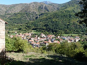
Vernet-les-Bains
Commune in Occitania, France
Distance: Approx. 152 meters
Latitude and longitude: 42.55,2.3886
Vernet-les-Bains (French pronunciation: [vɛʁnɛ le bɛ̃] ; Catalan: Vernet) is a commune in the Pyrénées-Orientales department in southern France. It is a centre for visitors and holidaymakers. The village has a sunny climate (with, on average, 300 days of sunshine each year) and is set in a sheltered valley in the foothills of the Canigou mountain - which rises to a height of 2,785 metres (over 9,000 feet).

Villefranche-de-Conflent
Commune in Occitania, France
Distance: Approx. 4468 meters
Latitude and longitude: 42.586825,2.366815
Villefranche-de-Conflent (French pronunciation: [vilfʁɑ̃ʃ də kɔ̃flɑ̃] ; Catalan: Vilafranca de Conflent) is historically a town in the Conflent region of Catalonia, and now a commune in the Pyrénées-Orientales department in southern France. It is a member of Les Plus Beaux Villages de France (The Most Beautiful Villages of France) Association.

Fillols
Commune in Occitania, France
Distance: Approx. 2366 meters
Latitude and longitude: 42.5619,2.4103
Fillols (French pronunciation: [fijɔls] ; Catalan: Fillols) is a commune in the Pyrénées-Orientales department in southern France.

Fuilla
Commune in Occitania, France
Distance: Approx. 2435 meters
Latitude and longitude: 42.5628,2.3633
Fuilla (French pronunciation: [fɥija] ; Catalan: Fullà) is a commune in the Pyrénées-Orientales department in southern France.
Sahorre
Commune in Occitania, France
Distance: Approx. 2692 meters
Latitude and longitude: 42.5333,2.3625
Sahorre (French pronunciation: [sa.ɔʁ] ; Catalan: Saorra) is a commune in the Pyrénées-Orientales department in southern France.

Corneilla-de-Conflent
Commune in Occitania, France
Distance: Approx. 2053 meters
Latitude and longitude: 42.5675,2.3814
Corneilla-de-Conflent (French pronunciation: [kɔʁnɛja də kɔ̃flɑ̃] , Corneilla of Conflent; Catalan: Cornellà de Conflent) is a commune in the Pyrénées-Orientales department in southern France.

Casteil
Commune in Occitania, France
Distance: Approx. 2049 meters
Latitude and longitude: 42.5319,2.3942
Casteil (French pronunciation: [kastɛj] ; Catalan: Castell de Vernet) is a commune in the Pyrénées-Orientales department in southern France, part of the historical Conflent comarca. The abbey Martin-du-Canigou is located above Casteil.
Village arboretum de Vernet-les-Bains
Distance: Approx. 153 meters
Latitude and longitude: 42.55,2.38861111
The Village arboretum de Vernet-les-Bains is an arboretum planted throughout the town of Vernet-les-Bains, Pyrénées-Orientales, Languedoc-Roussillon, France. It is open daily without charge. The arboretum's beginnings can be traced to a devastating flood in 1940, with a variety of trees planted in the 1960s during restoration work.

Church of St. Mary (Corneilla-de-Conflent)
Distance: Approx. 1906 meters
Latitude and longitude: 42.56638889,2.38305556
St. Mary is a church in Corneilla-de-Conflent, southern France. Built in the 11th-12th centuries, in Romanesque style, it was originally an Augustinian monastery.

Cady (river)
River in France
Distance: Approx. 4492 meters
Latitude and longitude: 42.5878,2.3696
The Cady (Catalan: Cadí) is a 19 km long river in the Catalan Pyrenees of southern France, near the border with eastern Spain. It rises on the slopes of the Canigou, and flows through the Cadí cirque where it feeds the Cadí Lakes. It then flows westwards for four kilomètres, before turning to the north, through the Cady Gorge.

1967 Air Ferry DC-4 accident
1967 aviation disaster
Distance: Approx. 2557 meters
Latitude and longitude: 42.52838889,2.39916667
The 1967 Air Ferry DC-4 accident occurred on 3 June 1967, when a Douglas DC-4 registered as G-APYK on a non-scheduled charter flight between Manston Airport in Kent, England and Perpignan Airport in France hit the Canigou mountain in France, killing all 88 on board. The cause of the accident was determined to be carbon monoxide poisoning of the flight crew due to a faulty cabin heater. The crash is the deadliest aviation accident involving a DC-4.
Weather in this IP's area
scattered clouds
7 Celsius
6 Celsius
6 Celsius
10 Celsius
1019 hPa
84 %
1019 hPa
942 hPa
10000 meters
2.45 m/s
2.64 m/s
281 degree
38 %
08:08:19
19:02:04