Country:
Region:
City:
Latitude and Longitude:
Time Zone:
Postal Code:
IP information under different IP Channel
ip-api
Country
Region
City
ASN
Time Zone
ISP
Blacklist
Proxy
Latitude
Longitude
Postal
Route
Luminati
Country
ASN
Time Zone
Europe/Paris
ISP
ITSVision S.A.R.L.
Latitude
Longitude
Postal
IPinfo
Country
Region
City
ASN
Time Zone
ISP
Blacklist
Proxy
Latitude
Longitude
Postal
Route
db-ip
Country
Region
City
ASN
Time Zone
ISP
Blacklist
Proxy
Latitude
Longitude
Postal
Route
ipdata
Country
Region
City
ASN
Time Zone
ISP
Blacklist
Proxy
Latitude
Longitude
Postal
Route
Popular places and events near this IP address
Vitry-sur-Seine
Administrative division in Île-de-France, France
Distance: Approx. 1284 meters
Latitude and longitude: 48.7875,2.3928
Vitry-sur-Seine (French pronunciation: [vitʁi syʁ sɛn] ) is a commune in the southeastern suburbs of Paris, France, 7.5 km (4.7 mi) from the centre of Paris.

Ivry-sur-Seine
Commune in Île-de-France, France
Distance: Approx. 1363 meters
Latitude and longitude: 48.8078,2.3747
Ivry-sur-Seine (French pronunciation: [ivʁi syʁ sɛn]) is a commune in the Val-de-Marne department in the southeastern suburbs of Paris, France. It is located 5.3 km (3+1⁄4 mi) from the centre of Paris. Paris's main Asian district, the Quartier Asiatique in the 13th arrondissement, borders the commune and now extends into the northern parts of Ivry.

Villejuif
Commune in Île-de-France, France
Distance: Approx. 1432 meters
Latitude and longitude: 48.7919,2.3636
Villejuif (French pronunciation: [vilʒɥif] ) is a commune in the southern suburbs of Paris, France. It is located 7 km (4.3 mi) from the centre of Paris.

Villejuif–Louis Aragon station
Metro station in Paris, France
Distance: Approx. 1474 meters
Latitude and longitude: 48.787175,2.367564
Villejuif–Louis Aragon station (French pronunciation: [vilʒɥif lwi aʁaɡɔ̃]) is a station of the Paris Métro, located in the commune of Villejuif.

Villejuif–Paul Vaillant-Couturier station
Metro station in Paris, France
Distance: Approx. 998 meters
Latitude and longitude: 48.795991,2.368248
Villejuif–Paul Vaillant-Couturier (French pronunciation: [vilʒɥif pɔl vajɑ̃ kutyʁje]) is a station of the Paris Métro, located on Line 7. It serves the commune of Villejuif.

Hôpital Paul-Brousse
Hospital in Val-de-Marne, France
Distance: Approx. 1481 meters
Latitude and longitude: 48.79583333,2.36166667
Hôpital Paul-Brousse is a hospital in Villejuif, Val-de-Marne, France. It is named after Paul Brousse, a French socialist. Marc Zelter MD and Daniel Vittecoq MD were professors in this hospital.

Musée d'Art Contemporain du Val-de-Marne
Art museum in Vitry-sur-Seine, France
Distance: Approx. 572 meters
Latitude and longitude: 48.79277778,2.38722222
The Musée d'Art Contemporain du Val-de-Marne, nicknamed MAC/VAL, is a museum of contemporary art located in the Place de la Libération in Vitry-sur-Seine, Val-de-Marne, a suburb of Paris, France. It is open daily except Mondays; an admission fee is charged. The museum opened in 2005, and is dedicated to works of art from the 1950s to the present.
Fort d'Ivry
Distance: Approx. 874 meters
Latitude and longitude: 48.80222,2.39
Fort d'Ivry was built in the Paris suburb of Ivry-sur-Seine between 1841 and 1845, as one of the forts in a ring of strong points surrounding Paris. The fort is about 1 kilometre outside the Thiers Wall, built by the same program in response to a perception that Paris was vulnerable to invasion and occupation. The fort was upgraded in the 1870s, to cope with improvements in artillery performance as part of the Séré de Rivières system.

Church of Saint-Cyr-Sainte-Julitte, Villejuif
Roman Catholic church in Villejuif, Val-de-Marne, France
Distance: Approx. 1419 meters
Latitude and longitude: 48.79222222,2.36361111
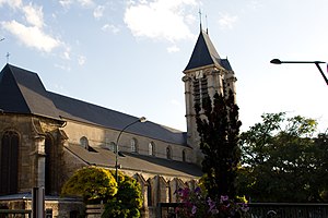
The Church of Saint-Cyr-Sainte-Julitte (French: église Saint-Cyr-Sainte-Julitte) is a Roman Catholic church located in Villejuif, Val-de-Marne, France. It is listed as a Historic Monument.

Hôtel de la Capitainerie des Chasses
Historic Monument in Villejuif, France
Distance: Approx. 1210 meters
Latitude and longitude: 48.79222222,2.36666667
The Hôtel de la Capitainerie des Chasses (lit. 'Hunting Master's Office Hotel') is a hôtel particulier and Historic Monument in Villejuif in the Val-de-Marne department, France.

Hôpital Charles-Foix
Public hospital in Ivry-sur-Seine, France
Distance: Approx. 1470 meters
Latitude and longitude: 48.8055555,2.3964393
The Hôpital Charles-Foix is a public hospital from Assistance Publique–Hôpitaux de Paris (AP-HP) located at 7 avenue de la République, in Ivry-sur-Seine (Val-de-Marne). On January 1, 2011, the two Pitié-Salpêtrière and Charles-Foix hospital groups were merged into a single hospital group. It is affiliated with Sorbonne University.

Mairie de Vitry-sur-Seine station
Paris Métro station in Vitry-sur-Seine
Distance: Approx. 832 meters
Latitude and longitude: 48.7899222,2.38721944
Mairie de Vitry-sur-Seine station is an upcoming underground station on Line 15 of the Paris Métro. It is part of the Grand Paris Express project. The station is located in the town of Vitry-sur-Seine at the intersection of Rue Édouard-Tremblay and Avenue Maximilien-Robespierre.
Weather in this IP's area
broken clouds
9 Celsius
7 Celsius
8 Celsius
10 Celsius
1023 hPa
97 %
1023 hPa
1016 hPa
10000 meters
3.6 m/s
90 degree
75 %
07:48:48
17:19:44

