Country:
Region:
City:
Latitude and Longitude:
Time Zone:
Postal Code:
IP information under different IP Channel
ip-api
Country
Region
City
ASN
Time Zone
ISP
Blacklist
Proxy
Latitude
Longitude
Postal
Route
Luminati
Country
ASN
Time Zone
Europe/Paris
ISP
KOESIO Networks SAS
Latitude
Longitude
Postal
IPinfo
Country
Region
City
ASN
Time Zone
ISP
Blacklist
Proxy
Latitude
Longitude
Postal
Route
db-ip
Country
Region
City
ASN
Time Zone
ISP
Blacklist
Proxy
Latitude
Longitude
Postal
Route
ipdata
Country
Region
City
ASN
Time Zone
ISP
Blacklist
Proxy
Latitude
Longitude
Postal
Route
Popular places and events near this IP address
Causse-Bégon
Commune in Occitanie, France
Distance: Approx. 6546 meters
Latitude and longitude: 44.0628,3.3608
Causse-Bégon (French pronunciation: [kos beɡɔ̃]; Occitan: Lo Causse Begon) is a commune in the Gard department in southern France.

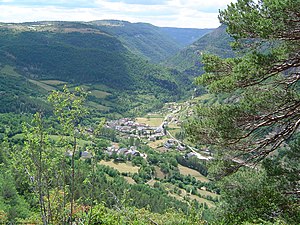
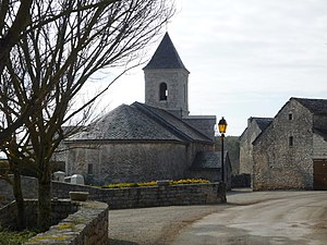
Nant, Aveyron
Commune in Occitanie, France
Distance: Approx. 102 meters
Latitude and longitude: 44.0217,3.3006
Nant (French pronunciation: [nɑ̃]) is a commune in the Aveyron department in southern France.
L'Hospitalet-du-Larzac
Commune in Occitanie, France
Distance: Approx. 9935 meters
Latitude and longitude: 43.9742,3.1969
L'Hospitalet-du-Larzac (French pronunciation: [lɔspitalɛ dy laʁzak]; Occitan: L'Espitalet de Larzac) is a commune in the Aveyron department in southern France, part of the southern Massif central, incorporating part of the Larzac plateau. The economy is agricultural, notably dairy produce (Roquefort cheese), but also beef and mutton production, and rural tourism. L'Hospitalet-du-Larzac is the site of discovery of one of the longest and most important inscriptions in the Gaulish language, a lead curse tablet (found in 1983).

Trèves, Gard
Commune in Occitania, France
Distance: Approx. 9432 meters
Latitude and longitude: 44.0789,3.3892
Trèves (French pronunciation: [tʁɛv]; Occitan: Trève) is a commune in the Gard department in southern France.

Revens
Commune in Occitania, France
Distance: Approx. 7276 meters
Latitude and longitude: 44.0878,3.2972
Revens is a commune in the Gard department in southern France.
Saint-Jean-du-Bruel
Commune in Occitanie, France
Distance: Approx. 4818 meters
Latitude and longitude: 44.0236,3.3614
Saint-Jean-du-Bruel (French pronunciation: [sɛ̃ ʒɑ̃ dy bʁyɛl]; Occitan: Sent Joan del Bruèlh) is a commune in the Aveyron department in southern France. Marie-Laurence Quatrefages was the mayor of Saint-Jean-du-Bruel from 1947 until 1965.
Sauclières
Commune in Occitanie, France
Distance: Approx. 7361 meters
Latitude and longitude: 43.9769,3.3678
Sauclières (French pronunciation: [soklijɛʁ]; Occitan: Sauclièiras) is a commune in the Aveyron department in southern France.
Weather in this IP's area
overcast clouds
11 Celsius
10 Celsius
11 Celsius
11 Celsius
1018 hPa
69 %
1018 hPa
960 hPa
10000 meters
2.24 m/s
7.15 m/s
347 degree
87 %
07:46:14
17:18:08


