185.239.66.31 - IP Lookup: Free IP Address Lookup, Postal Code Lookup, IP Location Lookup, IP ASN, Public IP
Country:
Region:
City:
Location:
Time Zone:
Postal Code:
IP information under different IP Channel
ip-api
Country
Region
City
ASN
Time Zone
ISP
Blacklist
Proxy
Latitude
Longitude
Postal
Route
Luminati
Country
ASN
Time Zone
Europe/Berlin
ISP
Campus, Hofnetz & Events GmbH
Latitude
Longitude
Postal
IPinfo
Country
Region
City
ASN
Time Zone
ISP
Blacklist
Proxy
Latitude
Longitude
Postal
Route
IP2Location
185.239.66.31Country
Region
schleswig-holstein
City
neuendorf
Time Zone
Europe/Berlin
ISP
Language
User-Agent
Latitude
Longitude
Postal
db-ip
Country
Region
City
ASN
Time Zone
ISP
Blacklist
Proxy
Latitude
Longitude
Postal
Route
ipdata
Country
Region
City
ASN
Time Zone
ISP
Blacklist
Proxy
Latitude
Longitude
Postal
Route
Popular places and events near this IP address

Elmshorn
Town in Schleswig-Holstein, Germany
Distance: Approx. 6035 meters
Latitude and longitude: 53.75194444,9.65111111
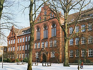
Elmshorn (German pronunciation: [ɛlmsˈhɔʁn] ; Low German: Elmshoorn) is a town in the district of Pinneberg in Schleswig-Holstein in Germany. It is 30 km north of Hamburg on the small river Krückau, a tributary of the Elbe, and with about 50,000 inhabitants is the sixth-largest town in the state of Schleswig-Holstein, Germany. It is the birthplace of writer and editor Hermann Schlüter (1851–1919), the mathematician Hermann Weyl (1885–1955) and the medievalist Heinz Woehlk (1944- ).

Elmshorn-Land
Amt in Germany
Distance: Approx. 6035 meters
Latitude and longitude: 53.75194444,9.65111111
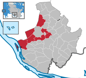
Elmshorn-Land is an Amt ("collective municipality") in the district of Pinneberg, in Schleswig-Holstein, Germany. It is situated around Elmshorn, which is the seat of the Amt, but not part of it.

Klein Nordende
Municipality in Schleswig-Holstein, Germany
Distance: Approx. 6204 meters
Latitude and longitude: 53.71666667,9.65
Klein Nordende is a municipality in the district of Pinneberg, in Schleswig-Holstein, Germany.

Raa-Besenbek
Municipality in Schleswig-Holstein, Germany
Distance: Approx. 4062 meters
Latitude and longitude: 53.76666667,9.6
Raa-Besenbek is a municipality in the district of Pinneberg, in Schleswig-Holstein, Germany.

Seester
Municipality in Schleswig-Holstein, Germany
Distance: Approx. 2345 meters
Latitude and longitude: 53.71666667,9.56666667
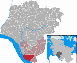
Seester (pronounced "sister") is a municipality in the district of Pinneberg, in Schleswig-Holstein, Germany.

Seestermühe
Municipality in Schleswig-Holstein, Germany
Distance: Approx. 4194 meters
Latitude and longitude: 53.7,9.56666667
Seestermühe is a municipality in the district of Pinneberg, in Schleswig-Holstein, Germany.

Neuendorf bei Elmshorn
Municipality in Schleswig-Holstein, Germany
Distance: Approx. 542 meters
Latitude and longitude: 53.73333333,9.56666667
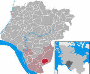
Neuendorf bei Elmshorn is a municipality in the district of Steinburg, in Schleswig-Holstein, Germany.

Altenmoor
Municipality in Schleswig-Holstein, Germany
Distance: Approx. 3246 meters
Latitude and longitude: 53.76666667,9.56666667
Altenmoor is a municipality in the district of Steinburg, in Schleswig-Holstein, Germany.

Kiebitzreihe
Municipality in Schleswig-Holstein, Germany
Distance: Approx. 6207 meters
Latitude and longitude: 53.78333333,9.61666667
Kiebitzreihe is a municipality in the district of Steinburg, in Schleswig-Holstein, Germany.

Kollmar
Municipality in Schleswig-Holstein, Germany
Distance: Approx. 4352 meters
Latitude and longitude: 53.75,9.5
Kollmar is a municipality in the district of Steinburg, in Schleswig-Holstein, Germany.

Krückau
River in Schleswig-Holstein, Germany
Distance: Approx. 4232 meters
Latitude and longitude: 53.7144,9.5118
Krückau is a river in the federal state of Schleswig-Holstein in the north of Germany. It flows into the river Elbe near Seestermühe. The 11.3 km (7.0 mi) lower part between the Elbe and Elmshorn is navigable but not classified.

Pinnau (river)
River in Schleswig-Holstein, Germany
Distance: Approx. 6928 meters
Latitude and longitude: 53.6762,9.5455
The Pinnau is a 41-kilometre-long (25 mi) river, which flows right or northeast of the main river, Elbe. The Pinnau is therefore a tributary in the southern part of Schleswig-Holstein, Germany. The Pinnau is categorized by German Bund/Länder-Arbeitsgemeinschaft Wasser (Federal/state association water) by "flow type" as a "marshland water body".
Weather in this IP's area
overcast clouds
5 Celsius
0 Celsius
4 Celsius
5 Celsius
1014 hPa
90 %
1014 hPa
1013 hPa
10000 meters
6.29 m/s
13.05 m/s
212 degree
100 %