Country:
Region:
City:
Latitude and Longitude:
Time Zone:
Postal Code:
IP information under different IP Channel
ip-api
Country
Region
City
ASN
Time Zone
ISP
Blacklist
Proxy
Latitude
Longitude
Postal
Route
Luminati
Country
ASN
Time Zone
Europe/Madrid
ISP
Hispasat S.A
Latitude
Longitude
Postal
IPinfo
Country
Region
City
ASN
Time Zone
ISP
Blacklist
Proxy
Latitude
Longitude
Postal
Route
db-ip
Country
Region
City
ASN
Time Zone
ISP
Blacklist
Proxy
Latitude
Longitude
Postal
Route
ipdata
Country
Region
City
ASN
Time Zone
ISP
Blacklist
Proxy
Latitude
Longitude
Postal
Route
Popular places and events near this IP address

Circuito Lasarte
Race track at Lasarte-Oria, Guipúzcoa, Spain
Distance: Approx. 4462 meters
Latitude and longitude: 43.25638889,-2.01861111
The Circuito Lasarte was an 17.749 km (11.029 mi) Grand Prix motor racing road course at Lasarte-Oria, Gipuzkoa, Spain in the Basque Country near the city of San Sebastián on the Bay of Biscay. The counterclockwise layout was used between 1923 and 1935 but racing ended with the eruption of the Spanish Civil War in 1936 and after the war auto racing resumed at new tracks near Barcelona. The Circuito Lasarte played host to the San Sebastian Grand Prix, Spanish Grand Prix and the 1926 European Grand Prix.
Aduna
Municipality in Basque Country, Spain
Distance: Approx. 2726 meters
Latitude and longitude: 43.2,-2.05
Aduna is a town located in the province of Gipuzkoa, in the autonomous community of Basque Country, in the North of Spain. In 2003, Aduna had a total population of 341. Aduna as a last name is likely to have a Basque origin, although none of the 341 inhabitants of the town of Aduna has that last name.
Andoain
Place in Gipuzkoa, Spain
Distance: Approx. 700 meters
Latitude and longitude: 43.21666667,-2.01666667
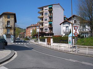
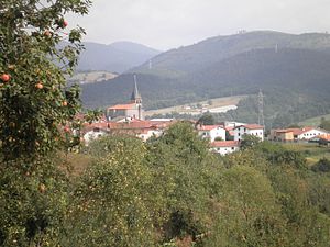
Andoain is a town in the province of Gipuzkoa, in the autonomous community of Basque Country, in the North of Spain. Nowadays it has a population of 14,637 inhabitants (2019), which has been quite stable since the 90s. Andoain is located where the Oria River meets the Leitzaran river, next to the mountains Belkoain and Buruntza.

Lasarte-Oria
Place in Basque Country, Spain
Distance: Approx. 5713 meters
Latitude and longitude: 43.26777778,-2.02
Lasarte-Oria is a town located in the province of Gipuzkoa, in the Autonomous Community of Basque Country, northern Spain. It was founded in 1986. It is estimated to have a population of around 19.000 people inhabitants.

Usurbil
Municipality in Basque Country, Spain
Distance: Approx. 5922 meters
Latitude and longitude: 43.26666667,-2.05
Usurbil (Spanish: Usúrbil) is a town and region located in the province of Gipuzkoa in the Autonomous Community of the Basque Country, in the North of Spain. It lies in an area well known for its sagardotegiak (cider houses) and the area adjacent to the river for its eels.
Amasa-Villabona
Municipality in Basque Country, Spain
Distance: Approx. 3869 meters
Latitude and longitude: 43.18805556,-2.0525
Amasa-Villabona is a village of over 5500 inhabitants in the comarca of Tolosaldea, Gipuzkoa province, Basque Country, Spain. It has an urban area, Villabona, close to the Oria River, and a rural area, Amasa, around which the village originally formed. Amasa-Villabona is located in the Oria Valley, in the foothills of Mount Gazume and Mount Uzturre.

Zizurkil
Place in Basque Country, Spain
Distance: Approx. 4600 meters
Latitude and longitude: 43.2,-2.07722222
Zizurkil (Spanish, Cizúrquil) is a town located in the province of Gipuzkoa, in the Autonomous Community of Basque Country, northern Spain.

Adarra
Mountain in the Basque Country
Distance: Approx. 5227 meters
Latitude and longitude: 43.20716111,-1.96219444
Adarra (short for "Adarramendi", meaning 'mount of horns' in Basque) is a mountain south of the city of San Sebastian in the Basque Country. It is a popular peak with the local residents. The mountain is flanked on the north by the minor summits of Oindi or Onddi (Basque pronunciation: ['onɟi], 545 m) and Onddo (781 m) to the south, all of them located at the top of a long mountain range of modest height between the Urumea and Leitzaran valleys, which extends south right to the edge of the Navarrese town of Leitza.

Buruntza
Mountain in the Basque Country
Distance: Approx. 2498 meters
Latitude and longitude: 43.23815,-2.01670278
Buruntza (441 m) is a minor mountain in the Basque Country (Spain) 12 km south of San Sebastian. Several towns lie at its foot, namely Andoain (S), Lasarte-Oria (N) and Urnieta (E). The mountain stretches out in a north-east to south-west disposition, starting at the pass of Azkorte (hermitage) on to a quarry at the southern end, by the neighbourhood Buruntza in Andoain.

Zubieta Facilities
Football training ground in Spain
Distance: Approx. 4646 meters
Latitude and longitude: 43.25833333,-2.02527778
The Zubieta Facilities (Basque: Zubietako Kirol-instalakuntzak, Spanish: Instalaciones de Zubieta), is the training ground of the Primera Division club Real Sociedad. Located in Zubieta, an enclave of San Sebastian (adjacent to the San Sebastián Hippodrome), it was opened in 2004 in its modernised form, although was originally inaugurated in 1981. Occupying an area of 70,000 m², it was designed by architect Izaskun Larzábal.

Battle of Andoain
Distance: Approx. 285 meters
Latitude and longitude: 43.21694444,-2.02181667
The Battle of Andoain (Basque: Andoaingo Gudua) was a military engagement of the First Carlist War that was fought on 14 September 1837. It took place around the Basque village of Andoain, south of the main Liberal stronghold of San Sebastián. Liberal troops under Leopoldo O'Donnell had captured Andoain on 9 September, driving the Carlist garrison there to the western bank of the Oria.
Lasarte-Oria station
Railway station in Lasarte-Oria, Basque Country, Spain
Distance: Approx. 6040 meters
Latitude and longitude: 43.27073056,-2.02011111
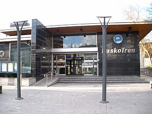
Lasarte-Oria is a railway station in Lasarte-Oria, Basque Country, Spain. It is owned by Euskal Trenbide Sarea and operated by Euskotren. It lies on a branch of the Bilbao-San Sebastián line and is served by the suburban Topo service.
Weather in this IP's area
clear sky
7 Celsius
7 Celsius
6 Celsius
9 Celsius
1022 hPa
86 %
1022 hPa
1016 hPa
10000 meters
0.89 m/s
1.34 m/s
166 degree
5 %
08:01:31
17:44:13


