Country:
Region:
City:
Latitude and Longitude:
Time Zone:
Postal Code:
IP information under different IP Channel
ip-api
Country
Region
City
ASN
Time Zone
ISP
Blacklist
Proxy
Latitude
Longitude
Postal
Route
Luminati
Country
ASN
Time Zone
Europe/Madrid
ISP
Hispasat S.A
Latitude
Longitude
Postal
IPinfo
Country
Region
City
ASN
Time Zone
ISP
Blacklist
Proxy
Latitude
Longitude
Postal
Route
db-ip
Country
Region
City
ASN
Time Zone
ISP
Blacklist
Proxy
Latitude
Longitude
Postal
Route
ipdata
Country
Region
City
ASN
Time Zone
ISP
Blacklist
Proxy
Latitude
Longitude
Postal
Route
Popular places and events near this IP address

Agüimes
Municipality in Canary Islands, Spain
Distance: Approx. 713 meters
Latitude and longitude: 27.9,-15.45
Agüimes is a Spanish town and municipality in the eastern part of the island of Gran Canaria in the Las Palmas province in the Canary Islands.
Santa Lucía de Tirajana
Municipality in Macaronesia, Spain
Distance: Approx. 9350 meters
Latitude and longitude: 27.91222222,-15.54083333
Santa Lucía de Tirajana is a town and a Spanish municipality in the south-eastern part of the island of Gran Canaria, in the Province of Las Palmas, in the Canary Islands.

Gran Canaria Airport
Spanish airport
Distance: Approx. 6550 meters
Latitude and longitude: 27.93194444,-15.38666667
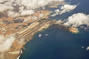
Gran Canaria Airport (IATA: LPA, ICAO: GCLP) (Spanish: Aeropuerto de Gran Canaria) is a passenger and freight airport on the island of Gran Canaria. It is an important airport within the Spanish air transport network (owned and managed by a public enterprise, AENA), as it holds the sixth position in terms of passengers, and fifth in terms of operations and cargo transported. It also ranks first of the Canary Islands in all three categories, although the island of Tenerife has higher passenger numbers overall if statistics from the two airports located on the island are combined.

Estadio Municipal de Vecindario
Distance: Approx. 6381 meters
Latitude and longitude: 27.84810833,-15.44813889
Estadio Municipal de Vecindario is a multi-use stadium in Santa Lucía de Tirajana, Spain. It is currently used mostly for football matches and is the home ground of UD Vecindario. The stadium holds 4,500 people.

Punta de Arinaga Lighthouse
Lighthouse on Gran Canaria, Spain
Distance: Approx. 7599 meters
Latitude and longitude: 27.86408,-15.384627
The Punta de Arinaga Lighthouse (Spanish: Faro de Punta de Arinaga) is an active lighthouse on the Spanish island of Gran Canaria in the Canary islands. The current lighthouse tower is the third to be constructed on the rocky headland of Punta Arinaga, near the town of the same name in the municipality of Agüimes. Arinaga is on the south-east side of the island and marks the coastline between the Maspalomas lighthouse to the south and the Punta de Melenara lighthouse of Telde to the north.
Guayadeque ravine
Distance: Approx. 7269 meters
Latitude and longitude: 27.93777778,-15.51027778
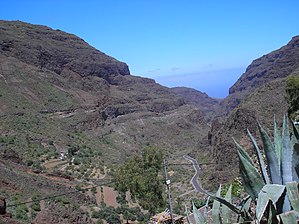
The Guayadeque ravine, in Spanish Barranco de Guayadeque, is a ravine-type valley located on the Spanish municipalities of Ingenio and Agüimes, in the province of Las Palmas on Grand Canary island, off the coast of Morocco. One of the largest ravines on the archipelago, it is notable for its archaeological remains and for its valuable endemic species of flora and fauna – the latter including one of the largest lizard species. It is also notable for the large quantity of cave houses, including a hermitage and various restaurants dug into the rock.

Four Doors cave site, Telde
Cave
Distance: Approx. 7107 meters
Latitude and longitude: 27.96440167,-15.418496
The Four Doors (in Spanish Cuatro Puertas) site, also known as Montaña Bermeja, 'Vermillion Mountain', is a complex of caves in the south of the municipality of Telde, Gran Canaria. The Cuatro Puertas site is named after its most spectacular cave, the most emblematic of Gran Canaria due to its uniqueness and location. The site includes many other caves, some linked with each other.

Vecindario
Place in Macaronesia, Spain
Distance: Approx. 6483 meters
Latitude and longitude: 27.84722222,-15.44305556
Vecindario is a town in the municipality of Santa Lucía de Tirajana in the south-eastern part of the island of Gran Canaria, in the Province of Las Palmas, in the Canary Islands. The population of Vecindario was estimated at 80 235 inhabitants in the 2023 census. Its current president is D. Francisco José García López.

Temisas Astronomical Observatory
Astronomical observatory in Gran Canaria, Canary Islands
Distance: Approx. 8480 meters
Latitude and longitude: 27.8986182,-15.5319536
The Temisas Astronomical Observatory (Spanish: Observatorio Astronomico del Temisas) is an astronomical observatory on the island of Gran Canaria in the Canary Islands, Spain. It is located on Montaña de Arriba, Temisas, in the Agüimes municipality in the south-east of the island, at an altitude of 850 metres (2,790 ft). The observatory was opened in 2008 and is operated by the Fundación Canaria Observatorio de Temisas.

Port of Arinaga
Seaport
Distance: Approx. 8169 meters
Latitude and longitude: 27.84555556,-15.39805556
The port of Arinaga is a small seaport off the eastern coast of the Spanish island of Gran Canaria, in the Canary Islands, themselves located in the Mid-Atlantic. It was not until the later part of the 19th century when the construction of a small harbor in order to facilitate the agricultural exports of the southern part of the island was proposed. Works initiated following the 1917 crisis during World War I and, in 1927, an expansion was commissioned, although it would not take place at the time.

Gando Air Base
Spanish Air and Space Force base
Distance: Approx. 7427 meters
Latitude and longitude: 27.936,-15.379
The Gando Air Base (in Spanish: Base Aérea de Gando) is a base of the Spanish Air and Space Force located in the Gran Canaria island, Spain, and next to the Gran Canaria Airport, eastward from its runways. Beyond several hangars opposite to the passenger terminal, the Gando Air Base contains ten shelters situated on the southern end of the eastern runway. They harbor the 46 Wing (Ala 46) which operates F/A-18 Hornet and CASA/IPTN CN-235 aircraft, and the SAR Eurocopter AS 532.
Weather in this IP's area
few clouds
16 Celsius
16 Celsius
16 Celsius
17 Celsius
1012 hPa
77 %
1012 hPa
979 hPa
10000 meters
1.03 m/s
20 %
07:23:36
18:09:31

