Country:
Region:
City:
Latitude and Longitude:
Time Zone:
Postal Code:
IP information under different IP Channel
ip-api
Country
Region
City
ASN
Time Zone
ISP
Blacklist
Proxy
Latitude
Longitude
Postal
Route
Luminati
Country
ASN
Time Zone
Europe/Madrid
ISP
Iberwix Telecom S.l.
Latitude
Longitude
Postal
IPinfo
Country
Region
City
ASN
Time Zone
ISP
Blacklist
Proxy
Latitude
Longitude
Postal
Route
db-ip
Country
Region
City
ASN
Time Zone
ISP
Blacklist
Proxy
Latitude
Longitude
Postal
Route
ipdata
Country
Region
City
ASN
Time Zone
ISP
Blacklist
Proxy
Latitude
Longitude
Postal
Route
Popular places and events near this IP address

Córdoba, Spain
City in Andalusia, Spain
Distance: Approx. 1654 meters
Latitude and longitude: 37.89,-4.78
Córdoba ( KOR-də-bə; Spanish: [ˈkoɾðoβa] ), or sometimes Cordova ( KOR-də-və), is a city in Andalusia, Spain, and the capital of the province of Córdoba. It is the third most populated municipality in Andalusia. The city primarily lies on the right bank of the Guadalquivir in the south of the Iberian Peninsula.

Torre de la Malmuerta
Distance: Approx. 1790 meters
Latitude and longitude: 37.89166667,-4.77777778
The Torre de la Malmuerta is a gate tower of the Axerquía wall in Córdoba, Spain. This albarrana tower was built in 1406–1408, by order of King Henry III of Castile, over a pre-existing Almohad structure, to defend the gates of Rincón and Colodro. Later it was also used as a prison for nobles.

Roman mausoleum of Córdoba
1st Century mausoleum in southern Spain
Distance: Approx. 1575 meters
Latitude and longitude: 37.8851,-4.785
The Roman mausoleum of Córdoba is an ancient structure in the Jardines de la Victoria, Córdoba, Andalusia, southern Spain. It is a funerary monument of cylinder-shaped that corresponded to a group of funerary monuments of the Republican era, built in the 1st century AD. It was discovered in 1993 during archaeological excavations. It includes the chamber tomb that housed the Urn, as well as remains of the basement, cornices, and crenellated parapet.

San Nicolás de la Villa
Distance: Approx. 1803 meters
Latitude and longitude: 37.88444444,-4.78222222
San Nicolás de la Villa is a church in Córdoba, Andalusia, southern Spain. It is one of the twelve Fernandine churches built in the city after its conquest by King Ferdinand III of Castile (1236), in Gothic-Mudéjar style, although it was completed only in the following centuries, with much renovation added in the sometime. The main portal, in Renaissance style, was added by Hernán Ruiz the Younger in the 16th century.

San Miguel, Córdoba
Distance: Approx. 1905 meters
Latitude and longitude: 37.88583333,-4.77944444
San Miguel is a Roman Catholic church in Córdoba, Andalusia, southern Spain. It is one of the twelve churches built by order of King Ferdinand III of Castile in the city after its conquest in the early 13th century. It was declared a monument of national interest in 1931.

Palacio de la Merced
Distance: Approx. 1631 meters
Latitude and longitude: 37.8904,-4.7801
The Palacio de la Merced is a historical building in Córdoba, Andalusia, southern Spain. Once home to the convent of La Merced Calzada, it is now home to the Provincial Government of Córdoba (Diputación de Córdoba, in Spanish), a sovra-municipal services institution of the province of Córdoba.

Plaza de Toros de los Califas
Stadium in Córdoba, Spain
Distance: Approx. 1487 meters
Latitude and longitude: 37.88194444,-4.79472222
Plaza de Toros de los Califas is a building in Córdoba, Spain. It is currently used for bull fighting. The stadium holds 14,000 people after the installation of red seats.

University of Córdoba (Spain)
Public university in Córdoba, Andalusia, Spain
Distance: Approx. 1417 meters
Latitude and longitude: 37.88472222,-4.78833333
The University of Córdoba (Spanish: Universidad de Córdoba, UCO), is a university in Córdoba, in Andalusia, Spain, chartered in 1972. It offers undergraduate and postgraduate studies in humanities, social sciences, health sciences, natural sciences and engineering.
San Juan y Todos los Santos
Distance: Approx. 1902 meters
Latitude and longitude: 37.8825,-4.78305556
San Juan y Todos los Santos (St John and All Saints), also known as Iglesia de la Trinidad (Trinity Church), is a Catholic church located on the Plaza de la Trinidad in Córdoba, Spain. It stands on the site of the former Convento de la Trinidad established shortly after Fernando III conquered the city in 1236. Built in the Baroque style, it forms part of the Historic centre of Córdoba, a UNESCO World Heritage site.
Royal Collegiate Church of Saint Hippolytus
Distance: Approx. 1648 meters
Latitude and longitude: 37.88583333,-4.78305556
The Royal Collegiate Church of Saint Hippolytus (Real Colegiata de San Hipólito in Spanish) is a Catholic Church in Córdoba, (Spain) founded in 1343 at the initiative of King Alfonso XI of Castile.

Al-Morabito Mosque
Mosque in Córdoba, Spain
Distance: Approx. 1812 meters
Latitude and longitude: 37.889924,-4.77812
Al Morabito Mosque (Spanish: Mezquita El Morabito) is an Islamic place of worship in Córdoba, Spain. It was built during the Spanish Civil War as a gift for Franco's Muslim soldiers and is considered Spain's first modern mosque. After the Spanish Transition and the return of democracy, the Association of Muslims in Cordoba asked the municipal government, then led by the mayor Julio Anguita, to give them the building to perform the congregational prayers.

Córdoba railway station
Railway station in Spain
Distance: Approx. 1022 meters
Latitude and longitude: 37.8885,-4.7896
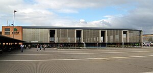
Córdoba railway station, also known as Córdoba Central is the main railway station of the Spanish city of Córdoba, Andalusia. It was opened in 1994 replacing an older station.
Weather in this IP's area
clear sky
16 Celsius
16 Celsius
16 Celsius
16 Celsius
1014 hPa
94 %
1014 hPa
998 hPa
10000 meters
1.03 m/s
07:59:01
18:08:33

