185.238.37.64 - IP Lookup: Free IP Address Lookup, Postal Code Lookup, IP Location Lookup, IP ASN, Public IP
Country:
 France
Region:
City:
Location:
Time Zone:
Postal Code:
ISP:
ASN:
language:
User-Agent:
Proxy IP:
Blacklist:
IP information under different IP Channel
ip-api
Country
Region
City
ASN
Time Zone
ISP
Blacklist
Proxy
Latitude
Longitude
Postal
Route
db-ip
Country
Region
City
ASN
Time Zone
ISP
Blacklist
Proxy
Latitude
Longitude
Postal
Route
IPinfo
Country
Region
City
ASN
Time Zone
ISP
Blacklist
Proxy
Latitude
Longitude
Postal
Route
IP2Location
185.238.37.64Country
frRegion
normandie
City
rouxmesnil-bouteilles
Time Zone
Europe/Paris
ISP
Language
User-Agent
Latitude
Longitude
Postal
ipdata
Country
Region
City
ASN
Time Zone
ISP
Blacklist
Proxy
Latitude
Longitude
Postal
Route
Popular places and events near this IP address
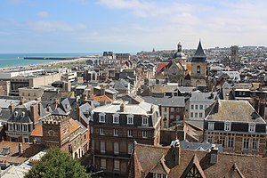
Dieppe
Subprefecture and commune in Normandy, France
Distance: Approx. 2110 meters
Latitude and longitude: 49.925,1.075
Dieppe (French pronunciation: [djɛp]; Norman: Dgieppe) is a coastal commune in the Seine-Maritime department, Normandy, northern France. Dieppe is a seaport on the English Channel at the mouth of the river Arques. A regular ferry service runs to Newhaven in England.

Arrondissement of Dieppe
Arrondissement in Normandy, France
Distance: Approx. 2638 meters
Latitude and longitude: 49.93,1.08
The arrondissement of Dieppe is an arrondissement of France in the Seine-Maritime department in the Normandy région. It has 342 communes. Its population is 232,559 (2021), and its area is 3,120.1 km2 (1,204.7 sq mi).

Dieppe station
Railway station in Dieppe, France
Distance: Approx. 1682 meters
Latitude and longitude: 49.92138889,1.08111111
Dieppe station (French: Gare de Dieppe) is the train station for the town of Dieppe, Seine-Maritime and was built by Chemins de fer de Paris à Cherbourg and opened on 28 July 1848. It used to have a direct connection with Paris-St. Lazare via Serqueux and Gisors, but this line was closed in 2006.

Dieppe Maritime station
Distance: Approx. 2392 meters
Latitude and longitude: 49.92777778,1.08055556
Dieppe Maritime station (French: Gare Maritime de Dieppe) was a railway station in the town of Dieppe, Seine-Maritime, France and was built by CF de l'Ouest in 1874. The station was the station for passengers from Paris to Newhaven, by steamers and then ferries. Steam ships began crossing the English Channel in 1816 and linked Dieppe to Brighton.

Dieppe Canadian War Cemetery
CWGC cemetery in Seine-Maritime, France
Distance: Approx. 1449 meters
Latitude and longitude: 49.89583333,1.06777778
Dieppe Canadian War Cemetery is a Second World War military war grave cemetery, located in the village of Hautot-sur-Mer, 5 km (3.1 mi) south of Dieppe in Normandy, France. It contains Canadian and British soldiers killed during the Dieppe Raid on the 18/19 August 1942. This large scale daylight assault on a fortified objective was an abject failure and casualties were very heavy.

Château de Dieppe
Distance: Approx. 2161 meters
Latitude and longitude: 49.92472222,1.07027778
The Château de Dieppe is a castle in the French town of Dieppe in the Seine-Maritime département. The castle was founded in 1188 by King Henry II of England, but was destroyed in 1195 by King Philip II of France. The site was restored in the 14th century.

Rouxmesnil-Bouteilles
Commune in Normandy, France
Distance: Approx. 812 meters
Latitude and longitude: 49.9058,1.0911
Rouxmesnil-Bouteilles (French pronunciation: [ʁumenil butɛj]) is a commune in the Seine-Maritime department in the Normandy region in northern France.

Communauté d'agglomération de la Région Dieppoise
Communauté d'agglomération in Normandy, France
Distance: Approx. 1772 meters
Latitude and longitude: 49.9222,1.07861
The Communauté d'agglomération de la région Dieppoise, also known as Dieppe Maritime is the communauté d'agglomération, an intercommunal structure, centred on the city of Dieppe. It is located in the Seine-Maritime department, in the Normandy region, northern France. It was created on 31 December 2002.

Clérette
River in France
Distance: Approx. 2735 meters
Latitude and longitude: 49.9,1.11666667
The Clérette is a river of Normandy, France, 10 kilometres (6.2 mi) in length, flowing through the department of Seine-Maritime. It is a right tributary of the Cailly.

Canton of Dieppe-1
Canton in Normandy, France
Distance: Approx. 1525 meters
Latitude and longitude: 49.92,1.08
The canton of Dieppe-1 is an administrative division of the Seine-Maritime department, in northern France. It was created at the French canton reorganisation which came into effect in March 2015. Its seat is in Dieppe.

Siege of Dieppe
Distance: Approx. 1525 meters
Latitude and longitude: 49.92,1.08
The siege of Dieppe (2 November 1442 – 14 August 1443) took place during the Hundred Years War where English forces led by John Talbot, Earl of Shrewsbury besieged and failed to capture the French-held port of Dieppe in Normandy.

Church of Saint-Jacques, Dieppe
Church in Dieppe, France
Distance: Approx. 2146 meters
Latitude and longitude: 49.92555556,1.07833333
The Church of Saint-Jacques in Dieppe (French: Église Saint-Jacques de Dieppe) is a church located in Dieppe, France. The building has been classified as a monument historique in 1840. The church is dedicated to Saint James the Great.
Weather in this IP's area
broken clouds
7 Celsius
4 Celsius
7 Celsius
7 Celsius
1019 hPa
70 %
1019 hPa
1012 hPa
10000 meters
2.88 m/s
3.43 m/s
21 degree
78 %