Country:
Region:
City:
Latitude and Longitude:
Time Zone:
Postal Code:
IP information under different IP Channel
ip-api
Country
Region
City
ASN
Time Zone
ISP
Blacklist
Proxy
Latitude
Longitude
Postal
Route
Luminati
Country
Region
nor
City
ouistreham
ASN
Time Zone
Europe/Paris
ISP
VOIP Telecom SAS
Latitude
Longitude
Postal
IPinfo
Country
Region
City
ASN
Time Zone
ISP
Blacklist
Proxy
Latitude
Longitude
Postal
Route
db-ip
Country
Region
City
ASN
Time Zone
ISP
Blacklist
Proxy
Latitude
Longitude
Postal
Route
ipdata
Country
Region
City
ASN
Time Zone
ISP
Blacklist
Proxy
Latitude
Longitude
Postal
Route
Popular places and events near this IP address

Operation Epsom
Allied military operation in France in 1944
Distance: Approx. 3723 meters
Latitude and longitude: 49.28333333,-0.3
Operation Epsom, also known as the First Battle of the Odon, was a British offensive in the Second World War between 26 and 30 June 1944, during the Battle of Normandy. The offensive was intended to outflank and seize the German-occupied city of Caen from the west, an important Allied objective, in the early stages of Operation Overlord, the Allied invasion of north-west Europe. Preceded by Operation Martlet to secure the right flank of the advance, Operation Epsom began early on 26 June, with units of the 15th (Scottish) Infantry Division advancing behind a rolling artillery barrage.

Amfreville, Calvados
Commune in Normandy, France
Distance: Approx. 3213 meters
Latitude and longitude: 49.2483,-0.235
Amfreville (French pronunciation: [ɑ̃fʁəvil] ) is a commune in the Calvados department in the Normandy region of north-western France.

Colleville-Montgomery
Commune in Normandy, France
Distance: Approx. 3722 meters
Latitude and longitude: 49.2833,-0.3
Colleville-Montgomery (French pronunciation: [kɔlvil mɔ̃ɡɔmʁi] ; formerly Colleville-sur-Orne) is a commune in the Calvados department in the Normandy region in northern France. It was known as Colleville-sur-Orne until 13 June 1946 to distinguish it from another town in the department, also in a coastal location, Colleville-sur-Mer. The new name honoured Field Marshal Bernard Montgomery, the senior-ranking British military commander who commanded the invasion of Normandy on 6 June 1944.

Merville-Franceville-Plage
Commune in Normandy, France
Distance: Approx. 3415 meters
Latitude and longitude: 49.2775,-0.20329
Merville-Franceville-Plage (French pronunciation: [mɛʁvil fʁɑ̃svil plaʒ] ) is a commune in the Calvados department in the Normandy region in northwestern France.
Ouistreham
Commune in Normandy, France
Distance: Approx. 877 meters
Latitude and longitude: 49.28,-0.26
Ouistreham (French pronunciation: [wistʁe.am]) is a commune in the Calvados department in Normandy region in northwestern France. Ouistreham is a small port with fishing boats, leisure craft and a ferry harbour. It serves as the port of the city of Caen.
Saint-Aubin-d'Arquenay
Commune in Normandy, France
Distance: Approx. 3036 meters
Latitude and longitude: 49.2631,-0.2875
Saint-Aubin-d'Arquenay (French pronunciation: [sɛ̃.t‿obɛ̃ daʁkənɛ] ) is a commune in the Calvados department in the Normandy region in northwestern France.

Orne (river)
River in France
Distance: Approx. 1780 meters
Latitude and longitude: 49.27833333,-0.22611111
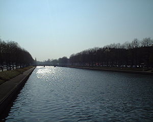
The Orne (French: [ɔʁn] ) is a river in Normandy, within northwestern France. It is 170 km (110 mi) long. It discharges into the English Channel at the port of Ouistreham.

Sallenelles
Commune in Normandy, France
Distance: Approx. 2053 meters
Latitude and longitude: 49.2639,-0.2281
Sallenelles (French pronunciation: [salnɛl]) is a commune in the Calvados department in the Normandy region in northwestern France.

Merville Gun Battery
Coastal fortification in Normandy, France
Distance: Approx. 3865 meters
Latitude and longitude: 49.26944444,-0.19777778
The Merville Gun Battery is a decommissioned coastal fortification in Normandy, France, which was built as part of the Germans' Atlantic Wall to defend continental Europe from Allied invasion. It was a particularly heavily fortified position and one of the first places to be attacked by Allied forces during the Normandy Landings commonly known as D-Day. A British force under the command of Lieutenant Colonel Terence Otway succeeded in capturing this position, suffering heavy casualties.

Battle of Merville Gun Battery
Battle during D-Day landings
Distance: Approx. 3954 meters
Latitude and longitude: 49.27,-0.19638889
The Battle of Merville Gun Battery was a series of British assaults beginning 6 June 1944, as part of Operation Tonga, part of the Normandy landings, during the Second World War. Allied intelligence believed the Merville Gun Battery was composed of heavy-calibre 150 mm (5.9 in) guns that could threaten the British landings at Sword Beach, only 8 miles (13 km) away. The 9th Parachute Battalion, part of the 3rd Parachute Brigade attached to 6th Airborne Division, was given the objective of destroying the battery.
Memorial Pegasus
Museum in Ranville, France
Distance: Approx. 4002 meters
Latitude and longitude: 49.2423,-0.2717
Memorial Pegasus at Ranville in Lower Normandy is a museum and memorial to the 6th Airborne Division in the Normandy landings and particular the capture of the Caen canal and Orne river bridges.

Canton of Ouistreham
Canton in Normandy, France
Distance: Approx. 877 meters
Latitude and longitude: 49.28,-0.26
The canton of Ouistreham is an administrative division of the Calvados department, northwestern France. Its borders were modified at the French canton reorganisation which came into effect in March 2015. Its seat is in Ouistreham.
Weather in this IP's area
broken clouds
10 Celsius
10 Celsius
10 Celsius
12 Celsius
1015 hPa
93 %
1015 hPa
1014 hPa
10000 meters
5.66 m/s
240 degree
75 %
08:16:40
17:16:07


