Country:
Region:
City:
Latitude and Longitude:
Time Zone:
Postal Code:
IP information under different IP Channel
ip-api
Country
Region
City
ASN
Time Zone
ISP
Blacklist
Proxy
Latitude
Longitude
Postal
Route
Luminati
Country
Region
vc
City
vilareal
ASN
Time Zone
Europe/Madrid
ISP
SAREnet, S.A.
Latitude
Longitude
Postal
IPinfo
Country
Region
City
ASN
Time Zone
ISP
Blacklist
Proxy
Latitude
Longitude
Postal
Route
db-ip
Country
Region
City
ASN
Time Zone
ISP
Blacklist
Proxy
Latitude
Longitude
Postal
Route
ipdata
Country
Region
City
ASN
Time Zone
ISP
Blacklist
Proxy
Latitude
Longitude
Postal
Route
Popular places and events near this IP address
Villarreal
Town in Valencian Community, Spain
Distance: Approx. 500 meters
Latitude and longitude: 39.93777778,-0.10138889
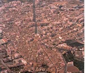
Villarreal (officially, in Valencian: Vila-real) is a city and municipality in the province of Castellón which is part of the Valencian Community in the east of Spain. The town is located at 42 m above sea level, 7 km to the south of the province's capital (Castelló de la Plana). Villarreal is separated from Castelló de la Plana by the Millars River.

Burriana, Castellón
Municipality in Valencian Community, Spain
Distance: Approx. 4946 meters
Latitude and longitude: 39.88944444,-0.0925
Burriana (Spanish: [buˈrjana]) or Borriana (Valencian: [boriˈana]) is a municipality in eastern Spain, in the province of Castellón, part of the Valencian Community. Its population exceeds 34,000. The town is located by the Mediterranean Sea, at the lowest region of the Plana Baixa, surrounded by orange tree fields watered by the Millars River.

Jaume I University
University in Castellón de la Plana, Spain
Distance: Approx. 7363 meters
Latitude and longitude: 39.99444444,-0.06888889
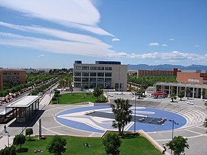
Jaume I University (Spanish: Universidad Jaime I, Valencian: Universitat Jaume I, UJI; IPA: [univeɾsiˈtad ˈdʒawme pɾiˈmeɾ]) is a university in the city of Castelló de la Plana, Valencian Community, Spain. It was founded in 1991, and it has approximately 14,000 students. The campus, covering 176 000 m2, has 4 faculties and many research and management buildings located around a central 13,000 m2 garden, called the Jardí dels Sentits (the garden of the senses).

Estadio de la Cerámica
Football stadium in Vila-real, Spain
Distance: Approx. 1220 meters
Latitude and longitude: 39.94416667,-0.10361111
Estadio de la Cerámica, formerly and informally called El Madrigal (Spanish pronunciation: [el maðɾiˈɣal]), is a football stadium in Villarreal, Spain, used since 1923. It is currently the home venue of Villarreal CF of La Liga, the highest football league in Spain. The stadium has 23,008 seats, a figure which is half the population of the city of Villarreal, making it the 26th-largest stadium in Spain and the 5th-largest in the Valencian Community.

Almassora
Municipality in Valencian Community, Spain
Distance: Approx. 3443 meters
Latitude and longitude: 39.94027778,-0.0625
Almassora (Valencian: [almaˈsoɾa]; Spanish: Almazora) is a town and municipality in the comarca of Plana Alta, Valencian Community, Spain.
Santa Quiteria Chapel (Almassora)
Church building in Almassora, Spain
Distance: Approx. 2452 meters
Latitude and longitude: 39.9547,-0.095
The Santa Quiteria Chapel is a Catholic chapel located in the municipality of Almassora, (Castellón Province, Spain). It was documented in the first half of the seventeenth century.

Ciudad Deportiva Villarreal CF
Distance: Approx. 1381 meters
Latitude and longitude: 39.94046,-0.11501
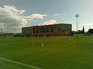
Ciudad Deportiva Villarreal CF, also known as Ciudad Deportiva Pamesa Cerámica for sponsorship reasons, is the training ground of Villarreal CF, and is located in Villarreal. Occupying an area of 70,000 m², the training centre is located at the western suburbs of Villarreal.
Orange Museum
Distance: Approx. 5053 meters
Latitude and longitude: 39.89022222,-0.08313889
The Orange Museum (Museu de la Taronja in Valencia) is located in 10 Major Street in Burriana (Castellón), Spain. The building is an example of Valencian Art Nouveau style.

Siege of Burriana
1233 battle in Valencia
Distance: Approx. 5109 meters
Latitude and longitude: 39.88944444,-0.08416667
The siege of Burriana was one of the battles that occurred during the Conquest of Valencia by James I of Aragon. Burriana was an important Muslim city, being the capital of La Plana, Valencia. It was known as the "Green City".
Castelló de la Plana railway station
Distance: Approx. 7431 meters
Latitude and longitude: 39.98833333,-0.0525
Castelló de la Plana railway station (IATA: CPJ) is the central railway station of Castelló de la Plana, Spain. It is located on Carrer del Pintor Oliet on the west side of the town centre. The station is part of Adif and it accommodates AVE high-speed trains, as well as RENFE Alvia long-distance and medium-distance trains.
Santa Quiteria Bridge
Bridge in Castellón Province, Spain
Distance: Approx. 3383 meters
Latitude and longitude: 39.96152778,-0.1165
The Santa Quiteria Bridge (Pont de Santa Quitèria in Catalan and Puente de Santa Quiteria in Spanish) is a medieval stone bridge between the towns of Vila-real and Almassora, in the Province of Castellón, Spain, that crosses the Mijares River. It is part of the ancient Royal Road near the Ermita de Santa Quiteria, in Almassora. The bridge was recognized as Bien de interés cultural (place of cultural interest) on 16 June 2006, and given the designation ID RI-51-0011536.

Carabona Tower
Distance: Approx. 6599 meters
Latitude and longitude: 39.8758,-0.1206
The Carabona Tower, also called the Farmhouse of Carabona, is a cultural heritage site (Bien de Interés Cultural) in the municipality of Burriana (Valencian: Borriana), close to the “Camí del Palmeral” road and about 250 meters away from “Camí Vell de Valencia” road, in the region of Plana Baixa in the province of Castellón, Spain. According to the General Directory of Artistic Heritage of the Generalitat Valenciana, it received its ministerial annotation number (R-I-51-0010939) on December 4, 2002. As its name suggests, it is an old farmhouse, built between the 13th and the 18th centuries.
Weather in this IP's area
overcast clouds
15 Celsius
15 Celsius
14 Celsius
16 Celsius
1022 hPa
97 %
1022 hPa
1017 hPa
10000 meters
3.37 m/s
5.1 m/s
49 degree
100 %
07:45:51
17:44:31


