185.230.88.240 - IP Lookup: Free IP Address Lookup, Postal Code Lookup, IP Location Lookup, IP ASN, Public IP
Country:
Region:
City:
Location:
Time Zone:
Postal Code:
ISP:
ASN:
language:
User-Agent:
Proxy IP:
Blacklist:
IP information under different IP Channel
ip-api
Country
Region
City
ASN
Time Zone
ISP
Blacklist
Proxy
Latitude
Longitude
Postal
Route
db-ip
Country
Region
City
ASN
Time Zone
ISP
Blacklist
Proxy
Latitude
Longitude
Postal
Route
IPinfo
Country
Region
City
ASN
Time Zone
ISP
Blacklist
Proxy
Latitude
Longitude
Postal
Route
IP2Location
185.230.88.240Country
Region
kyivska oblast
City
boyarka
Time Zone
Europe/Kiev
ISP
Language
User-Agent
Latitude
Longitude
Postal
ipdata
Country
Region
City
ASN
Time Zone
ISP
Blacklist
Proxy
Latitude
Longitude
Postal
Route
Popular places and events near this IP address
Battle on the Irpin River
Semi-legendary, supposed 1320s battle between Lithuania and Kiev
Distance: Approx. 9184 meters
Latitude and longitude: 50.38333333,30.21666667
The Battle on the Irpin River was a semi-legendary battle between the armies of the Grand Duchy of Lithuania and Principality of Kiev. According to the story, Gediminas, the Grand Duke of Lithuania, conquered Volhynia before turning his attention to Kiev. He was opposed by Prince Stanislav of Kiev allied with the Principality of Pereyaslavl and Bryansk.

Boiarka
City in Kyiv Oblast, Ukraine
Distance: Approx. 1295 meters
Latitude and longitude: 50.32916667,30.28861111
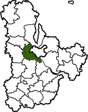
Boiarka or Boyarka (Ukrainian: Боярка, IPA: [ˈbɔjɐrkɐ]) is a city in Fastiv Raion of Kyiv Oblast (region) of Ukraine, about 20 km SW from Kyiv. It hosts the administration of Boiarka urban hromada, one of the hromadas of Ukraine. Population: 34,394 (2022 estimate).
Vyshneve, Kyiv Oblast
City in Kyiv Oblast, Ukraine
Distance: Approx. 8664 meters
Latitude and longitude: 50.38694444,30.35805556
Vyshneve (Ukrainian: Вишневе, IPA: [wɪʃˈnɛwe]) is a city in Bucha Raion, Kyiv Oblast, Ukraine, located two kilometres (1.2 mi) south of the capital Kyiv. Vyshneve hosts the administration of Vyshneve urban hromada, one of the hromadas of Ukraine. It has a population of 42,983 (2022 estimate).

Kyiv-Sviatoshyn Raion
Former subdivision of Kyiv Oblast, Ukraine
Distance: Approx. 9046 meters
Latitude and longitude: 50.38972222,30.23472222
Kyiv-Sviatoshyn Raion (Ukrainian: Києво-Святошинський район, romanized: Kyievo-Sviatoshynskyi raion) was a raion (district) in Kyiv Oblast of Ukraine, adjacent to the city of Kyiv which served as the administrative center for the raion. The city of Kyiv itself did not belong to the raion. The raion was abolished on 18 July 2020 as part of the administrative reform of Ukraine, which reduced the number of raions of Kyiv Oblast to seven.

Vasylkiv Air Base
Ukrainian Air Force
Distance: Approx. 9560 meters
Latitude and longitude: 50.23333333,30.3
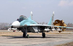
Vasylkiv (also Vasyl'kiv) was an air base of the Ukrainian Air Force located near Vasylkiv, Kyiv Oblast, Ukraine. The base was home to the 40th Tactical Aviation Brigade.
Hlevakha
Rural locality in Kyiv Oblast, Ukraine
Distance: Approx. 6372 meters
Latitude and longitude: 50.26222222,30.28944444
Hlevakha (Ukrainian: Глеваха) is a rural settlement in Fastiv Raion of Kyiv Oblast (region) of Ukraine. It hosts the administration of Hlevakha settlement hromada, one of the hromadas of Ukraine. Population: 8,800 (2022 estimate).
Hatne, Ukraine
Rural locality in Kyiv Oblast, Ukraine
Distance: Approx. 8388 meters
Latitude and longitude: 50.35833333,30.39888889
Hatne (Ukrainian: Гатне) is a selo in Fastiv Raion in Kyiv Oblast of northern Ukraine. It hosts the administration of Hatne rural hromada, one of the hromadas of Ukraine.
Zelenyi Bir
Distance: Approx. 9250 meters
Latitude and longitude: 50.25,30.37
Zelenyi Bir is a small village in Fastiv Raion, Kyiv Oblast of central Ukraine. It belongs to Hlevakha settlement hromada, one of the hromadas of Ukraine. Zelenyi Bir has 794 inhabitants.
Bilhorod Kyivskyi
Ruined city-castle of Kievan Rus'
Distance: Approx. 9198 meters
Latitude and longitude: 50.383499,30.216672
Bilhorod Kyivskyi (Ukrainian: Білгород-Київський) or Belgorod Kiyevsky (Russian: Белгород Киевский) was a legendary city-castle in Kievan Rus', on the right bank of the Irpin River. The remains of the city are in Kyiv Oblast, Ukraine.

Chabany
Rural locality in Kyiv Oblast, Ukraine
Distance: Approx. 9172 meters
Latitude and longitude: 50.34027778,30.42277778
Chabany (Ukrainian: Чабани) is a rural settlement in Fastiv Raion of Kyiv Oblast (province), located on the southern border of Kyiv. It hosts the administration of Chabany settlement hromada, one of the hromadas of Ukraine. Population: 5,334 (2022 estimate).
Kriukivshchyna
Rural locality in Kyiv Oblast, Ukraine
Distance: Approx. 7395 meters
Latitude and longitude: 50.36833333,30.36805556
Kriukivshchyna (Ukrainian: Крюківщина) is a village in Bucha Raion (district) of Kyiv Oblast in northern Ukraine. It belongs to Vyshneve urban hromada, one of the hromadas of Ukraine.
Markhalivka
Rural locality in Kyiv Oblast, Ukraine
Distance: Approx. 7301 meters
Latitude and longitude: 50.27388889,30.37222222
Markhalivka (Ukrainian: Мархалівка) is a village in Fastiv Raion of Kyiv Oblast, Ukraine. It belongs to Hlevakha settlement hromada, one of the hromadas of Ukraine. The population is 1316 people.
Weather in this IP's area
clear sky
3 Celsius
-0 Celsius
3 Celsius
3 Celsius
1024 hPa
62 %
1024 hPa
1004 hPa
10000 meters
4.87 m/s
9.59 m/s
323 degree
10 %
