Country:
Region:
City:
Latitude and Longitude:
Time Zone:
Postal Code:
IP information under different IP Channel
ip-api
Country
Region
City
ASN
Time Zone
ISP
Blacklist
Proxy
Latitude
Longitude
Postal
Route
Luminati
Country
ASN
Time Zone
Europe/Oslo
ISP
Lyse Tele
Latitude
Longitude
Postal
IPinfo
Country
Region
City
ASN
Time Zone
ISP
Blacklist
Proxy
Latitude
Longitude
Postal
Route
db-ip
Country
Region
City
ASN
Time Zone
ISP
Blacklist
Proxy
Latitude
Longitude
Postal
Route
ipdata
Country
Region
City
ASN
Time Zone
ISP
Blacklist
Proxy
Latitude
Longitude
Postal
Route
Popular places and events near this IP address

Alstahaug Municipality
Municipality in Nordland, Norway
Distance: Approx. 7649 meters
Latitude and longitude: 65.95666667,12.57277778
Alstahaug is a municipality in Nordland county, Norway. It is part of the Helgeland region. The administrative centre of the municipality is the town of Sandnessjøen.

Sandnessjøen
Town in Alstahaug, Norway
Distance: Approx. 1011 meters
Latitude and longitude: 66.0181,12.6159
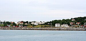
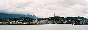
Sandnessjøen is a town and the administrative centre of Alstahaug Municipality in Nordland county, Norway. Sandnessjøen was granted special trading privileges in the late 1600s, but it did not receive town status until 1999. Sandnessjøen is located on the west coast of the island of Alsta, just west of the De syv søstre (lit. 'The Seven Sisters') mountain range.
Artscape Nordland
International art project in Nordland, Norway
Distance: Approx. 2702 meters
Latitude and longitude: 66.02833333,12.69388889
Artscape Nordland (Norwegian: Skulpturlandskap Nordland) is an international art project that aims to bring art to people where they live, art museums being few and far apart in the sparsely populated county of Nordland. The first phase of the project lasted from 1992 until 1998. The project included 33 sculptures by 33 artists from 18 different countries placed in 32 municipalities in Nordland county plus 1 municipality in Troms county.

Alsta
Island in Nordland, Norway
Distance: Approx. 6038 meters
Latitude and longitude: 65.96667,12.614722
Alsta is an island in Alstahaug Municipality and Leirfjord Municipality in Nordland county, Norway. The island is surrounded by the Vefsnfjorden to the east, the Leirfjorden to the north, and the Alstenfjorden to the south and west. The eastern part of the island is dominated by the Seven Sisters mountain range (Norwegian: De syv søstre) which has five mountains that are more than 1,000 metres (3,300 ft) tall, while the western part of the island is relatively flat and it is the location of the town of Sandnessjøen and the village of Søvika in the south.

De syv søstre
Mountain range in Nordland county, Norway
Distance: Approx. 6516 meters
Latitude and longitude: 65.9617,12.628
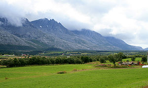
De syv søstre (Norwegian) or The Seven Sisters (English) is a mountain range on the island of Alsten in Alstahaug Municipality in Nordland county, Norway. The mountain range consists of seven peaks on the southeastern half of the island. The mountains are (listed from northeast to southwest): Botnkrona, with a height of 1,072 metres (3,517 ft) Grytfoten, with a height of 1,019 metres (3,343 ft) Skjæringen, with a height of 1,037 metres (3,402 ft) Tvillingene ("the twins"), with a height of 980 metres (3,220 ft) for the taller one and 945 metres (3,100 ft) for the shorter one) Kvasstinden, with a height of 1,010 metres (3,310 ft) Breitinden, with a height of 910 metres (2,990 ft) The range is popular with hikers and offers scenic views over the surrounding area.
Leines
Village in Steigen Municipality, Norway
Distance: Approx. 3953 meters
Latitude and longitude: 66.0438,12.7028
Leines is a small village in Steigen Municipality in Nordland county, Norway. It is located on the southern shore of the mouth of the Leinesfjorden, about 20 kilometres (12 mi) west of Nordfold. The villages of Leinesfjorden and Sørskot are located a few kilometres across the fjord on the opposite shore.

Sandnessjøen Municipality
Former municipality in Nordland, Norway
Distance: Approx. 1011 meters
Latitude and longitude: 66.0181,12.6159
Sandnessjøen (historically named Stamnes) is a former municipality in Nordland county, Norway. The 45-square-kilometre (17 sq mi) municipality existed from 1899 until its dissolution in 1965. The municipality encompassed the northern part of the island of Alsta in what is now Alstahaug Municipality.

Sandnessjøen Church
Church in Nordland, Norway
Distance: Approx. 887 meters
Latitude and longitude: 66.01922006,12.61820689
Sandnessjøen Church (Norwegian: Sandnessjøen kirke) is a parish church of the Church of Norway in Alstahaug Municipality in Nordland county, Norway. It is located in the town of Sandnessjøen. It is the church for the Sandnessjøen parish which is part of the Nord-Helgeland prosti (deanery) in the Diocese of Sør-Hålogaland.
Leirfjorden
Fjord in Nordland, Norway
Distance: Approx. 2379 meters
Latitude and longitude: 66.0297,12.6847
Leirfjorden is a fjord in Leirfjord Municipality and Alstahaug Municipality in Nordland county, Norway. The 20-kilometre (12 mi) long fjord is located east of the town of Sandnessjøen, between the mainland and the island of Alsta. There is a short strait that connects it to the Vefsnfjorden to the south.
Hestad, Dønna
Village in Dønna Municipality, Norway
Distance: Approx. 6409 meters
Latitude and longitude: 66.0547,12.5244
Hestad is a village in Dønna Municipality in Nordland county, Norway. The village is located on the southern part of the island of Dønna, about 6 kilometres (3.7 mi) northwest of the mainland town of Sandnessjøen. Hæstad Church is located in the village.
Hæstad Church
Church in Nordland, Norway
Distance: Approx. 6615 meters
Latitude and longitude: 66.05426598,12.51798749
Hæstad Church (Norwegian: Hæstad kirke) is a parish church of the Church of Norway in Dønna Municipality in Nordland county, Norway. It is located in the village of Hestad on the southern part of the island of Dønna. It is one of the churches for the Dønna parish which is part of the Nord-Helgeland prosti (deanery) in the Diocese of Sør-Hålogaland.

Bjørn, Dønna
Village in Dønna Municipality, Norway
Distance: Approx. 7253 meters
Latitude and longitude: 66.0817,12.5854
Bjørn is a village in Dønna Municipality in Nordland county, Norway. The village is located on the east coast of the island of Dønna, about 5 kilometres (3.1 mi) northeast of the village of Hestad. The village has a regular ferry connection to the nearby island of Lokta and to the mainland town of Sandnessjøen.
Weather in this IP's area
broken clouds
9 Celsius
5 Celsius
9 Celsius
9 Celsius
1019 hPa
100 %
1019 hPa
1019 hPa
7000 meters
11.32 m/s
190 degree
75 %
08:46:26
15:01:00

