185.228.43.94 - IP Lookup: Free IP Address Lookup, Postal Code Lookup, IP Location Lookup, IP ASN, Public IP
Country:
Region:
City:
Location:
Time Zone:
Postal Code:
ISP:
ASN:
language:
User-Agent:
Proxy IP:
Blacklist:
IP information under different IP Channel
ip-api
Country
Region
City
ASN
Time Zone
ISP
Blacklist
Proxy
Latitude
Longitude
Postal
Route
db-ip
Country
Region
City
ASN
Time Zone
ISP
Blacklist
Proxy
Latitude
Longitude
Postal
Route
IPinfo
Country
Region
City
ASN
Time Zone
ISP
Blacklist
Proxy
Latitude
Longitude
Postal
Route
IP2Location
185.228.43.94Country
Region
karnten
City
ferndorf
Time Zone
Europe/Vienna
ISP
Language
User-Agent
Latitude
Longitude
Postal
ipdata
Country
Region
City
ASN
Time Zone
ISP
Blacklist
Proxy
Latitude
Longitude
Postal
Route
Popular places and events near this IP address
Millstätter See
Glacial lake in Carinthia
Distance: Approx. 7570 meters
Latitude and longitude: 46.795,13.57972222
Lake Millstatt (German: Millstätter See, sometimes written "Millstättersee") is a lake in Carinthia, Austria.

Radenthein
Municipality in Carinthia, Austria
Distance: Approx. 8232 meters
Latitude and longitude: 46.8,13.7
Radenthein (Slovene: Radenče) is a town in Spittal an der Drau District, in the Austrian state of Carinthia.
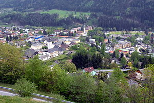
Ferndorf
Municipality in Carinthia, Austria
Distance: Approx. 777 meters
Latitude and longitude: 46.73333333,13.63333333
Ferndorf is a municipality in the district of Villach-Land in the Austrian state of Carinthia.

Fresach
Municipality in Carinthia, Austria
Distance: Approx. 5415 meters
Latitude and longitude: 46.71666667,13.7
Fresach (Slovene: Breze) is a municipality in Villach-Land District, in the Austrian state of Carinthia.

Paternion
Municipality in Carinthia, Austria
Distance: Approx. 2584 meters
Latitude and longitude: 46.71666667,13.63333333
Paternion (Slovene: Špatrjan) is a market town in the district of Villach-Land in the Austrian state of Carinthia. It is located within the Drava valley about 18 kilometres (11 mi) in the north-west of the city of Villach.

Stockenboi
Municipality in Carinthia, Austria
Distance: Approx. 4193 meters
Latitude and longitude: 46.73333333,13.58333333
Stockenboi is a municipality in the district of Villach-Land in the Austrian state of Carinthia.
Weißenstein
Municipality in Carinthia, Austria
Distance: Approx. 8711 meters
Latitude and longitude: 46.68333333,13.71666667
Weißenstein (Slovene: Bilšak) is a town in the district of Villach-Land in the Austrian state of Carinthia.

Feffernitz
Distance: Approx. 7882 meters
Latitude and longitude: 46.68333333,13.7
Feffernitz is a sub-municipality of Paternion in the Villach-Land District of the Carinthia in Austria, the site of a post World War II British sector displaced person camp.

Feistritz an der Drau
Distance: Approx. 5636 meters
Latitude and longitude: 46.7,13.68333333
Feistritz an der Drau (Slovene: Bistrica na Dravi), often referred to as simply Feistritz (Austrian German: [ˈfaɪstrɪts] ), is a village in the municipality of Paternion, in Carinthia, Austria. The 1989 Biathlon World Championship was held here, the first joint Men and Women Biathlon World Championships. The Windische Höhe Pass connects St.

Obermillstatt
Distance: Approx. 8653 meters
Latitude and longitude: 46.81055556,13.59083333
Obermillstatt is a village and cadastral community in the municipality of Millstatt in Spittal an der Drau District, in Carinthia, Austria.
Burgruine Rothenthurn
Distance: Approx. 4771 meters
Latitude and longitude: 46.763,13.585
Rothenthurn is a castle in the municipality of Spittal an der Drau in Carinthia, Austria.

Egelsee (Kärnten)
Lake in the Carinthia, Austria
Distance: Approx. 7653 meters
Latitude and longitude: 46.7842,13.561
Egelsee (formerly also called Ecksee) is a mire lake in Carinthia, Austria. The lake and its environment are part of a protected landscape area.
Weather in this IP's area
broken clouds
3 Celsius
2 Celsius
3 Celsius
3 Celsius
1018 hPa
90 %
1018 hPa
882 hPa
10000 meters
1.49 m/s
1.83 m/s
286 degree
78 %


