Country:
 Italy
ItalyRegion:
City:
Latitude and Longitude:
Time Zone:
Postal Code:
IP information under different IP Channel
ip-api
Country
Region
City
ASN
Time Zone
ISP
Blacklist
Proxy
Latitude
Longitude
Postal
Route
IPinfo
Country
Region
City
ASN
Time Zone
ISP
Blacklist
Proxy
Latitude
Longitude
Postal
Route
MaxMind
Country
Region
City
ASN
Time Zone
ISP
Blacklist
Proxy
Latitude
Longitude
Postal
Route
Luminati
Country
ITRegion
65
City
tortoreto
ASN
Time Zone
Europe/Rome
ISP
2Bite s.r.l.
Latitude
Longitude
Postal
db-ip
Country
Region
City
ASN
Time Zone
ISP
Blacklist
Proxy
Latitude
Longitude
Postal
Route
ipdata
Country
Region
City
ASN
Time Zone
ISP
Blacklist
Proxy
Latitude
Longitude
Postal
Route
Popular places and events near this IP address

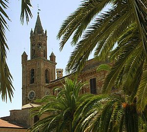
Giulianova
Comune in Abruzzo, Italy
Distance: Approx. 6819 meters
Latitude and longitude: 42.75,13.95
Giulianova (Giuliese: Gigljië [ˈdʒiʝʝə]) is a coastal town and comune in the province of Teramo, Abruzzo region, Italy. The comune also has city (Italian: città) status, thus also known as Città di Giulianova.

Alba Adriatica
Comune in Abruzzo, Italy
Distance: Approx. 3177 meters
Latitude and longitude: 42.8347,13.921
Alba Adriatica is a town and comune with 12,386 residents (2014) in the province of Teramo in the Abruzzo region of central eastern Italy. It is known as one of the "seven sisters" of the northern Abruzzo coast, i.e. the seven coastal towns in the province of Teramo, the other six being (from north to south) Martinsicuro, Tortoreto, Giulianova, Roseto degli Abruzzi, Silvi Marina and Pineto.
Corropoli
Comune in Abruzzo, Italy
Distance: Approx. 6937 meters
Latitude and longitude: 42.81666667,13.83333333
Corropoli (locally Currùppië) is a town and comune in Teramo province in the Abruzzo region of eastern Italy. In recent years the town has had a population of just under 4000 individuals. The commune has approximately 1300 families and 1500 habitations.
Mosciano Sant'Angelo
Comune in Abruzzo, Italy
Distance: Approx. 6848 meters
Latitude and longitude: 42.75,13.88333333
Mosciano Sant'Angelo (Moscianese: Mëscià, Muscianë) is a town and comune of the province of Teramo in the Abruzzo region of eastern Italy. Nearby communes include Bellante, Castellalto, Giulianova, Notaresco, Roseto degli Abruzzi, Sant'Omero, Tortoreto .

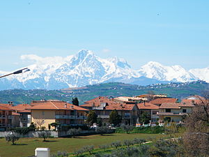
Tortoreto
Comune in Abruzzo, Italy
Distance: Approx. 702 meters
Latitude and longitude: 42.8,13.91666667
Tortoreto Italian pronunciation: [tortoˈreto] (Teramano: Tërtërètë) is a coastal town and comune of the province of Teramo in the Abruzzo region of Italy. It has two distinct parts. The old town is on a hill not far from the Adriatic Sea.
Montone, Mosciano Sant'Angelo
Frazione in Abruzzo, Italy
Distance: Approx. 4298 meters
Latitude and longitude: 42.76777778,13.92055556
Montone is a frazione in the Province of Teramo in the Abruzzo region of Italy.
Ripoli, Corropoli
Frazione in Abruzzo, Italy
Distance: Approx. 3124 meters
Latitude and longitude: 42.82611111,13.89
Ripoli (Corropoli) is a frazione in the Province of Teramo in the Abruzzo region of Italy.
Villa Rosa (Martinsicuro)
Frazione in Abruzzo, Italy
Distance: Approx. 5162 meters
Latitude and longitude: 42.8525,13.9225
Villa Rosa is a frazione (subdivision) of the town of Martinsicuro, in the Province of Teramo in the Abruzzo region of Italy.
Corropoli internment camp
World War II Internment Camp
Distance: Approx. 6965 meters
Latitude and longitude: 42.81694444,13.83305556
Corropoli internment camp, in Corropoli, in the province of Teramo, was one of several internment camps set up by the fascist government following the entry of Italy into World War II, to sit foreigners and anti-fascists. It operated from January 1941 to May 1944, with a maximum capacity of 150 people. Irredentist Slavic and Italian communists were interned and after September 8, 1943 it also served as a concentration camp for Jews.
Alba Adriatica-Nereto-Controguerra railway station
Railway station in Italy
Distance: Approx. 3102 meters
Latitude and longitude: 42.83416667,13.91666667
Alba Adriatica-Nereto-Controguerra (Italian: Stazione di Alba Adriatica-Nereto-Controguerra) is a railway station serving the towns of Alba Adriatica, Nereto and Controguerra in the region of Abruzzo, Italy. The station is located on the Adriatic railway and the train services are operated by Trenitalia and Ferrovia Adriatico Sangritana.
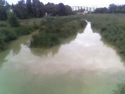
Salinello
River in Italy
Distance: Approx. 4163 meters
Latitude and longitude: 42.7813,13.955
The Salinello (Latin: Zerninus) is a river in Italy. It is located in the province of Teramo in the Abruzzo region of southern Italy. The source of the river is in the Monti della Laga range southwest of Montagna dei Fiori.
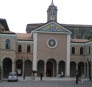
Sanctuary Madonna of the Splendor
Italian shrine
Distance: Approx. 6819 meters
Latitude and longitude: 42.75,13.95
The Sanctuary Madonna of the Splendor is a shrine in Giulianova, Province of Teramo, central Italy. Next to the shrine stand a convent, a miraculous spring water fountain, and a museum. The sanctuary is served by Capuchin fathers.
Weather in this IP's area
overcast clouds
18 Celsius
18 Celsius
17 Celsius
19 Celsius
1013 hPa
75 %
1013 hPa
998 hPa
10000 meters
2.98 m/s
3.7 m/s
320 degree
98 %
06:48:38
19:07:33