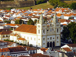
Country:
Region:
City:
Latitude and Longitude:
Time Zone:
Postal Code:
IP information under different IP Channel
ip-api
Country
Region
City
ASN
Time Zone
ISP
Blacklist
Proxy
Latitude
Longitude
Postal
Route
Luminati
Country
ASN
Time Zone
Europe/Lisbon
ISP
Nos Comunicacoes, S.A.
Latitude
Longitude
Postal
IPinfo
Country
Region
City
ASN
Time Zone
ISP
Blacklist
Proxy
Latitude
Longitude
Postal
Route
db-ip
Country
Region
City
ASN
Time Zone
ISP
Blacklist
Proxy
Latitude
Longitude
Postal
Route
ipdata
Country
Region
City
ASN
Time Zone
ISP
Blacklist
Proxy
Latitude
Longitude
Postal
Route
Popular places and events near this IP address

Angra do Heroísmo
Municipality in Azores, Portugal
Distance: Approx. 205 meters
Latitude and longitude: 38.65555556,-27.21944444
Angra do Heroísmo (Portuguese pronunciation: [ˈɐ̃ɡɾɐ ðu eɾuˈiʒmu] ), or simply Angra, is a city and municipality on Terceira Island, Portugal, and one of the three capital cities of the Azores. Founded in 1478, Angra was historically the most important city in the Azores, as seat of the Bishop of the Azores, government entities, and having previously served as the capital city of Portugal during the Liberal Wars. The population in 2011 was 35,402, in an area of 239.00 km2.
Sé (Angra do Heroísmo)
Civil parish in Azores, Portugal
Distance: Approx. 244 meters
Latitude and longitude: 38.655,-27.22083333
Sé is a parish in the municipality of Angra do Heroísmo on the island of Terceira in the Azores. The population in 2011 was 955, in an area of 1.65 km². It is one of the smallest parishes in Angra do Heroísmo.

Roman Catholic Diocese of Angra
Roman Catholic diocese in Portugal
Distance: Approx. 270 meters
Latitude and longitude: 38.65528889,-27.22094722
The Diocese of Angra (Portuguese: Diocese de Angra, Latin: Dioecesis Angrensis) is a Latin Church diocese of the Catholic church in the Portuguese archipelago of the Azores. The see is located in Angra do Heroísmo, in the Terceira island. The current Ordinary is Armando Esteves Domingues.

Cais da Alfândega (Angra do Heroísmo)
Distance: Approx. 27 meters
Latitude and longitude: 38.653681,-27.218255
The Wharf of the Customshouse (Portuguese: Cais da Alfândega) is located on the edge of the Bay of Angra, in the civil parish of Sé, municipality of Angra do Heroísmo, on the island of Terceira, Portuguese archipelago of the Azores.

Duke of Terceira Garden
Distance: Approx. 311 meters
Latitude and longitude: 38.65668611,-27.21862222
Duke of Terceira Garden (Portuguese: Jardim Duque da Terceira) is a manicured garden in the historical centre of Angra do Heroísmo, on the island of Terceira in the Portuguese archipelago of the Azores. One of the classic gardens emblematic of the Romantic period of Portuguese history, it is part of the municipal gardens of the city of Angra (located within the civil parish of Nossa Senhora da Conceição.

Bettencourt Palace
Palace in the Azores, Portugal
Distance: Approx. 236 meters
Latitude and longitude: 38.65475278,-27.22088056
The Palace Bettencourt (Portuguese: Palácio Bettencourt) is a former residence of the Bettencourt family, and current seat of the public library and regional archive, in the civil parish, in the municipality of Angra do Heroísmo, in the Portuguese archipelago of the Azores.

Angra do Heroísmo City Hall
City Hall in Angra do Heroísmo, Portugal
Distance: Approx. 234 meters
Latitude and longitude: 38.656,-27.21822222
The Angra do Heroísmo City Hall (Portuguese: Paços do Concelho de Angra do Heroísmo) is a medieval structure constructed to house the municipal council/authority, situated in the civil parish of Sé, municipality of Angra do Heroísmo, on the Portuguese archipelago of the Azores.

Cathedral of Angra do Heroísmo
Church in Azores, Portugal
Distance: Approx. 279 meters
Latitude and longitude: 38.65533333,-27.22102778
The Cathedral of Angra do Heroísmo (Portuguese: Sé Catedral de Angra do Heroísmo) is a Portuguese 16th-century cathedral located in the civil parish of Sé, in the municipality of Angra do Heroísmo, on the island of Terceira in the archipelago of the Azores.

Episcopal Palace, Angra do Heroísmo
Distance: Approx. 267 meters
Latitude and longitude: 38.65444444,-27.22138889
The Episcopal Palace (Portuguese: Paço Episcopal) is a 16th-century former-religious building situated in the civil parish of Sé, municipality of Angra do Heroísmo, on the Portuguese island of Terceira, in the archipelago of the Azores.

Solar de D. Violante do Canto
Manorhouse in Sé, Portugal
Distance: Approx. 275 meters
Latitude and longitude: 38.65497222,-27.21555556
The Manor of D. Violante do Canto (Portuguese: Solar de D. Violante do Canto), commonly known as the House of Dona Violante do Canto (Portuguese: Casa de D. Violante do Canto), is an urban manorhouse located in the civil parish of Sé, municipality of Angra do Heroísmo, in the Portuguese island of Terceira, archipelago of the Azores.
Solar de Nossa Senhora dos Remédios
Manorhouse in Nossa Senhora da Conceição, Portugal
Distance: Approx. 275 meters
Latitude and longitude: 38.65497222,-27.21555556
The Manor of Nossa Senhora dos Remédios (Portuguese: Solar de Nossa Senhora dos Remédios), popularly known as the Manor of Remédios or Manor of the Privisioner of Arms, located in the neighbourhood of Corpo Santo, civil parish of Conceição, in the municipality of Angra do Heroísmo, in the Portuguese archipelago of Azores. It is one of the notable histo-cultural and architectural buildings in the historic centre of Angra, part of the UNESCO-classified heritage site.

Customshouse of Angra do Heroísmo
Custom house in Sé, Portugal
Distance: Approx. 33 meters
Latitude and longitude: 38.65385833,-27.21877778
The Customhouse of Angra do Heroísmo (Portuguese: Alfândega de Angra do Heroísmo) is a well-preserved Portuguese custom house located in the civil parish of Sé, in the municipality of Angra do Heroísmo, in archipelago of the Azores.
Weather in this IP's area
broken clouds
19 Celsius
19 Celsius
19 Celsius
19 Celsius
1020 hPa
88 %
1020 hPa
1017 hPa
10000 meters
8.68 m/s
10.34 m/s
65 degree
75 %
07:34:49
17:33:44

