Country:
Region:
City:
Latitude and Longitude:
Time Zone:
Postal Code:
IP information under different IP Channel
ip-api
Country
Region
City
ASN
Time Zone
ISP
Blacklist
Proxy
Latitude
Longitude
Postal
Route
Luminati
Country
ASN
Time Zone
Europe/London
ISP
ILAND
Latitude
Longitude
Postal
IPinfo
Country
Region
City
ASN
Time Zone
ISP
Blacklist
Proxy
Latitude
Longitude
Postal
Route
db-ip
Country
Region
City
ASN
Time Zone
ISP
Blacklist
Proxy
Latitude
Longitude
Postal
Route
ipdata
Country
Region
City
ASN
Time Zone
ISP
Blacklist
Proxy
Latitude
Longitude
Postal
Route
Popular places and events near this IP address

South Ascot
Human settlement in Berkshire, England
Distance: Approx. 1089 meters
Latitude and longitude: 51.403,-0.671
South Ascot is a village just south of and down the hill from the small town of Ascot in the English county of Berkshire. It is bounded on the west by the Kingsride area of Swinley Woods, on the north by the Reading to Waterloo railway line and merges with Sunninghill to the east.
Sunninghill, Berkshire
Village in England
Distance: Approx. 196 meters
Latitude and longitude: 51.4025,-0.655
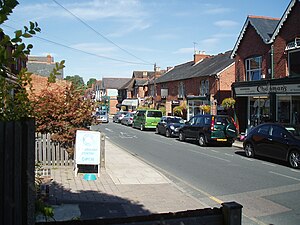
Sunninghill is a village in the civil parish of Sunninghill and Ascot in the Royal Borough of Windsor and Maidenhead in the English county of Berkshire.

St George's School, Ascot
Private day and boarding school in Ascot, Berkshire, England
Distance: Approx. 1126 meters
Latitude and longitude: 51.4083,-0.6666
St George's School, Ascot is an independent girls' boarding and day school in Ascot, Berkshire, England. It was founded as a boys' school but later became a girls' school.

Sunninghill and Ascot
Civil parish in England
Distance: Approx. 1098 meters
Latitude and longitude: 51.41,-0.65
Sunninghill and Ascot is a civil parish in the Royal Borough of Windsor and Maidenhead and takes up most of the south-east corner of the English county of Berkshire. It covers the town of Ascot, and the village of Sunninghill including the neighbourhoods Cheapside and South Ascot. As well as part of the village of North Ascot.

Sunningdale Park
Distance: Approx. 1158 meters
Latitude and longitude: 51.40305556,-0.63944444
Sunningdale Park is a country estate centred around a property known as Northcote House in Sunningdale, Berkshire.
The Marist School, Sunninghill
Distance: Approx. 473 meters
Latitude and longitude: 51.4031,-0.65
The Marist School is an independent Catholic day school for girls aged 2–18 with a co-ed Nursery in Sunninghill near Ascot, Berkshire, England. The Marist School is a Catholic school but welcomes all Christians and other faiths who are in sympathy with the schools' ethos. Once girls reach 11 they often join Senior and Sixth Form until age 18 years.
National School of Government
Distance: Approx. 1146 meters
Latitude and longitude: 51.403,-0.6396
The National School of Government (previously known as the Civil Service College and the Centre for Management and Policy Studies, or CMPS) was the part of the Cabinet Office that ran training, organisational development and consultancy courses for UK civil servants and private individual learners. It was mostly based at Sunningdale Park, near Ascot in Berkshire, but had other centres on Belgrave Road in London, and later in Edinburgh.
Charters School
Academy in Ascot, Berkshire, England
Distance: Approx. 977 meters
Latitude and longitude: 51.39241,-0.65158
Charters School is a secondary school and sixth form with academy status located in Sunningdale, Berkshire.

Berystede
Hotel in South Ascot
Distance: Approx. 755 meters
Latitude and longitude: 51.39504,-0.66146
The Berystede is a hotel in the village of South Ascot, Berkshire, England.
Charters House
Distance: Approx. 649 meters
Latitude and longitude: 51.396472,-0.649451
Charters House is a Grade II listed building overlooking Sunningdale, Berkshire, built in 1938. The architects were George Adie and H. G. Hammond of Adie, Button and Partners. Charters was built for the industrialist Frank Parkinson on the site of an earlier house built in the late 1860s by William Terrick Hamilton.
The Cedars, Sunninghill
Distance: Approx. 1020 meters
Latitude and longitude: 51.40944444,-0.65083333
The Cedars is a large detached house in Sunninghill, Berkshire. It is two storeys in height, painted white render and has a hipped slate roof. The house has a roughly rectangular plan.

St Michael and All Angels Church, Sunninghill
Church in Sunninghill, Berkshire
Distance: Approx. 977 meters
Latitude and longitude: 51.40888889,-0.65027778
The Church of Saint Michael and All Angels is in the village of Sunninghill, in Berkshire, England. It is an active Anglican parish church in the diocese of Oxford. It is in the parish of Sunninghill and South Ascot with the church of All Souls in South Ascot.
Weather in this IP's area
moderate rain
8 Celsius
6 Celsius
7 Celsius
8 Celsius
1008 hPa
93 %
1008 hPa
1000 hPa
10000 meters
2.06 m/s
140 degree
100 %
07:26:01
16:10:01
