185.223.194.156 - IP Lookup: Free IP Address Lookup, Postal Code Lookup, IP Location Lookup, IP ASN, Public IP
Country:
Region:
City:
Location:
Time Zone:
Postal Code:
IP information under different IP Channel
ip-api
Country
Region
City
ASN
Time Zone
ISP
Blacklist
Proxy
Latitude
Longitude
Postal
Route
Luminati
Country
ASN
Time Zone
Europe/London
ISP
The WEST Retail group LImited
Latitude
Longitude
Postal
IPinfo
Country
Region
City
ASN
Time Zone
ISP
Blacklist
Proxy
Latitude
Longitude
Postal
Route
IP2Location
185.223.194.156Country
Region
england
City
humber
Time Zone
Europe/London
ISP
Language
User-Agent
Latitude
Longitude
Postal
db-ip
Country
Region
City
ASN
Time Zone
ISP
Blacklist
Proxy
Latitude
Longitude
Postal
Route
ipdata
Country
Region
City
ASN
Time Zone
ISP
Blacklist
Proxy
Latitude
Longitude
Postal
Route
Popular places and events near this IP address

Bishopsteignton
Village in Devon, England
Distance: Approx. 1523 meters
Latitude and longitude: 50.554,-3.542
Bishopsteignton is a village and civil parish in South Devon, England, between Newton Abbot and Teignmouth, close to the Teign Estuary. The village is on a steep hill, and has a post office and pharmacy and a small, family-run village shop. The village school has about 180 pupils.

Coombe Cellars
Pub in Combeinteignhead, Devon, UK
Distance: Approx. 2869 meters
Latitude and longitude: 50.540938,-3.551063
Coombe Cellars Inn is a public house on the south bank of the estuary of the River Teign in south Devon, England. It is in the parish of Haccombe with Combe, near the village of Combeinteignhead. The pub was owned by Brewers Fayre until 2006.
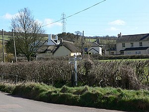
Luton, Teignbridge
Village in Devon, England
Distance: Approx. 1646 meters
Latitude and longitude: 50.581424,-3.552122
Luton is a village in Devon, England, within Teignbridge local authority area. Historically Luton formed part of Ashcombe Hundred. The village is in the parish of Bishopsteignton, but has a chapel of ease, dedicated to St John the Evangelist, built in the 19th century.
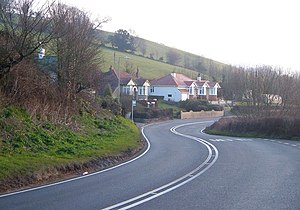
Ashwell, Devon
Village in Devon, England
Distance: Approx. 920 meters
Latitude and longitude: 50.5591,-3.5551
Ashwell is a village in Devon, England.
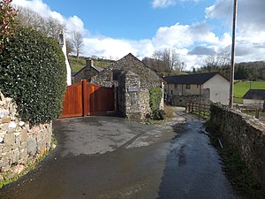
Olchard
Village in Devon, England
Distance: Approx. 3192 meters
Latitude and longitude: 50.58,-3.59
Olchard is a village in Devon, England.

Castle Dyke
Iron Age hill fort in Devon, England
Distance: Approx. 2506 meters
Latitude and longitude: 50.5826,-3.5249
Castle Dyke is an Iron Age hill fort situated between Chudleigh and Dawlish in Devon, England. The fort is situated on a hilltop at approximately 140 metres above sea level.

Lindridge House
Demolished mansion in Devon, England
Distance: Approx. 792 meters
Latitude and longitude: 50.5711,-3.5588
Lindridge House was a large 17th-century mansion (with 20th-century alterations), one of the finest in the south-west situated about 1 mile south of Ideford in the parish of Bishopsteignton, Devon, about 4 1/2 miles NE of Newton Abbot. It was destroyed by fire on 25 April 1963 and its ruins were finally demolished in the early 1990s, upon which was built a housing development. The gardens have been restored and are Grade II listed in the National Register of Historic Parks and Gardens.

Ideford Common
Distance: Approx. 3289 meters
Latitude and longitude: 50.596,-3.556
Ideford Common is a Site of Special Scientific Interest consisting of an area of lowland heath in Devon, England. The site is a habitat for nightjars and Dartford warblers, and is the site of several Bronze Age cairns and a barrow. Ideford and Haldon Forest are nearby.
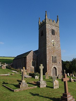
Ideford
Village in Devon, England
Distance: Approx. 2195 meters
Latitude and longitude: 50.58333333,-3.56666667
Ideford (or Ideford Parish) is a village in the Teignbridge district of Devon, England. It is 5 miles (8 km) north of Newton Abbot. To the west is the A380 dual carriageway and to the east are Luton and Teignmouth Golf Club.
Teignmouth A.F.C.
Football club
Distance: Approx. 3065 meters
Latitude and longitude: 50.55547778,-3.51042778
Teignmouth Association Football Club is a football club based in Teignmouth, England. They are currently members of the South West Peninsula League Premier Division East and play at Coombe Valley, Teignmouth.
Haldon Aerodrome
Defunct airfield in England
Distance: Approx. 1676 meters
Latitude and longitude: 50.57555556,-3.53083333
Haldon Aerodrome was the first airfield in Devon.
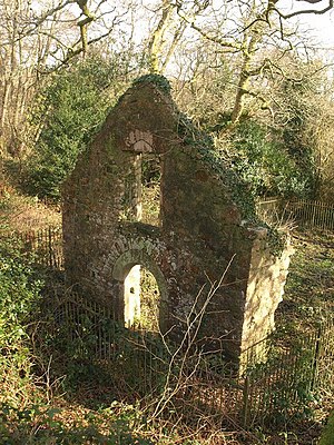
Lidwell Chapel
Medieval chapel in England
Distance: Approx. 2262 meters
Latitude and longitude: 50.574781,-3.520642
Lidwell Chapel, also known as St Mary's Chapel, is a medieval chapel, now in ruins, within the parish of Dawlish in Devon, England. The chapel is a Grade II listed building, and was first listed in 1951.
Weather in this IP's area
light rain
11 Celsius
11 Celsius
11 Celsius
12 Celsius
1009 hPa
88 %
1009 hPa
992 hPa
10000 meters
14.67 m/s
23.39 m/s
229 degree
100 %