Country:
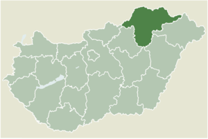
Region:
City:
Latitude and Longitude:
Time Zone:
Postal Code:
IP information under different IP Channel
ip-api
Country
Region
City
ASN
Time Zone
ISP
Blacklist
Proxy
Latitude
Longitude
Postal
Route
Luminati
Country
Region
bz
City
onga
ASN
Time Zone
Europe/Budapest
ISP
Microsystem-Kecskemet Kft
Latitude
Longitude
Postal
IPinfo
Country
Region
City
ASN
Time Zone
ISP
Blacklist
Proxy
Latitude
Longitude
Postal
Route
db-ip
Country
Region
City
ASN
Time Zone
ISP
Blacklist
Proxy
Latitude
Longitude
Postal
Route
ipdata
Country
Region
City
ASN
Time Zone
ISP
Blacklist
Proxy
Latitude
Longitude
Postal
Route
Popular places and events near this IP address

Tiszadob
Village in Szabolcs-Szatmár-Bereg, Hungary
Distance: Approx. 7604 meters
Latitude and longitude: 48.00694444,21.16944444
Tiszadob is a village in Szabolcs-Szatmár-Bereg county, in the Northern Great Plain region of eastern Hungary.

Girincs
Place in Borsod-Abaúj-Zemplén, Hungary
Distance: Approx. 9906 meters
Latitude and longitude: 47.96934,20.98474
Girincs is a village in Borsod-Abaúj-Zemplén county, Hungary.

Berzék
Place in Borsod-Abaúj-Zemplén, Hungary
Distance: Approx. 9202 meters
Latitude and longitude: 48.02439,20.95307
Berzék is a village in Borsod-Abaúj-Zemplén county, Hungary.

Bőcs
Village in Northern Hungary, Hungary
Distance: Approx. 8170 meters
Latitude and longitude: 48.03785,20.966181
Bőcs is a village in Borsod-Abaúj-Zemplén county, Hungary famous for the Borsod Brewery and its products.
Sarkadtanya
Distance: Approx. 3163 meters
Latitude and longitude: 48.03333333,21.03333333
Sarkadtanya (formerly Sarkad) is a populated place, now part of Tiszalúc, in the county of Borsod-Abaúj-Zemplén, Hungary.

Hernádnémeti
Large village in Northern Hungary, Hungary
Distance: Approx. 9200 meters
Latitude and longitude: 48.07948,20.97236
Hernádnémeti is a village in Borsod-Abaúj-Zemplén County in northeastern Hungary. It is situated on the left bank of the Hernád River, 14 kilometres (8.7 mi) from Miskolc. The village is 120 metres (390 ft) above sea level.

Kesznyéten
Village in Northern Hungary, Hungary
Distance: Approx. 7760 meters
Latitude and longitude: 47.96666667,21.05
Kesznyéten is a village in Borsod-Abaúj-Zemplén County in northeastern Hungary.
Kiscsécs
Village in Northern Hungary, Hungary
Distance: Approx. 8713 meters
Latitude and longitude: 47.96666667,21.01666667
Kiscsécs is a village in Borsod-Abaúj-Zemplén County in northeastern Hungary.

Tiszalúc
Large village in Northern Hungary, Hungary
Distance: Approx. 1000 meters
Latitude and longitude: 48.03675,21.06292
Tiszalúc is a village in Borsod-Abaúj-Zemplén County in northeastern Hungary.

Sajóörös
Village in Northern Hungary, Hungary
Distance: Approx. 9893 meters
Latitude and longitude: 47.95,21.03333333
Sajóörös is a village in Borsod-Abaúj-Zemplén County in northeastern Hungary.
Taktaharkány
Large village in Northern Hungary, Hungary
Distance: Approx. 7417 meters
Latitude and longitude: 48.09096,21.12802
Taktaharkány is a village in Borsod-Abaúj-Zemplén County in northeastern Hungary.

Andrássy Castle
Castle in Tiszadob, Hungary
Distance: Approx. 7559 meters
Latitude and longitude: 48.0172,21.1741
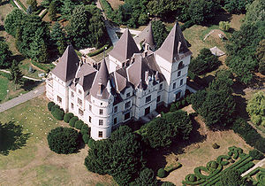
Andrássy Castle is located in the north-eastern part of Hungary, in Tiszadob, Szabolcs-Szatmár-Bereg County. It was designed by Artúr Meinig, a.k.a. Arthur Meinig, for Count Gyula Andrássy, who was the second Foreign Minister of Austria-Hungary and first Hungarian prime minister.
Weather in this IP's area
clear sky
5 Celsius
4 Celsius
5 Celsius
5 Celsius
1031 hPa
74 %
1031 hPa
1019 hPa
10000 meters
1.81 m/s
1.83 m/s
8 degree
06:33:23
16:05:47