Country:
Region:
City:
Latitude and Longitude:
Time Zone:
Postal Code:
IP information under different IP Channel
ip-api
Country
Region
City
ASN
Time Zone
ISP
Blacklist
Proxy
Latitude
Longitude
Postal
Route
Luminati
Country
Region
vc
City
castellodelaplana
ASN
Time Zone
Europe/Madrid
ISP
SAREnet, S.A.
Latitude
Longitude
Postal
IPinfo
Country
Region
City
ASN
Time Zone
ISP
Blacklist
Proxy
Latitude
Longitude
Postal
Route
db-ip
Country
Region
City
ASN
Time Zone
ISP
Blacklist
Proxy
Latitude
Longitude
Postal
Route
ipdata
Country
Region
City
ASN
Time Zone
ISP
Blacklist
Proxy
Latitude
Longitude
Postal
Route
Popular places and events near this IP address
Castellón de la Plana
Municipality in Valencian Community, Spain
Distance: Approx. 2135 meters
Latitude and longitude: 39.98305556,-0.03305556
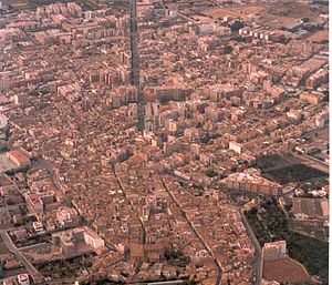
Castellón de la Plana (officially in Valencian: Castelló de la Plana), or simply Castellón (Valencian: Castelló), is the capital city of the province of Castellón, in the Valencian Community, Spain. It is located in the east of the Iberian Peninsula, on the Costa del Azahar by the Mediterranean Sea. The mountain range known as Desert de les Palmes rises inland north of the town.

Jaume I University
University in Castellón de la Plana, Spain
Distance: Approx. 1190 meters
Latitude and longitude: 39.99444444,-0.06888889
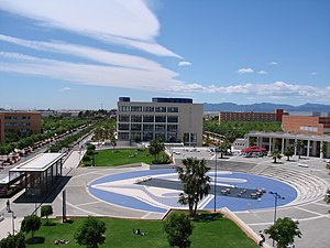
Jaume I University (Spanish: Universidad Jaime I, Valencian: Universitat Jaume I, UJI; IPA: [univeɾsiˈtad ˈdʒawme pɾiˈmeɾ]) is a university in the city of Castelló de la Plana, Valencian Community, Spain. It was founded in 1991, and it has approximately 14,000 students. The campus, covering 176 000 m2, has 4 faculties and many research and management buildings located around a central 13,000 m2 garden, called the Jardí dels Sentits (the garden of the senses).

Estadio de la Cerámica
Football stadium in Vila-real, Spain
Distance: Approx. 6702 meters
Latitude and longitude: 39.94416667,-0.10361111
Estadio de la Cerámica, formerly and informally called El Madrigal (Spanish pronunciation: [el maðɾiˈɣal]), is a football stadium in Villarreal, Spain, used since 1923. It is currently the home venue of Villarreal CF of La Liga, the highest football league in Spain. The stadium has 23,008 seats, a figure which is half the population of the city of Villarreal, making it the 26th-largest stadium in Spain and the 5th-largest in the Valencian Community.
Nou Estadi Castàlia
Multi-purpose stadium in Spain
Distance: Approx. 1497 meters
Latitude and longitude: 39.99605278,-0.03879167
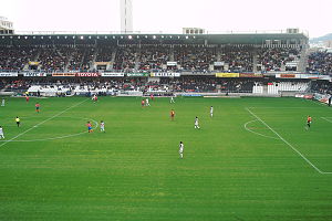
Estadio Municipal de Castalia is a multi-purpose stadium in Castellón de la Plana, Spain. It is currently used mostly for football matches and is the home ground of CD Castellón. The stadium holds 15,500 (all-seater) and was built in 1987, replacing the original Estadi Castàlia which stood on this site, but at 90° to the current layout.

Plana Alta
Comarca in Valencian Community, Spain
Distance: Approx. 2901 meters
Latitude and longitude: 40.00657778,-0.02746389
Plana Alta (Valencian: [ˈplana ˈalta]; Spanish: [ˈplana ˈalta]) is a comarca in the province of Castellón in the Valencian Community, Spain. The largest town in the comarca is Castellón de la Plana, which is also the capital and largest town in the province.

Almassora
Municipality in Valencian Community, Spain
Distance: Approx. 5756 meters
Latitude and longitude: 39.94027778,-0.0625
Almassora (Valencian: [almaˈsoɾa]; Spanish: Almazora) is a town and municipality in the comarca of Plana Alta, Valencian Community, Spain.
Club de Campo del Mediterráneo
Distance: Approx. 4759 meters
Latitude and longitude: 40.03444444,-0.05444444
Club de Campo del Mediterráneo is a country club located in Castellón, Spain. Opened in 1978, the Ramon Espinosa designed golf course was the venue for the former European Tour event, the Castelló Masters Costa Azahar. The inaugural tournament, held in October 2008, was won by home favourite Sergio García, whose father is also the club professional.
Santa Quiteria Chapel (Almassora)
Church building in Almassora, Spain
Distance: Approx. 5327 meters
Latitude and longitude: 39.9547,-0.095
The Santa Quiteria Chapel is a Catholic chapel located in the municipality of Almassora, (Castellón Province, Spain). It was documented in the first half of the seventeenth century.

Castelló Co-Cathedral
Catholic Co-Cathedral in Castelló de la Plana, Spain
Distance: Approx. 1693 meters
Latitude and longitude: 39.986,-0.037
The Co-cathedral of Saint Mary (Valencian: Cocatedral de Santa Maria, Spanish: Concatedral de Santa María) is the cathedral of Castelló de la Plana, located in the comarca of Plana Alta, in the Valencian Community, Spain.
Castelló de la Plana railway station
Distance: Approx. 449 meters
Latitude and longitude: 39.98833333,-0.0525
Castelló de la Plana railway station (IATA: CPJ) is the central railway station of Castelló de la Plana, Spain. It is located on Carrer del Pintor Oliet on the west side of the town centre. The station is part of Adif and it accommodates AVE high-speed trains, as well as RENFE Alvia long-distance and medium-distance trains.

El Fadrí
Distance: Approx. 1699 meters
Latitude and longitude: 39.98555556,-0.03716667
El Fadrí, also known as the Fadrí Tower, is a standing alone bell-tower of the Gothic procathedral Castelló Cathedral of Castellón de la Plana, Spain. It was built in the 15th century, commencing in 1440 and completed in 1604. It is an octagonal building, about 58 metres (190 ft) high.
Santa Quiteria Bridge
Bridge in Castellón Province, Spain
Distance: Approx. 6201 meters
Latitude and longitude: 39.96152778,-0.1165
The Santa Quiteria Bridge (Pont de Santa Quitèria in Catalan and Puente de Santa Quiteria in Spanish) is a medieval stone bridge between the towns of Vila-real and Almassora, in the Province of Castellón, Spain, that crosses the Mijares River. It is part of the ancient Royal Road near the Ermita de Santa Quiteria, in Almassora. The bridge was recognized as Bien de interés cultural (place of cultural interest) on 16 June 2006, and given the designation ID RI-51-0011536.
Weather in this IP's area
overcast clouds
16 Celsius
15 Celsius
16 Celsius
16 Celsius
1022 hPa
72 %
1022 hPa
1017 hPa
10000 meters
3.29 m/s
5.26 m/s
47 degree
100 %
07:45:48
17:44:11


