Country:
Region:
City:
Latitude and Longitude:
Time Zone:
Postal Code:
IP information under different IP Channel
ip-api
Country
Region
City
ASN
Time Zone
ISP
Blacklist
Proxy
Latitude
Longitude
Postal
Route
Luminati
Country
Region
20
City
predboj
ASN
Time Zone
Europe/Prague
ISP
TRIOPTIMUM s.r.o.
Latitude
Longitude
Postal
IPinfo
Country
Region
City
ASN
Time Zone
ISP
Blacklist
Proxy
Latitude
Longitude
Postal
Route
db-ip
Country
Region
City
ASN
Time Zone
ISP
Blacklist
Proxy
Latitude
Longitude
Postal
Route
ipdata
Country
Region
City
ASN
Time Zone
ISP
Blacklist
Proxy
Latitude
Longitude
Postal
Route
Popular places and events near this IP address

Měšice
Municipality in Central Bohemian, Czech Republic
Distance: Approx. 4277 meters
Latitude and longitude: 50.19805556,14.52
Měšice is a municipality and village in Prague-East District in the Central Bohemian Region of the Czech Republic. It has about 2,200 inhabitants.

Líbeznice
Municipality in Central Bohemian, Czech Republic
Distance: Approx. 3768 meters
Latitude and longitude: 50.19194444,14.49361111
Líbeznice is a municipality and village in Prague-East District in the Central Bohemian Region of the Czech Republic. It has about 3,200 inhabitants.

Bašť
Municipality in the Czech Republic
Distance: Approx. 2062 meters
Latitude and longitude: 50.20527778,14.47222222
Bašť is a municipality and village in Prague-East District in the Central Bohemian Region of the Czech Republic. It has about 3,100 inhabitants.

Zlonín
Municipality in Central Bohemian, Czech Republic
Distance: Approx. 2474 meters
Latitude and longitude: 50.21583333,14.50777778
Zlonín is a municipality and village in Prague-East District in the Central Bohemian Region of the Czech Republic. It has about 1,300 inhabitants. As of 2024, the municipality has the youngest population in the country.

Sedlec (Prague-East District)
Municipality in Central Bohemian, Czech Republic
Distance: Approx. 4272 meters
Latitude and longitude: 50.18694444,14.45805556
Sedlec is a municipality and village in Prague-East District in the Central Bohemian Region of the Czech Republic. It has about 500 inhabitants.

Nová Ves (Prague-East District)
Municipality in Central Bohemian, Czech Republic
Distance: Approx. 4341 meters
Latitude and longitude: 50.21916667,14.53583333
Nová Ves is a municipality and village in Prague-East District in the Central Bohemian Region of the Czech Republic. It has about 1,500 inhabitants.

Kojetice (Mělník District)
Municipality in Central Bohemian, Czech Republic
Distance: Approx. 2860 meters
Latitude and longitude: 50.23805556,14.50861111
Kojetice is a municipality and village in Mělník District in the Central Bohemian Region of the Czech Republic. It has about 1,000 inhabitants.

Čakovičky
Municipality in Central Bohemian, Czech Republic
Distance: Approx. 4092 meters
Latitude and longitude: 50.23166667,14.53138889
Čakovičky is a municipality and village in Mělník District in the Central Bohemian Region of the Czech Republic. It has about 700 inhabitants.

Klíčany
Municipality in Central Bohemian, Czech Republic
Distance: Approx. 3767 meters
Latitude and longitude: 50.20222222,14.43444444
Klíčany is a municipality and village in Prague-East District in the Central Bohemian Region of the Czech Republic. It has about 600 inhabitants.

Panenské Břežany
Municipality in Central Bohemian, Czech Republic
Distance: Approx. 2723 meters
Latitude and longitude: 50.21388889,14.44027778
Panenské Břežany (German: Jungfern-Breschan) is a municipality and village in Prague-East District in the Central Bohemian Region of the Czech Republic. It has about 700 inhabitants.

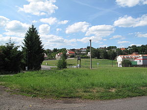
Předboj
Municipality in Central Bohemian, Czech Republic
Distance: Approx. 228 meters
Latitude and longitude: 50.22555556,14.47666667
Předboj is a municipality and village in Prague-East District in the Central Bohemian Region of the Czech Republic. It has about 1,400 inhabitants.

Veliká Ves (Prague-East District)
Municipality in Central Bohemian, Czech Republic
Distance: Approx. 2635 meters
Latitude and longitude: 50.24361111,14.45527778
Veliká Ves is a municipality and village in Prague-East District in the Central Bohemian Region of the Czech Republic. It has about 400 inhabitants.
Weather in this IP's area
overcast clouds
6 Celsius
5 Celsius
6 Celsius
7 Celsius
1026 hPa
77 %
1026 hPa
1000 hPa
10000 meters
2.57 m/s
240 degree
100 %
07:16:10
16:17:33