185.217.82.80 - IP Lookup: Free IP Address Lookup, Postal Code Lookup, IP Location Lookup, IP ASN, Public IP
Country:
Region:
City:
Location:
Time Zone:
Postal Code:
ISP:
ASN:
language:
User-Agent:
Proxy IP:
Blacklist:
IP information under different IP Channel
ip-api
Country
Region
City
ASN
Time Zone
ISP
Blacklist
Proxy
Latitude
Longitude
Postal
Route
db-ip
Country
Region
City
ASN
Time Zone
ISP
Blacklist
Proxy
Latitude
Longitude
Postal
Route
IPinfo
Country
Region
City
ASN
Time Zone
ISP
Blacklist
Proxy
Latitude
Longitude
Postal
Route
IP2Location
185.217.82.80Country
Region
bayern
City
jettingen
Time Zone
Europe/Berlin
ISP
Language
User-Agent
Latitude
Longitude
Postal
ipdata
Country
Region
City
ASN
Time Zone
ISP
Blacklist
Proxy
Latitude
Longitude
Postal
Route
Popular places and events near this IP address
Konzenberg
Village in Bavaria, Germany
Distance: Approx. 6858 meters
Latitude and longitude: 48.45,10.43333333
Konzenberg (498 m above sea level) is located in Bavaria in Germany. It is a small village eastern in the valley of the river Mindel, which ends in the Danube.

Jettingen-Scheppach
Municipality in Bavaria, Germany
Distance: Approx. 569 meters
Latitude and longitude: 48.38333333,10.43333333
Jettingen-Scheppach is a market community in the Günzburg Landkreis in the Schwaben (Swabia) Regierungsbezirk in Bavaria. It lies between Ulm and Augsburg. Its population as of 1 December 2005 was 7,044.

Burgau
Town in Bavaria, Germany
Distance: Approx. 5280 meters
Latitude and longitude: 48.43222222,10.40694444
Burgau is a town in the district of Günzburg in Swabia, Bavaria. Burgau lies on the river Mindel and has a population of just under 10,000.

Wettenhausen Abbey
Distance: Approx. 5645 meters
Latitude and longitude: 48.39638889,10.35888889
Wettenhausen Abbey (German: Kloster Wettenhausen, Reichsabtei Wettenhausen) was an Imperial Abbey of Augustinian Canons until its secularization in 1802–1803. Being one of the 40-odd self-ruling Imperial Abbeys of the Holy Roman Empire, Wettenhaussen Abbey was a virtually independent state. Its abbot had seat and voice in the Imperial Diet, where he sat on the Bench of the Prelates of Swabia.

Burtenbach
Municipality in Bavaria, Germany
Distance: Approx. 4430 meters
Latitude and longitude: 48.35,10.45
Burtenbach is a municipality in the district of Günzburg in Bavaria in Germany.

Kammeltal
Municipality in Bavaria, Germany
Distance: Approx. 5032 meters
Latitude and longitude: 48.38333333,10.36666667
Kammeltal is a municipality in the district of Günzburg in Bavaria in Germany.

Röfingen
Municipality in Bavaria, Germany
Distance: Approx. 5002 meters
Latitude and longitude: 48.43333333,10.43333333
Röfingen is a municipality in the district of Günzburg in Bavaria in Germany.
Krähenbach (Kammel)
River in Germany
Distance: Approx. 5909 meters
Latitude and longitude: 48.3708,10.3589
Krähenbach is a river of Bavaria, Germany. It is a right tributary of the Kammel in Ettenbeuren.
Rieder Bach (Mindel)
River in Germany
Distance: Approx. 345 meters
Latitude and longitude: 48.39,10.4303
Rieder Bach is a river of Bavaria, Germany. It is a right tributary of the Mindel in Jettingen-Scheppach.

Burgau (Schwab) station
Railway station in Germany
Distance: Approx. 4088 meters
Latitude and longitude: 48.42480556,10.427
Burgau (Schwab) station (German: Bahnhof Burgau (Schwab)), is a railway station in the town of Burgau, in Bavaria, Germany. It is located on the standard gauge Ulm–Augsburg line of Deutsche Bahn.

Jettingen station
Railway station in Germany
Distance: Approx. 1451 meters
Latitude and longitude: 48.39908,10.44556
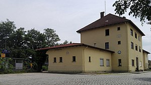
Jettingen station (German: Haltepunkt Jettingen) is a railway stop in the market municipality of Jettingen-Scheppach, in Bavaria, Germany. The train station is located in the district of Jettingen and on the standard gauge railroad line Ulm-Augsburg of Deutsche Bahn.

Freihalden station
Railway station in Germany
Distance: Approx. 5055 meters
Latitude and longitude: 48.38465,10.50244
Freihalden station (German: Haltepunkt Jettingen) is a stop on the Augsburg-Ulm railroad line of Deutsche Bahn and is located in the municipality of Jettingen-Scheppach in the Freihalden district. The trains are operated by Deutsche Bahn Regio Bayern.
Weather in this IP's area
scattered clouds
6 Celsius
4 Celsius
5 Celsius
7 Celsius
1012 hPa
63 %
1012 hPa
954 hPa
10000 meters
2.49 m/s
2.46 m/s
186 degree
47 %