185.216.253.13 - IP Lookup: Free IP Address Lookup, Postal Code Lookup, IP Location Lookup, IP ASN, Public IP
Country:
Region:
City:
Location:
Time Zone:
Postal Code:
IP information under different IP Channel
ip-api
Country
Region
City
ASN
Time Zone
ISP
Blacklist
Proxy
Latitude
Longitude
Postal
Route
Luminati
Country
Region
ct
City
guissona
ASN
Time Zone
Europe/Madrid
ISP
Corporacion Alimentaria Guissona, S.A
Latitude
Longitude
Postal
IPinfo
Country
Region
City
ASN
Time Zone
ISP
Blacklist
Proxy
Latitude
Longitude
Postal
Route
IP2Location
185.216.253.13Country
Region
catalunya
City
sant guim de freixenet
Time Zone
Europe/Madrid
ISP
Language
User-Agent
Latitude
Longitude
Postal
db-ip
Country
Region
City
ASN
Time Zone
ISP
Blacklist
Proxy
Latitude
Longitude
Postal
Route
ipdata
Country
Region
City
ASN
Time Zone
ISP
Blacklist
Proxy
Latitude
Longitude
Postal
Route
Popular places and events near this IP address

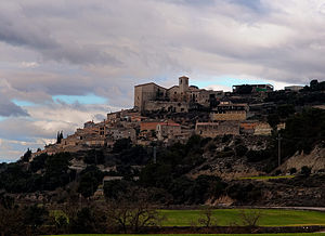
Argençola
Municipality in Catalonia, Spain
Distance: Approx. 6677 meters
Latitude and longitude: 41.59833333,1.44361111
Argençola (Catalan pronunciation: [əɾʒənˈsɔlə]) is a municipality in the comarca of the Anoia in Catalonia, Spain. It is situated in the east of the comarca, bordering the Segarra and the Conca de Barberà. The Anoia river has its source on the territory of the municipality.

Autovía A-2
Road in Spain
Distance: Approx. 4044 meters
Latitude and longitude: 41.61944444,1.41722222
The Autovía A-2 (also called Autovia del Nordeste and Avenida de América, Catalan: Autovia del Nord-est) is a Spanish autovía and autopista route which starts in Madrid and ends in Barcelona.
Copons
Municipality in Catalonia, Spain
Distance: Approx. 8479 meters
Latitude and longitude: 41.63833333,1.51944444
Copons is a municipality in the comarca of the Anoia in Catalonia, Spain.

Montmaneu
Municipality in Catalonia, Spain
Distance: Approx. 3180 meters
Latitude and longitude: 41.62722222,1.41722222
Montmaneu (Catalan pronunciation: [mumːəˈnɛw]) is a municipality in the comarca of the Anoia in Catalonia, Spain.

Pujalt
Municipality in Catalonia, Spain
Distance: Approx. 6973 meters
Latitude and longitude: 41.71833333,1.42166667
Pujalt is a municipality in the comarca of the Anoia in Catalonia, Spain. It comprises the settlements of Pujalt (2013 population: 94), Conill (45), L'Astor (33), La Guàrdia Pilosa (14), and Vilamajor (12).

Sant Martí Sesgueioles
Municipality in Catalonia, Spain
Distance: Approx. 7857 meters
Latitude and longitude: 41.70305556,1.49027778
Sant Martí Sesgueioles (Catalan pronunciation: [ˈsam məɾˈti səzɣəˈjɔləs]; Old Catalan for 'St. Martin [of] the Little Churches') is a municipality in the comarca of the Anoia in Catalonia, Spain.

Veciana
Municipality in Catalonia, Spain
Distance: Approx. 5767 meters
Latitude and longitude: 41.65833333,1.48944444
Veciana is a municipality in the comarca of the Anoia in Catalonia, Spain. The municipality is split into two parts, the bigger northern part containing Veciana village.

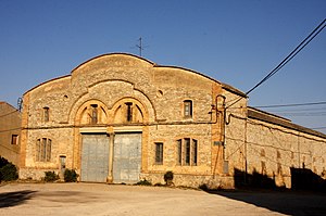
Sant Guim de Freixenet
Municipality in Catalonia, Spain
Distance: Approx. 247 meters
Latitude and longitude: 41.6575,1.42194444
Sant Guim de Freixenet (Catalan pronunciation: [ˈsaŋ ˈgim de fɾejʃeˈnet]) is a municipality in the comarca of la Segarra in Catalonia, Spain.

Estaràs
Municipality in Catalonia, Spain
Distance: Approx. 5437 meters
Latitude and longitude: 41.69388889,1.37944444
Estaràs is a village in the province of Lleida and autonomous community of Catalonia, Spain.
Les Oluges
Municipality in Catalonia, Spain
Distance: Approx. 9515 meters
Latitude and longitude: 41.69916667,1.32166667
Les Oluges (Catalan pronunciation: [lez oˈluʒes]) is a village in the comarca of Segarra, in the province of Lleida and autonomous community of Catalonia, Spain.

Ribera d'Ondara
Municipality in Catalonia, Spain
Distance: Approx. 7052 meters
Latitude and longitude: 41.62944444,1.34305556
Ribera d'Ondara (Catalan pronunciation: [riˈβeɾa ðonˈdaɾa]) is a municipality in the province of Lleida and autonomous community of Catalonia, Spain. The municipality is split into three parts, the biggest central part containing the main town, Sant Antolí i Vilanova.
Sant Ramon
Municipality in Catalonia, Spain
Distance: Approx. 9310 meters
Latitude and longitude: 41.7275,1.36277778
Sant Ramon (Catalan pronunciation: [ˈsan raˈmon]) is a municipality in the county of Segarra, in Catalonia. It includes the villages of Gospí, Portell and Viver de Segarra. The name references Saint Raymond Nonnatus because he was born in Portell.
Weather in this IP's area
clear sky
3 Celsius
3 Celsius
3 Celsius
5 Celsius
1032 hPa
95 %
1032 hPa
942 hPa
10000 meters
0.92 m/s
1.12 m/s
3 degree


