185.215.196.226 - IP Lookup: Free IP Address Lookup, Postal Code Lookup, IP Location Lookup, IP ASN, Public IP
Country:
Region:
City:
Location:
Time Zone:
Postal Code:
ISP:
ASN:
language:
User-Agent:
Proxy IP:
Blacklist:
IP information under different IP Channel
ip-api
Country
Region
City
ASN
Time Zone
ISP
Blacklist
Proxy
Latitude
Longitude
Postal
Route
db-ip
Country
Region
City
ASN
Time Zone
ISP
Blacklist
Proxy
Latitude
Longitude
Postal
Route
IPinfo
Country
Region
City
ASN
Time Zone
ISP
Blacklist
Proxy
Latitude
Longitude
Postal
Route
IP2Location
185.215.196.226Country
Region
vastra gotalands lan
City
kungalv
Time Zone
Europe/Stockholm
ISP
Language
User-Agent
Latitude
Longitude
Postal
ipdata
Country
Region
City
ASN
Time Zone
ISP
Blacklist
Proxy
Latitude
Longitude
Postal
Route
Popular places and events near this IP address
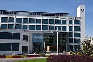
Kungälv Municipality
Municipality in Västra Götaland County, Sweden
Distance: Approx. 951 meters
Latitude and longitude: 57.86666667,11.96666667
Kungälv Municipality (Kungälvs kommun) is a municipality in Västra Götaland County in western Sweden. Its seat is located in the city of Kungälv. It is the 50th largest municipality in Sweden by population size, which exceeded 50 000 during May 2024.
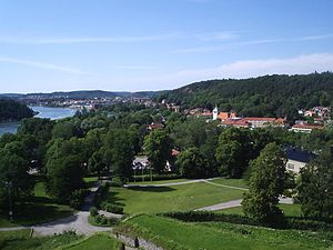
Kungälv
City in Bohuslän, Sweden
Distance: Approx. 951 meters
Latitude and longitude: 57.86666667,11.96666667
Kungälv (Swedish pronunciation: [ˈkɵ̂ŋːɛlv]) is a city and the seat of Kungälv Municipality in Västra Götaland County, Sweden. It is also a part of Greater Gothenburg Metropolitan Area. It had 22,768 inhabitants in 2010.

Bohus Fortress
Medieval fortress on the former Norwegian–Swedish border
Distance: Approx. 1529 meters
Latitude and longitude: 57.86166667,11.99944444
Bohus Fortress lies in Kungälv, Bohuslän, Sweden, north east from Hisingen where the Göta river splits into two branches (20 km (12 mi) north of Gothenburg). It commands the surrounding area from a cliff 40 m (130 ft) high, with the river forming a natural moat around it. The fortress used to be situated along the old Norwegian–Swedish border.
Kungahälla
Medieval city in sweden
Distance: Approx. 3753 meters
Latitude and longitude: 57.8452,11.9397
Kungahälla (Swedish: Kungahälla, Norwegian: Konghelle, Old Norse: Konungahella) was a medieval settlement in southern Bohuslän at a site which is located in Kungälv Municipality in Västra Götaland County in Sweden. It is the site of the former fortification at Ragnhildsholmen (Borgen på Ragnhildsholmen).
Diseröd
Place in Bohuslän, Sweden
Distance: Approx. 5516 meters
Latitude and longitude: 57.91666667,12.01666667
Diseröd is a locality situated in Kungälv Municipality, Västra Götaland County, Sweden. It had 1,241 inhabitants in 2010.
Rödbo
Place in Bohuslän, Sweden
Distance: Approx. 2954 meters
Latitude and longitude: 57.85,11.95
Rödbo is a locality situated in Göteborg Municipality, Västra Götaland County, Sweden. It had 278 inhabitants in 2010.
Kastellegården
Building in Kungälv Municipality, Gothenburg and Bohus County, Sweden
Distance: Approx. 3474 meters
Latitude and longitude: 57.84956,11.93788
Kastellegården is a mansion and gardens in Bohuslän, Sweden. It is located in Kungälv Municipality.
Skarpe Nord
Ice skating rink in Kungälv, Sweden
Distance: Approx. 665 meters
Latitude and longitude: 57.8667,11.9727
Skarpe Nord is an ice skating rink in Kungälv. It is the home of IFK Kungälv, Kareby IS, and Kungälvs SK. It is open to the public in the winter, when it is cold and there is ice on the rink.
Surte Church
Church in Västra Götaland County, Sweden
Distance: Approx. 4721 meters
Latitude and longitude: 57.83253889,12.014075
Surte Church (Swedish: Surte kyrka) is a church in Surte about 10 km (6.2 mi) north of Gothenburg, Sweden. It is part of Nödinge parish in the Diocese of Gothenburg.

Nödinge Church
Church in Nödinge-Nol, Sweden
Distance: Approx. 5140 meters
Latitude and longitude: 57.89055556,12.05916667
Nödinge Church (Swedish: Nödinge kyrka) is a church in Nödinge-Nol in Västergötland, Sweden, about 2 miles (3.2 km) north of Gothenburg. The current church was built in 1727, replacing an older Romanesque church from the 12th or 13th century. The church has a fine baroque interior, with ceiling paintings by master painter Alexander Fox added in 1734.

Kungälv resecentrum
Bus station
Distance: Approx. 741 meters
Latitude and longitude: 57.87188,11.96809
Kungälv resecentrum is Kungälv's primary bus station, operated by Västtrafik. It serves as the city's main public transit link. The station is located just next to the E6 highway, connecting Kungälv to many other cities.

Siege of Bohus fortress
Danish siege against Sweden 1678
Distance: Approx. 1529 meters
Latitude and longitude: 57.86166667,11.99944444
The siege of Bohus fortress was a siege by Dano–Norwegian troops during the Scanian War. The siege was endured by the Swedish defenders for weeks before forcing a Dano–Norwegian retreat.
Weather in this IP's area
moderate rain
2 Celsius
-1 Celsius
2 Celsius
2 Celsius
1023 hPa
91 %
1023 hPa
1016 hPa
10000 meters
3.27 m/s
7.6 m/s
207 degree
80 %


