185.214.228.184 - IP Lookup: Free IP Address Lookup, Postal Code Lookup, IP Location Lookup, IP ASN, Public IP
Country:
Region:
City:
Location:
Time Zone:
Postal Code:
IP information under different IP Channel
ip-api
Country
Region
City
ASN
Time Zone
ISP
Blacklist
Proxy
Latitude
Longitude
Postal
Route
Luminati
Country
ASN
Time Zone
Europe/Berlin
ISP
FIS-ASP Application Service Providing & IT-Outsourcing GmbH
Latitude
Longitude
Postal
IPinfo
Country
Region
City
ASN
Time Zone
ISP
Blacklist
Proxy
Latitude
Longitude
Postal
Route
IP2Location
185.214.228.184Country
Region
bayern
City
grafenrheinfeld
Time Zone
Europe/Berlin
ISP
Language
User-Agent
Latitude
Longitude
Postal
db-ip
Country
Region
City
ASN
Time Zone
ISP
Blacklist
Proxy
Latitude
Longitude
Postal
Route
ipdata
Country
Region
City
ASN
Time Zone
ISP
Blacklist
Proxy
Latitude
Longitude
Postal
Route
Popular places and events near this IP address
Schweinfurt (district)
District in Bavaria, Germany
Distance: Approx. 3578 meters
Latitude and longitude: 50,10.25
Schweinfurt is a Landkreis (district) in the northwestern part of Bavaria, Germany. Neighboring districts are (from the north clockwise) Bad Kissingen, Rhön-Grabfeld, Haßberge, Bamberg, Kitzingen, Würzburg and Main-Spessart. The district-free city Schweinfurt is surrounded by the district.

Bergrheinfeld
Municipality in Bavaria, Germany
Distance: Approx. 2385 meters
Latitude and longitude: 50,10.16666667
Bergrheinfeld is a municipality in the district of Schweinfurt in Bavaria, Germany.

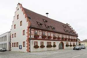
Grafenrheinfeld
Municipality in Bavaria, Germany
Distance: Approx. 0 meters
Latitude and longitude: 50,10.2
Grafenrheinfeld is a municipality in the district of Schweinfurt in Bavaria, Germany. The municipality is home to the nuclear power station, Grafenrheinfeld, which opened in 1982.

Röthlein
Municipality in Bavaria, Germany
Distance: Approx. 3898 meters
Latitude and longitude: 49.96666667,10.21666667
Röthlein is a municipality in the district of Schweinfurt in Bavaria, Germany. The village is located south of Schweinfurt, close to the Main valley. The quarters are Röthlein, Heidenfeld and Hirschfeld.

Schwebheim
Municipality in Bavaria, Germany
Distance: Approx. 3294 meters
Latitude and longitude: 49.99722222,10.24583333
Schwebheim is a municipality in the district of Schweinfurt in Bavaria, Germany. Historically important as the location of the Bibra family castle by the same name. The castle was heavily damaged during severe bombings of Schweinfurt in World War II and only partially repaired.

Grafenrheinfeld nuclear power plant
Now-offline electricity-generating facility near Grafenrheinfeld, Germany
Distance: Approx. 2084 meters
Latitude and longitude: 49.98408611,10.18466944
The Grafenrheinfeld nuclear power plant (German: Kernkraftwerk Grafenrheinfeld, KKG) is a now-offline electricity-generating facility near Grafenrheinfeld, south of Schweinfurt at the river Main. The plant operated from 1981 to June 28, 2015, when it was taken offline as part of the phase out policy for nuclear power in Germany. As a result of the plant's closure, Germany has relied heavily on coal and natural gas, primarily from Russia, to generate electricity.
Schweinfurt Hauptbahnhof
Railway station in Schweinfurt, Germany
Distance: Approx. 4045 meters
Latitude and longitude: 50.03555556,10.21166667
Schweinfurt Hauptbahnhof is the largest railway station in the Lower Franconian city of Schweinfurt and its transfer hub to the majority of regional buses. In addition to the Hauptbahnhof, the Schweinfurt Mitte (Schweinfurt Central) and Schweinfurt Stadt (Schweinfurt Town) stations also lie within the city, closer to the centre, on the Bamberg–Würzburg railway.

Alexander-von-Humboldt-Gymnasium, Schweinfurt
Public school in Bavaria, Germany
Distance: Approx. 4925 meters
Latitude and longitude: 50.04423056,10.20123889
The Alexander-von-Humboldt-Gymnasium (English: Alexander von Humboldt Gymnasium) is a Gymnasium in Schweinfurt, Bavaria, Germany. The eponym is Alexander von Humboldt (1769–1859). The school has approximately 100 teachers and 1,200 students.
Unkenbach (Main)
River in Germany
Distance: Approx. 4979 meters
Latitude and longitude: 49.9573,10.1793
Unkenbach is a river of Bavaria, Germany. It is a left tributary of the Main near Röthlein.

Schweinfurt Mitte station
Railway halt in Schweinfurt, Germany
Distance: Approx. 4996 meters
Latitude and longitude: 50.040549,10.229922
Schweinfurt Mitte (German for Schweinfurt Central) is a railway station in the Lower Franconian city of Schweinfurt, Germany. It is located close to the city centre, and is served by regional trains.
VfR 07 Schweinfurt
Football club
Distance: Approx. 4954 meters
Latitude and longitude: 50.03863889,10.23436111
Verein für Rasenspiele 1907 Schweinfurt e.V., called VfR 07 Schweinfurt, VfR Schweinfurt, or simply VfR 07, was a German association football club established in Schweinfurt (Bavaria) in 1907. The club dissolved in 2015 after it had gone bankrupt. VfR Schweinfurt experienced a number of successful years from the late 1930s to the early 1940s.

Stadion am Hutrasen
Distance: Approx. 4954 meters
Latitude and longitude: 50.03863889,10.23436111
Stadion am Hutrasen was a football stadium and is now a sports ground in Schweinfurt, Germany. It was the venue of 1. FC Schweinfurt 05 and VfR 07 Schweinfurt, and is today used by Türkiyemspor SV-12 Schweinfurt for its home games.
Weather in this IP's area
overcast clouds
8 Celsius
4 Celsius
8 Celsius
8 Celsius
1000 hPa
95 %
1000 hPa
968 hPa
10000 meters
8.17 m/s
18.07 m/s
225 degree
100 %
