185.212.75.48 - IP Lookup: Free IP Address Lookup, Postal Code Lookup, IP Location Lookup, IP ASN, Public IP
Country:
 France
Region:
City:
Location:
Time Zone:
Postal Code:
ISP:
ASN:
language:
User-Agent:
Proxy IP:
Blacklist:
IP information under different IP Channel
ip-api
Country
Region
City
ASN
Time Zone
ISP
Blacklist
Proxy
Latitude
Longitude
Postal
Route
db-ip
Country
Region
City
ASN
Time Zone
ISP
Blacklist
Proxy
Latitude
Longitude
Postal
Route
IPinfo
Country
Region
City
ASN
Time Zone
ISP
Blacklist
Proxy
Latitude
Longitude
Postal
Route
IP2Location
185.212.75.48Country
frRegion
ile-de-france
City
la ferte-gaucher
Time Zone
Europe/Paris
ISP
Language
User-Agent
Latitude
Longitude
Postal
ipdata
Country
Region
City
ASN
Time Zone
ISP
Blacklist
Proxy
Latitude
Longitude
Postal
Route
Popular places and events near this IP address

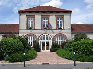
La Ferté-Gaucher
Commune in Île-de-France, France
Distance: Approx. 151 meters
Latitude and longitude: 48.7842,3.308
La Ferté-Gaucher (French pronunciation: [la fɛʁte ɡoʃe] ) is a commune in the Seine-et-Marne department in the Île-de-France region in north-central France.

Canton of La Ferté-Gaucher
Former canton in Île-de-France, France
Distance: Approx. 2415 meters
Latitude and longitude: 48.77,3.28055556
The canton of La Ferté-Gaucher is a French former administrative division, located in the arrondissement of Provins, in the Seine-et-Marne département (Île-de-France région). It was disbanded following the French canton reorganisation which came into effect in March 2015. It consisted of 18 communes, which joined the canton of Coulommiers in 2015.

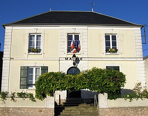
La Chapelle-Moutils
Commune in Île-de-France, France
Distance: Approx. 6271 meters
Latitude and longitude: 48.775,3.3914
La Chapelle-Moutils is a commune in the Seine-et-Marne department in the Île-de-France region in north-central France. It was created in 1973 by the merger of two former communes: La Chapelle-Véronge and Moutils.

Chartronges
Commune in Île-de-France, France
Distance: Approx. 4909 meters
Latitude and longitude: 48.7464,3.2697
Chartronges (French pronunciation: [ʃaʁtʁɔ̃ʒ] ) is a commune in the Seine-et-Marne department in the Île-de-France region in north-central France.
Choisy-en-Brie
Commune in Île-de-France, France
Distance: Approx. 6921 meters
Latitude and longitude: 48.7583,3.2203
Choisy-en-Brie (French pronunciation: [ʃwazi ɑ̃ bʁi] , literally Choisy in Brie) is a commune in the Seine-et-Marne department in the Île-de-France region in north-central France.

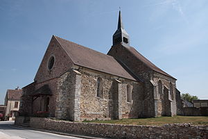
Jouy-sur-Morin
Commune in Île-de-France, France
Distance: Approx. 2859 meters
Latitude and longitude: 48.7953,3.2725
Jouy-sur-Morin (French pronunciation: [ʒwi syʁ mɔʁɛ̃] , literally Jouy on Morin) is a commune in the Seine-et-Marne department in the Île-de-France region in north-central France.
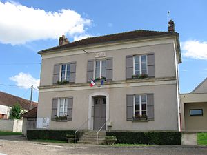
Lescherolles
Commune in Île-de-France, France
Distance: Approx. 3629 meters
Latitude and longitude: 48.7633,3.3461
Lescherolles (French pronunciation: [lɛʃʁɔl] )) is a commune in the Seine-et-Marne department in the Île-de-France region in north-central France.
Leudon-en-Brie
Commune in Île-de-France, France
Distance: Approx. 6032 meters
Latitude and longitude: 48.7342,3.2714
Leudon-en-Brie (French pronunciation: [lødɔ̃ ɑ̃ bʁi] , literally Leudon in Brie) is a commune in the Seine-et-Marne department in the Île-de-France region in north-central France.

Saint-Barthélemy, Seine-et-Marne
Commune in Île-de-France, France
Distance: Approx. 5517 meters
Latitude and longitude: 48.8172,3.3614
Saint-Barthélemy (French pronunciation: [sɛ̃ baʁtelemi] ) is a commune in the Seine-et-Marne department in the Île-de-France region in north-central France.

Saint-Mars-Vieux-Maisons
Commune in Île-de-France, France
Distance: Approx. 4640 meters
Latitude and longitude: 48.7425,3.3211
Saint-Mars-Vieux-Maisons (French pronunciation: [sɛ̃ maʁ vjø mɛzɔ̃]) is a commune in the Seine-et-Marne department in the Île-de-France region in north-central France.

Saint-Martin-des-Champs, Seine-et-Marne
Commune in Île-de-France, France
Distance: Approx. 2250 meters
Latitude and longitude: 48.7786,3.3367
Saint-Martin-des-Champs (French pronunciation: [sɛ̃ maʁtɛ̃ de ʃɑ̃] ) is a commune in the Seine-et-Marne department in the Île-de-France region in north-central France.
Saint-Rémy-de-la-Vanne
Commune in Île-de-France, France
Distance: Approx. 5498 meters
Latitude and longitude: 48.7928,3.2333
Saint-Rémy-de-la-Vanne (French pronunciation: [sɛ̃ ʁemi də la van]; before 2024: Saint-Rémy-la-Vanne) is a commune in the Seine-et-Marne department in the Île-de-France region in north-central France.
Weather in this IP's area
moderate rain
6 Celsius
3 Celsius
6 Celsius
6 Celsius
1015 hPa
82 %
1015 hPa
996 hPa
10000 meters
4.23 m/s
11.42 m/s
126 degree
100 %