Country:
Region:
City:
Latitude and Longitude:
Time Zone:
Postal Code:
IP information under different IP Channel
ip-api
Country
Region
City
ASN
Time Zone
ISP
Blacklist
Proxy
Latitude
Longitude
Postal
Route
Luminati
Country
Region
an
City
sierradeyeguas
ASN
Time Zone
Europe/Madrid
ISP
Telecomunicaciones Publicas Andaluzas S.L.
Latitude
Longitude
Postal
IPinfo
Country
Region
City
ASN
Time Zone
ISP
Blacklist
Proxy
Latitude
Longitude
Postal
Route
db-ip
Country
Region
City
ASN
Time Zone
ISP
Blacklist
Proxy
Latitude
Longitude
Postal
Route
ipdata
Country
Region
City
ASN
Time Zone
ISP
Blacklist
Proxy
Latitude
Longitude
Postal
Route
Popular places and events near this IP address

Fuente de Piedra Lagoon
Wetland in Andalusia, Spain
Distance: Approx. 8452 meters
Latitude and longitude: 37.107,-4.771
Fuente de Piedra Lagoon is a wetland located in the Málaga province of Spain. It is used by the greater flamingo for its annual reproduction cycle, constituting the largest colony on the Iberian Peninsula of this bird. The lagoon is fed by underwater springs that pass through mineral salt deposits, so the lagoon is saline - indeed salt was harvested until recently.

Campillos
Place in Andalusia, Spain
Distance: Approx. 8435 meters
Latitude and longitude: 37.05,-4.85
Campillos is a municipality and town in the province of Málaga, part of the autonomous community of Andalusia in southern Spain. It is located northwest of the province in the comarca of Guadalteba and within the judicial district of Antequera. The municipality is approximately 30 kilometers from Antequera and 70 from the provincial capital.

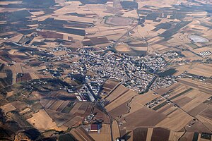
Sierra de Yeguas
Place in Andalusia, Spain
Distance: Approx. 969 meters
Latitude and longitude: 37.11666667,-4.86666667
Sierra de Yeguas is a town and municipality in the province of Málaga, part of the autonomous community of Andalusia in southern Spain. It belongs to the comarca of Antequera. The municipality is situated approximately 95 kilometres from the provincial capital of Málaga.

Martín de la Jara
City in Seville, Spain
Distance: Approx. 8168 meters
Latitude and longitude: 37.1,-4.95
Martín de la Jara is a city located in the province of Seville, Spain. According to the 2005 census (INE), the city has a population of 2,748.
Hoya of Antequera
Distance: Approx. 8444 meters
Latitude and longitude: 37.10694444,-4.77111111
The Hoya of Antequera (also Antequera Depression or, in Spanish, Depresión de Antequera, Hoya de Antequera or Vega de Antequera) is a sedimentary basin located in the northern part of the province of Málaga, Andalusia, Spain. It takes its name from the city of Antequera, located within the depression. It is located in the Baetic Cordillera, with the Cordilleras Subbéticas to its north and the Cordillera Penibética to its south.
Weather in this IP's area
broken clouds
16 Celsius
16 Celsius
16 Celsius
16 Celsius
1016 hPa
79 %
1016 hPa
962 hPa
10000 meters
3.93 m/s
9.16 m/s
139 degree
73 %
07:58:42
18:09:45
