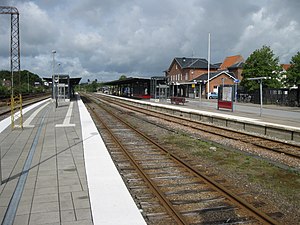
Country:
Region:
City:
Latitude and Longitude:
Time Zone:
Postal Code:
IP information under different IP Channel
ip-api
Country
Region
City
ASN
Time Zone
ISP
Blacklist
Proxy
Latitude
Longitude
Postal
Route
Luminati
Country
ASN
Time Zone
Europe/Copenhagen
ISP
Kobalt ApS
Latitude
Longitude
Postal
IPinfo
Country
Region
City
ASN
Time Zone
ISP
Blacklist
Proxy
Latitude
Longitude
Postal
Route
db-ip
Country
Region
City
ASN
Time Zone
ISP
Blacklist
Proxy
Latitude
Longitude
Postal
Route
ipdata
Country
Region
City
ASN
Time Zone
ISP
Blacklist
Proxy
Latitude
Longitude
Postal
Route
Popular places and events near this IP address

Them, Denmark
Town in Central Denmark, Denmark
Distance: Approx. 2096 meters
Latitude and longitude: 56.09166667,9.54833333
Them is a small town in central Denmark with a population of 2,431 (1 January 2024), located in Silkeborg Municipality (formerly Them Municipality) in Jutland, lying a few kilometers south-west of Silkeborg, and north-east of Bryrup.

Himmelbjerget
Hill in Denmark
Distance: Approx. 6581 meters
Latitude and longitude: 56.10516944,9.68505
Himmelbjerget ("The Sky Mountain" or "The Mountain of Heaven") is a hill located between Ry and Silkeborg, Denmark in the area known as Søhøjlandet. With an elevation of 147 m (482 ft), Himmelbjerget is one of the highest natural points in the Danish landscape. The hill and surrounding area has been a centre for various gatherings and celebrations for more than 200 years and in 1875, a red brick tower was erected at the top.

Them Municipality
Distance: Approx. 1851 meters
Latitude and longitude: 56.1,9.55
Them municipality was a municipality (Danish, kommune) in the former Aarhus County on the Jutland peninsula in central Denmark. The municipality covered an area of 210 km2, and had a total population of 7,000 (2005). Its last mayor was Torben Hansen, a member of the Socialist People's Party (Socialistisk Folkeparti) political party.
Silkeborg Stadium
Distance: Approx. 6800 meters
Latitude and longitude: 56.157884,9.553278
Silkeborg Stadium (Danish: Silkeborg Stadion), latterly known as Mascot Park for sponsorship reasons, was a Danish football stadium in the town of Silkeborg, located in the middle of Jutland. It was home to the Danish Superliga club Silkeborg IF until the opening of JYSK Park in 2017. The track was founded in 1925, and in 1943 was also a stadium house built with primitive dressing rooms.

Gjessø
Town in Denmark
Distance: Approx. 5341 meters
Latitude and longitude: 56.11666667,9.5
Gjessø is a small town near Silkeborg in Denmark with a population of 835 (1 January 2024). Gjessø is famous for its big lake which fills half of the town. It is used every year by tourists and natives.

Museum Jorn, Silkeborg
Art museum in Silkeborg, Denmark
Distance: Approx. 7023 meters
Latitude and longitude: 56.16055556,9.55833333
Museum Jorn, Silkeborg, (formerly Silkeborg Kunstmuseum) is an art museum located by Gudenåen in Silkeborg, Denmark. The museum holds the collections that were developed by Asger Jorn (1914–1973) from the early 1950s until his death in 1973, since when they have doubled in extent. In consequence, the museum is not only home to the most comprehensive collection of Jorn’s own works but also holds thousands of paintings, sculptures and works on paper by other artists – members of the CoBrA avant-garde art movement and older international artists who inspired Jorn or were kindred artistic spirits including, among others, Max Ernst, Francis Picabia, Fernand Léger and Man Ray.

Silkeborg Forests
Forest in Denmark
Distance: Approx. 3873 meters
Latitude and longitude: 56.13333333,9.58333333
Silkeborg Forests is Denmark’s largest forest. It comprises a collection of several independent private and public woodlands, that have been allowed to merge into a single connected forest south of the city of Silkeborg. At 22,400 ha, it is Denmark's largest forest since 2004, after Rold Skov, and it is located within the largest forest district in the country as well.

Virklund
Town in Midtjylland, Denmark
Distance: Approx. 3779 meters
Latitude and longitude: 56.13055556,9.55916667
Virklund is a town in Denmark, located about 5 km (3.1 mi) south of Silkeborg, to which it functions as a satellite city. It has a population of 3,747 (1 January 2024). Virklund is located in Silkeborg Municipality and therefore is part of the Central Denmark Region.

Silkeborg railway station
Railway station in Jutland, Denmark
Distance: Approx. 7625 meters
Latitude and longitude: 56.16416667,9.54416667
Silkeborg station (Danish: Silkeborg Station or Danish: Silkeborg Banegård) is a railway station serving the town of Silkeborg in Central Jutland, Denmark. It is located in the centre of the town, on the southern edge of the historic town centre, and immediately adjacent to the Silkeborg bus station. The station is located on the Skanderborg–Skjern railway line from Skanderborg to Skjern.
Svejbæk railway station
Railway station in East Jutland, Denmark
Distance: Approx. 5193 meters
Latitude and longitude: 56.13277778,9.63666667
Svejbæk station is a railway station serving the railway town of Svejbæk in Central Jutland, Denmark. The station is located on the Skanderborg–Skjern railway line from Skanderborg to Skjern. The station opened on 2 May 1871 with the Skanderborg-Silkeborg section of the Skanderborg-Skjern railway.

Sejs-Svejbæk
Town in Central Jutland Region, Denmark
Distance: Approx. 5027 meters
Latitude and longitude: 56.13694,9.62251
Sejs-Svejbæk is a railway town, with a population of 4,608 (1 January 2024). It is located in Silkeborg Municipality, Central Jutland Region in Denmark, 7 km southeast of Silkeborg. Sejs-Svejbæk is served by Svejbæk railway station, located on the Skanderborg–Skjern railway line.

Møgelø
Island in Denmark
Distance: Approx. 6790 meters
Latitude and longitude: 56.12222222,9.68055556
Møgelø is an island in Julsø opposite of Himmelbjerget in Denmark. The name Møgelø means "Big Island", as it is the largest in the lake with 28 hectares of land. Between 1915 and 1942, the FDF in Silkeborg bought up a total of 24 acres of land on the island.
Weather in this IP's area
overcast clouds
10 Celsius
10 Celsius
10 Celsius
10 Celsius
1018 hPa
86 %
1018 hPa
1006 hPa
10000 meters
6.34 m/s
11.96 m/s
261 degree
98 %
07:59:20
16:13:33
