185.208.93.59 - IP Lookup: Free IP Address Lookup, Postal Code Lookup, IP Location Lookup, IP ASN, Public IP
Country:
Region:
City:
Location:
Time Zone:
Postal Code:
ISP:
ASN:
language:
User-Agent:
Proxy IP:
Blacklist:
IP information under different IP Channel
ip-api
Country
Region
City
ASN
Time Zone
ISP
Blacklist
Proxy
Latitude
Longitude
Postal
Route
db-ip
Country
Region
City
ASN
Time Zone
ISP
Blacklist
Proxy
Latitude
Longitude
Postal
Route
IPinfo
Country
Region
City
ASN
Time Zone
ISP
Blacklist
Proxy
Latitude
Longitude
Postal
Route
IP2Location
185.208.93.59Country
Region
vestfold og telemark
City
sande
Time Zone
Europe/Oslo
ISP
Language
User-Agent
Latitude
Longitude
Postal
ipdata
Country
Region
City
ASN
Time Zone
ISP
Blacklist
Proxy
Latitude
Longitude
Postal
Route
Popular places and events near this IP address

Sande, Vestfold
Village in Holmestrand, Norway
Distance: Approx. 2 meters
Latitude and longitude: 59.58679,10.20808
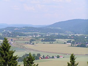
Sande or Sande i Vestfold is a village in Holmestrand Municipality in Vestfold county, Norway. The village is located along the Sandebukta bay off the Ytre Oslofjord about 60 kilometres (37 mi) south of Oslo (about 50 minutes driving time). There are several nearby villages around Sande including the villages of Klever and Eikeberg about 7 kilometres (4.3 mi) to the north, the village of Selvik about 4 kilometres (2.5 mi) to the southeast, the town of Holmestrand about 10 kilometres (6.2 mi) to the south, and the village of Hof about 10 kilometres (6.2 mi) to the west.

Selvik
Village in Holmestrand, Norway
Distance: Approx. 3703 meters
Latitude and longitude: 59.56645,10.26006
Selvik is a village in Holmestrand Municipality in Vestfold county, Norway. The village is located on the shore of the Sandebukta bay, about 3.5 kilometres (2.2 mi) southeast of the village of Sande i Vestfold and about 10 kilometres (6.2 mi) to the north of the town of Holmestrand. The village of Berger (in Drammen Municipality) lies about 9 kilometres (5.6 mi) to the southeast, at the mouth of the Drammensfjorden.
Klever, Norway
Village in Holmestrand, Norway
Distance: Approx. 7100 meters
Latitude and longitude: 59.65056,10.20487
Klever or Klevjer is a village in Holmestrand Municipality in Vestfold county, Norway. The village is located about 7 kilometres (4.3 mi) to the north of the village of Sande i Vestfold and about 4 kilometres (2.5 mi) south of the village of Skoger (in Drammen Municipality). The European route E18 highway and the Vestfoldbanen railway line both run along the east side of Klever.
Eikeberg
Village in Holmestrand, Norway
Distance: Approx. 5970 meters
Latitude and longitude: 59.63823,10.23814
Eikeberg or Ekeberg is a village in Holmestrand Municipality in Vestfold county, Norway. The village is located about 6 kilometres (3.7 mi) to the north of the village of Sande i Vestfold and about 5 kilometres (3.1 mi) to the south of the village of Skoger (in Drammen Municipality). The European route E18 highway and the Vestfoldbanen railway line both pass by just to the west of the village.

Hanekleiv Tunnel
Road tunnel in Vestfold, Norway
Distance: Approx. 2640 meters
Latitude and longitude: 59.56666667,10.18333333
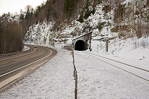
The Hanekleiv Tunnel (Norwegian: Hanekleivtunnelen) is a road tunnel in Holmestrand Municipality in Vestfold county, Norway. The 1,765-metre (5,791 ft) long tunnel is one of seven along the European route E18 highway in Holmestrand Municipality. The tunnel became the centre of controversy on 25 December 2006 when part of the roof collapsed, and investigations revealed that several tunnels on the E18 highway through Vestfold were insufficiently secured.

Sande Station
Railway station in Sande, Norway
Distance: Approx. 266 meters
Latitude and longitude: 59.585,10.205
Sande Station (Norwegian: Sande stasjon) is a railway station on the Vestfold Line in the village of Sande in Holmestrand Municipality in Vestfold county, Norway. The station is served with regional trains on the RE11 line operated by Vy. The original station building opened in 1881, but a new station was built in 2001 as part of the new Vestfold Line through Sande.
Hof Prison
Prison in Vestfold, Norway
Distance: Approx. 8508 meters
Latitude and longitude: 59.54361111,10.08361111
Hof Prison (Norwegian: Hof fengsel) was a prison in Hof in Vestfold, Norway. It had a capacity of 105 prisoners, serving sentences of up to one year. It was closed in 2019.

Smørstein Tunnel
Tunnel at Smørstein in Holmestrand, Norway
Distance: Approx. 7956 meters
Latitude and longitude: 59.5254,10.2803
The Smørstein Tunnel is a 288-meter (945 ft) tunnel located at Smørstein in Holmestrand, Norway. The tunnel carried a single, electrified track of the Vestfold Line. The need for a tunnel arose after a 19 August 1918 landslide washed away the railway past Smørstein.
Hillestad Church
Church in Vestfold, Norway
Distance: Approx. 8461 meters
Latitude and longitude: 59.5117368,10.184586
Hillestad Church (Norwegian: Hillestad kirke) is a parish church of the Church of Norway in Holmestrand Municipality in Vestfold county, Norway. It is located at Hillestad, about 3 kilometres (1.9 mi) east of the village of Sundbyfoss. It is one of the churches for the Botne parish which is part of the Nord-Jarlsberg prosti (deanery) in the Diocese of Tunsberg.

Sande Municipality (Vestfold)
Former municipality in Norway
Distance: Approx. 2 meters
Latitude and longitude: 59.58679,10.20808
Sande is a former municipality in Vestfold county, Norway. The 178-square-kilometre (69 sq mi) municipality existed from 1838 until its dissolution in 2020. The area is now part of Holmestrand Municipality in the traditional district of Jarlsberg.

Hof Church (Vestfold)
Church in Vestfold, Norway
Distance: Approx. 8946 meters
Latitude and longitude: 59.539535,10.079806
Hof Church (Norwegian: Hof kirke) is a parish church of the Church of Norway in Holmestrand Municipality in Vestfold county, Norway. It is located in the village of Hof. It is one of the churches for the "Hof, Vassås og Eidsfoss" parish which is part of the Nord-Jarlsberg prosti (deanery) in the Diocese of Tunsberg.

Sande Church (Vestfold)
Church in Vestfold, Norway
Distance: Approx. 219 meters
Latitude and longitude: 59.58876,10.208348
Sande Church (Norwegian: Sande kirke) is a parish church of the Church of Norway in Holmestrand Municipality in Vestfold county, Norway. It is located in the village of Sande i Vestfold. It is the church for the Sande parish which is part of the Nord-Jarlsberg prosti (deanery) in the Diocese of Tunsberg.
Weather in this IP's area
light snow
-2 Celsius
-4 Celsius
-2 Celsius
-2 Celsius
1022 hPa
94 %
1022 hPa
998 hPa
10000 meters
1.63 m/s
2.32 m/s
313 degree
100 %
