185.208.65.85 - IP Lookup: Free IP Address Lookup, Postal Code Lookup, IP Location Lookup, IP ASN, Public IP
Country:
Region:
City:
Location:
Time Zone:
Postal Code:
IP information under different IP Channel
ip-api
Country
Region
City
ASN
Time Zone
ISP
Blacklist
Proxy
Latitude
Longitude
Postal
Route
Luminati
Country
Region
ct
City
girona
ASN
Time Zone
Europe/Madrid
ISP
Vola los del Internet S.L.
Latitude
Longitude
Postal
IPinfo
Country
Region
City
ASN
Time Zone
ISP
Blacklist
Proxy
Latitude
Longitude
Postal
Route
IP2Location
185.208.65.85Country
Region
catalunya
City
tremp
Time Zone
Europe/Madrid
ISP
Language
User-Agent
Latitude
Longitude
Postal
db-ip
Country
Region
City
ASN
Time Zone
ISP
Blacklist
Proxy
Latitude
Longitude
Postal
Route
ipdata
Country
Region
City
ASN
Time Zone
ISP
Blacklist
Proxy
Latitude
Longitude
Postal
Route
Popular places and events near this IP address

Talarn
Municipality in Catalonia, Spain
Distance: Approx. 1866 meters
Latitude and longitude: 42.18333333,0.9
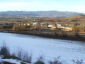
Talarn (Catalan pronunciation: [taˈlaɾn]) is a municipality in the comarca of the Pallars Jussà in Catalonia, Spain. It is situated in the centre of the Tremp basin, on the Noguera Pallaresa river below the Sant Antoni reservoir. It is the site of a hydroelectric power station and of a training school of the Spanish army (Academia Básica de Suboficiales).

Talarn Dam
Concrete gravity dam on the Noguera Pallaresa River in Catalonia, Spain
Distance: Approx. 2064 meters
Latitude and longitude: 42.17968611,0.91313889
Talarn Dam is a concrete gravity dam on the Noguera Pallaresa River, a tributary of the Ebro River, north of Tremp near Lleida in Catalonia, Spain. The dam is 206 meters long and 82 meters high and supplies a hydro-electric station with an output of 30 MW. Construction of the dam began in 1913, a huge undertaking needing ten million cubic feet of concrete. It was part of a larger project to build dams to store water in reservoirs to feed powerplants and to provide irrigation for farming.
Lleida–La Pobla Line
Railway line in Catalonia
Distance: Approx. 656 meters
Latitude and longitude: 42.17277778,0.89333333
The Lleida–La Pobla Line (Catalan: Línia Lleida-La Pobla) is a 89.4-kilometre-long (55.6 mi) railway line linking Lleida and La Pobla de Segur, in Catalonia, Spain. Most of its users concentrate between Lleida and Balaguer, where a frequent service is offered, with few trains continuing to La Pobla de Segur. Since 2009, a heritage railway service branded Tren dels Llacs (English: "Lakes Train"), in reference to the number of reservoirs skirted by the line north of Balaguer, has been running on the railway.
Salàs de Pallars
Municipality in Catalonia, Spain
Distance: Approx. 6125 meters
Latitude and longitude: 42.21444444,0.9325
Salas de Pallars (Catalan pronunciation: [saˈlaz ðe paˈʎas]) is a municipality in the comarca of the Pallars Jussà in Catalonia, Spain. It is about 8 km from Tremp and 5 km from Pobla de Segur. The town is served by the C-147 motorway.

Castell de Mur
Municipality in Catalonia, Spain
Distance: Approx. 8222 meters
Latitude and longitude: 42.09416667,0.87833333
Castell de Mur (Catalan pronunciation: [kasˈteʎ de ˈmuɾ]) is a municipality in the province of Lleida and autonomous community of Catalonia, Spain.
Gavet de la Conca
Municipality in Catalonia, Spain
Distance: Approx. 5171 meters
Latitude and longitude: 42.125,0.92166667
Gavet de la Conca is a village in the province of Lleida and autonomous community of Catalonia, Spain.

Celler Castell d'Encus
Spanish winery
Distance: Approx. 4520 meters
Latitude and longitude: 42.2075,0.89888889
Celler Castell d'Encus is a winery in the Costers del Segre DOP, in Western Catalonia. The vineyards are located between 850 and 1250 metres asl in the Spanish Pre-Pyrenees, making them the highest vineyards in Catalonia. The winery's name comes from the nearby abandoned medieval village and castle of Castelló d'Encús (ca).
Weather in this IP's area
clear sky
12 Celsius
11 Celsius
12 Celsius
12 Celsius
1029 hPa
39 %
1029 hPa
930 hPa
10000 meters
1.49 m/s
0.8 m/s
202 degree


