185.204.61.88 - IP Lookup: Free IP Address Lookup, Postal Code Lookup, IP Location Lookup, IP ASN, Public IP
Country:
Region:
City:
Location:
Time Zone:
Postal Code:
IP information under different IP Channel
ip-api
Country
Region
City
ASN
Time Zone
ISP
Blacklist
Proxy
Latitude
Longitude
Postal
Route
Luminati
Country
Region
an
City
zafarraya
ASN
Time Zone
Europe/Madrid
ISP
Jetnet Wimax S.A
Latitude
Longitude
Postal
IPinfo
Country
Region
City
ASN
Time Zone
ISP
Blacklist
Proxy
Latitude
Longitude
Postal
Route
IP2Location
185.204.61.88Country
Region
andalucia
City
alpujarra granadina
Time Zone
Europe/Madrid
ISP
Language
User-Agent
Latitude
Longitude
Postal
db-ip
Country
Region
City
ASN
Time Zone
ISP
Blacklist
Proxy
Latitude
Longitude
Postal
Route
ipdata
Country
Region
City
ASN
Time Zone
ISP
Blacklist
Proxy
Latitude
Longitude
Postal
Route
Popular places and events near this IP address
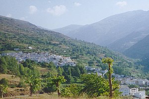
Trevélez
Municipality in Andalusia, Spain
Distance: Approx. 9968 meters
Latitude and longitude: 37,-3.26666667
Trevélez (pronounced [tɾeˈβeleθ]) is a village in the province of Granada, Spain. Its population in 2011 was estimated at 823. The river Trevélez flows through the village.
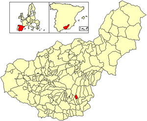
Juviles
Municipality in Andalusia, Spain
Distance: Approx. 2845 meters
Latitude and longitude: 36.95,-3.21666667
Juviles is a village and municipality in the central Alpujarras, in the province of Granada in Spain. The village is located at 36° 57' north and 3° 13' east, and stands at an altitude of 1,255 metres, on the road from Trevélez to Ugíjar. The municipality has an area of 12 square km, and its population in 2003 was estimated at 160.
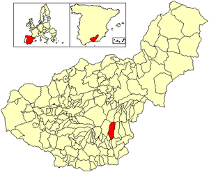
Bérchules
Municipality in Andalusia, Spain
Distance: Approx. 4152 meters
Latitude and longitude: 36.96666667,-3.18333333
Bérchules is a village and municipality in the central Alpujarra, in the province of Granada in Spain. The origins of the village are Arab. There are two villages in the municipality, Bérchules (36° 58' north and 3° 11' east, elevation 1350 metres), and Alcútar (36° 58' north and 3° 11' east, elevation 1250 metres).
Almegíjar
Place in Andalusia, Spain
Distance: Approx. 9892 meters
Latitude and longitude: 36.9,-3.3
Almegíjar is a Spanish village and municipality located in the province of Granada, Andalusia. According to the 2005 census (INE), it has a population of 435 inhabitants.
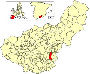
Alpujarra de la Sierra
Municipality in Granada, Spain
Distance: Approx. 4077 meters
Latitude and longitude: 36.93333333,-3.15
Alpujarra de la Sierra is a municipality located in the province of Granada, Spain. According to the 2007 census (INE), the city has a population of 1,168 inhabitants.
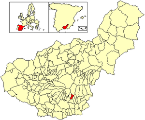
Busquístar
Place in Granada, Spain
Distance: Approx. 9286 meters
Latitude and longitude: 36.93333333,-3.3
Busquístar is a small community located in the province of Granada, Spain. It is located in a region called The Alpujarras. According to the 2013 census (INE), the city has a population of 265 inhabitants.

Cádiar
Place in Granada, Spain
Distance: Approx. 2600 meters
Latitude and longitude: 36.93333333,-3.16666667
Cádiar is a town located in the province of Granada, Spain. According to the 2005 census (INE), the city has a population of 1601 inhabitants. It borders the municipalities of Lobras, Bérchules, Alpujarra de la Sierra, Ugíjar, Murtas and Albondón.
Cástaras
Place in Granada, Spain
Distance: Approx. 4841 meters
Latitude and longitude: 36.93333333,-3.25
Cástaras is a municipality located in the province of Granada, Spain. According to the 2005 census (INE), the city has a population of 251 inhabitants.

Lobras
City in Granada, Spain
Distance: Approx. 482 meters
Latitude and longitude: 36.93333333,-3.2
Lobras is a municipality located in the province of Granada, Spain. According to the 2005 census (INE), the city has a population of 126 inhabitants.
Jorairatar
Distance: Approx. 7864 meters
Latitude and longitude: 36.92586,-3.10754
Jorairátar is a village of the Southern Alpujarras in the autonomous community of Andalusia, Spain. It is located within the municipality of Ugíjar in the Province of Granada.

Yegen
Distance: Approx. 9152 meters
Latitude and longitude: 36.98333333,-3.11666667
Yegen is a village of the municipality of Alpujarra de la Sierra in the province of Granada. The village was the home of the British writer Gerald Brenan in the 1920s, and he described its customs in South from Granada, one of his best-known books. Brenan stated in the book that he chose Yegen (at the time with no paved road connection or public transport) because of its favourable geography, including abundant water.
Weather in this IP's area
overcast clouds
10 Celsius
9 Celsius
10 Celsius
10 Celsius
1025 hPa
69 %
1025 hPa
879 hPa
10000 meters
1.82 m/s
2.43 m/s
183 degree
100 %

