185.203.158.86 - IP Lookup: Free IP Address Lookup, Postal Code Lookup, IP Location Lookup, IP ASN, Public IP
Country:
Region:
City:
Location:
Time Zone:
Postal Code:
ISP:
ASN:
language:
User-Agent:
Proxy IP:
Blacklist:
IP information under different IP Channel
ip-api
Country
Region
City
ASN
Time Zone
ISP
Blacklist
Proxy
Latitude
Longitude
Postal
Route
db-ip
Country
Region
City
ASN
Time Zone
ISP
Blacklist
Proxy
Latitude
Longitude
Postal
Route
IPinfo
Country
Region
City
ASN
Time Zone
ISP
Blacklist
Proxy
Latitude
Longitude
Postal
Route
IP2Location
185.203.158.86Country
Region
stredocesky kraj
City
brod
Time Zone
Europe/Prague
ISP
Language
User-Agent
Latitude
Longitude
Postal
ipdata
Country
Region
City
ASN
Time Zone
ISP
Blacklist
Proxy
Latitude
Longitude
Postal
Route
Popular places and events near this IP address

Příbram
Town in Central Bohemian, Czech Republic
Distance: Approx. 3072 meters
Latitude and longitude: 49.68833333,14.00916667
Příbram (Czech pronunciation: [ˈpr̝̊iːbram]; German: Pribram or Przibram) is a town in the Central Bohemian Region of the Czech Republic. It has about 33,000 inhabitants. It is known for its mining history, and more recently, its new venture into economic restructuring.
FK Příbram
Czech professional football club
Distance: Approx. 3233 meters
Latitude and longitude: 49.67694444,13.97638889
FK Příbram is a Czech professional football club based in Příbram. The club currently plays in the Czech National Football League (2nd tier). It is the legal successor to Dukla Prague, a club which won 11 national league titles between 1953 and 1982.

Na Litavce
Distance: Approx. 3233 meters
Latitude and longitude: 49.67694444,13.97638889
Na Litavce is a football stadium in Příbram, Czech Republic. It is currently used as the home ground of FK Příbram. The stadium holds 9,100 people.
Mining Museum Příbram
Museum in Czech Republic
Distance: Approx. 3080 meters
Latitude and longitude: 49.68285,13.987775
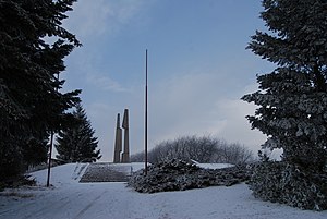
Mining Museum Příbram (Czech: Hornické muzeum Příbram) is a large open-air museum of mining with historical buildings and expositions of mining history and mineralogy. It is located in Příbram's Březové Hory quarter, former important Czech mining centre. It is one of the biggest museums in the Czech Republic.

Battle of Slivice
Battle
Distance: Approx. 3103 meters
Latitude and longitude: 49.64333333,14.04722222
The Battle of Slivice (Czech: Bitva u Slivice) was the last large World War II battle in the area of the Czech lands. During 11–12 May 1945, German troops, trying to surrender to nearby American troops rather than the USSR, defended themselves against local partisans and the Red Army. The Germans eventually capitulated during early hours of May 12.
Háje (Příbram District)
Municipality in Central Bohemian, Czech Republic
Distance: Approx. 2765 meters
Latitude and longitude: 49.67277778,14.0475
Háje is a municipality and village in Příbram District in the Central Bohemian Region of the Czech Republic. It has about 600 inhabitants.

Lešetice
Municipality in Central Bohemian, Czech Republic
Distance: Approx. 1611 meters
Latitude and longitude: 49.64722222,14.02111111
Lešetice is a municipality and village in Příbram District in the Central Bohemian Region of the Czech Republic. It has about 200 inhabitants.

Milín
Municipality in Central Bohemian, Czech Republic
Distance: Approx. 3977 meters
Latitude and longitude: 49.63194444,14.04611111
Milín is a municipality and village in Příbram District in the Central Bohemian Region of the Czech Republic. It has about 2,200 inhabitants.
Narysov
Municipality in Central Bohemian, Czech Republic
Distance: Approx. 3818 meters
Latitude and longitude: 49.64083333,13.97083333
Narysov is a municipality and village in Příbram District in the Central Bohemian Region of the Czech Republic. It has about 300 inhabitants.
Podlesí (Příbram District)
Municipality in Central Bohemian, Czech Republic
Distance: Approx. 3995 meters
Latitude and longitude: 49.69027778,13.98194444
Podlesí is a municipality and village in Příbram District in the Central Bohemian Region of the Czech Republic. It has about 1,100 inhabitants.

Březové Hory
Town part in Central Bohemian, Czech Republic
Distance: Approx. 3492 meters
Latitude and longitude: 49.68833333,13.99027778
Příbram VI-Březové Hory (until 1953 Březové Hory; German: Birkenberg) is a town part of Příbram in the Central Bohemian Region of the Czech Republic. Until 1953, it was a separate town. It is known as a former royal mining town.
Ševčiny mine
Mine in Central Bohemia Region, Czech Republic
Distance: Approx. 3135 meters
Latitude and longitude: 49.68305556,13.98694444
The Ševčiny mine (Czech: Ševčinský důl, also důl Ševčiny or šachta císaře Františka Josefa I or francšachta) is a retired silver and lead ore mine at Březové Hory, Czech republic. Today the mine is a Czech national monument and is managed by the Mining Museum Příbram. The mine was given its name according to the Ševčiny vein, which was one of the most important veins in the mineral district Březové Hory.
Weather in this IP's area
overcast clouds
-2 Celsius
-2 Celsius
-4 Celsius
-2 Celsius
1030 hPa
85 %
1030 hPa
966 hPa
10000 meters
1.3 m/s
1.32 m/s
114 degree
85 %


