185.201.167.167 - IP Lookup: Free IP Address Lookup, Postal Code Lookup, IP Location Lookup, IP ASN, Public IP
Country:
Region:
City:
Location:
Time Zone:
Postal Code:
IP information under different IP Channel
ip-api
Country
Region
City
ASN
Time Zone
ISP
Blacklist
Proxy
Latitude
Longitude
Postal
Route
Luminati
Country
ASN
Time Zone
Europe/London
ISP
CSL (DualCom) Limited
Latitude
Longitude
Postal
IPinfo
Country
Region
City
ASN
Time Zone
ISP
Blacklist
Proxy
Latitude
Longitude
Postal
Route
IP2Location
185.201.167.167Country
Region
england
City
harefield
Time Zone
Europe/London
ISP
Language
User-Agent
Latitude
Longitude
Postal
db-ip
Country
Region
City
ASN
Time Zone
ISP
Blacklist
Proxy
Latitude
Longitude
Postal
Route
ipdata
Country
Region
City
ASN
Time Zone
ISP
Blacklist
Proxy
Latitude
Longitude
Postal
Route
Popular places and events near this IP address
Harefield
Village in Hillingdon, London, England
Distance: Approx. 527 meters
Latitude and longitude: 51.6034,-0.478
Harefield is a village in the London Borough of Hillingdon, England, 17 miles (27 km) northwest of Charing Cross near Greater London's boundary with Buckinghamshire to the west and Hertfordshire to the north. The population at the 2011 Census was 7,399. Harefield is the westernmost settlement in Greater London, and lies outside the capital's contiguous built-up area.
Denham Film Studios
British film studio
Distance: Approx. 2029 meters
Latitude and longitude: 51.584569,-0.498902
Denham Film Studios (later dubbed Anvil Studios) was a British film production studio operating from 1936 to 1952, founded by Alexander Korda, in Buckinghamshire. Notable films made at Denham include Brief Encounter and David Lean's Great Expectations. From the 1950s to the 1970s the studio became best known for recording film music, including the scores for Alfred Hitchcock's Vertigo, Chitty Chitty Bang Bang, and Star Wars.
Harefield United F.C.
Association football club in England
Distance: Approx. 475 meters
Latitude and longitude: 51.60111111,-0.47666667
Harefield United Football Club are an English football club based in Harefield in the London Borough of Hillingdon. The club is the oldest in Middlesex. The club is affiliated to the Middlesex County Football Association.

Harefield Hospital
Hospital in England
Distance: Approx. 780 meters
Latitude and longitude: 51.607,-0.483
Harefield Hospital is a health institution in Harefield, London Borough of Hillingdon, England. It is managed by the Guy's and St Thomas' NHS Foundation Trust.

Old Park Wood
Natural area in Greater London, England
Distance: Approx. 1222 meters
Latitude and longitude: 51.6108,-0.48648
Old Park Wood is a 16.7-hectare (41-acre) Site of Special Scientific Interest in Harefield in the London Borough of Hillingdon. The southeast part is an 8-hectare (20-acre) nature reserve owned and managed by the Hertfordshire and Middlesex Wildlife Trust. The site is ancient woodland which dates back to the Domesday Book.

Mid Colne Valley
Distance: Approx. 1075 meters
Latitude and longitude: 51.593,-0.494
Mid Colne Valley is a 132 hectare biological Site of Special Scientific Interest in Harefield in the London Borough of Hillingdon and Denham in South Buckinghamshire. Its main importance lies in its extensive diversity of birdlife in lakes in former gravel pits. The site is divided into three areas.
Harefield Pit
Site of Special Scientific Interest in Harefield, London
Distance: Approx. 291 meters
Latitude and longitude: 51.598,-0.486
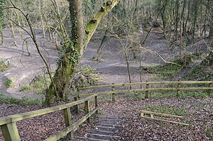
Harefield Pit is a 1.8-hectare geological Site of Special Scientific Interest in Harefield in the London Borough of Hillingdon. It occupies much of a partially filled-in chalk quarry. It has two entries in the Geological Conservation Review database.
Harefield Academy
Academy in Harefield, Greater London, England
Distance: Approx. 1032 meters
Latitude and longitude: 51.60672,-0.47302
Harefield School is a secondary school in Uxbridge, London. Located on the site of the former community school, John Penrose School, which closed on 31 August 2005, it reopened as an academy in 2005 and specialises in sports. Among other connections, Watford Football Club provides coaching there (the school serves as its youth system), and it also hosts an elite gymnastics division.
Dews Farm Sand Pits
Nature reserve in West London, England
Distance: Approx. 1903 meters
Latitude and longitude: 51.584,-0.4736
Dews Farm Sand Pits is a 1.2-hectare (3.0-acre) nature reserve near Harefield in the London Borough of Hillingdon. It is managed by the London Wildlife Trust, and is a Site of Borough Importance for Nature Conservation, Grade I. The site is an old quarry which has been reclaimed by nature. It has areas of woodland, dominated by pedunculate oak and ash.
Northmoor Hill Wood
Local nature reserve in Buckinghamshire, England
Distance: Approx. 1967 meters
Latitude and longitude: 51.5921,-0.50875
Northmoor Hill Wood is an 8.7 hectares (21 acres) Local Nature Reserve in Denham in Buckinghamshire. It is also of geological interest. The western area near the entrance has wet clay flora, with alder woodland, sedges, rushes, yellow archangel and star of Bethlehem orchids.

Colne Valley Viaduct
HS2 Railway Bridge in Harefield
Distance: Approx. 1637 meters
Latitude and longitude: 51.5859,-0.49
The Colne Valley Viaduct is a bridge, under construction as of 2024, which will carry the High Speed 2 railway over the Colne Valley Regional Park and the Grand Union Canal, in Hillingdon, west London. When completed, its length of 3.4 kilometres (2.1 mi) and a weight of 116,000 tonnes will make it the largest railway bridge in the UK. It is one of the largest single civil engineering works of HS2 Phase 1. A contract for the section of the railway pertaining to the viaduct was awarded during 2017 and the design concept was released to the public on 19 January 2018.
Uxbridge power station
Power station in London, England
Distance: Approx. 1150 meters
Latitude and longitude: 51.61,-0.4875
Uxbridge power station supplied electricity to the District of Uxbridge and the surrounding area from 1902 to 1962. The power station was built by the Uxbridge and District Electric Supply Company Limited which operated it until the nationalisation of the British electricity supply industry in 1948.
Weather in this IP's area
mist
2 Celsius
1 Celsius
1 Celsius
4 Celsius
1041 hPa
92 %
1041 hPa
1033 hPa
9000 meters
1.54 m/s
210 degree
100 %


