185.2.5.137 - IP Lookup: Free IP Address Lookup, Postal Code Lookup, IP Location Lookup, IP ASN, Public IP
Country:
Region:
City:
Location:
Time Zone:
Postal Code:
ISP:
ASN:
language:
User-Agent:
Proxy IP:
Blacklist:
IP information under different IP Channel
ip-api
Country
Region
City
ASN
Time Zone
ISP
Blacklist
Proxy
Latitude
Longitude
Postal
Route
db-ip
Country
Region
City
ASN
Time Zone
ISP
Blacklist
Proxy
Latitude
Longitude
Postal
Route
IPinfo
Country
Region
City
ASN
Time Zone
ISP
Blacklist
Proxy
Latitude
Longitude
Postal
Route
IP2Location
185.2.5.137Country
Region
toscana
City
sesto fiorentino
Time Zone
Europe/Rome
ISP
Language
User-Agent
Latitude
Longitude
Postal
ipdata
Country
Region
City
ASN
Time Zone
ISP
Blacklist
Proxy
Latitude
Longitude
Postal
Route
Popular places and events near this IP address

Sesto Fiorentino
Comune in Tuscany, Italy
Distance: Approx. 444 meters
Latitude and longitude: 43.83194444,11.19944444
Sesto Fiorentino (Italian pronunciation: [ˈsɛsto fjorenˈtiːno]), known locally as just Sesto, is a commune in the Metropolitan City of Florence, Tuscany, central Italy.

Chiesa dell'Autostrada del Sole, Campi Bisenzio
Roman Catholic church in Florence, Italy
Distance: Approx. 3088 meters
Latitude and longitude: 43.83166944,11.15694444
The Church of San Giovanni Battista or Chiesa dell'Autostrada del Sole is a church in Campi Bisenzio, near Florence, Italy, within a large motorway rest area shared between two autostrada roads. It can also be reached on foot from a local road outside the autostrada system. The church is formally named after John the Baptist but has also earned the name Church of the Freeway of the Sun for its location between autostrada del Sole (Freeway of the Sun) and the A11 Firenze-Mare highway.
Calenzano
Comune in Tuscany, Italy
Distance: Approx. 4251 meters
Latitude and longitude: 43.86666667,11.16666667
Calenzano (Italian pronunciation: [kalenˈdzaːno]) is a comune (municipality) in the Metropolitan City of Florence in the Italian region Tuscany, located about 11 kilometres (7 mi) northwest of Florence. As of 31 December 2004, it had a population of 15,557 and an area of 76.9 square kilometres (29.7 sq mi). Calenzano borders the following municipalities: Barberino di Mugello, Campi Bisenzio, Prato, San Piero a Sieve, Sesto Fiorentino, Vaglia, Vaiano.
Peretola
Village near Florence, Italy
Distance: Approx. 4176 meters
Latitude and longitude: 43.797,11.19657
Peretola is a suburb of Florence, Italy, located on the northern extremity of the Florentine commune. It belongs administratively to Quartiere 5 - Rifredi. It lends its name to the nearby international airport and is claimed as the birthplace of Amerigo Vespucci.

Villa di Castello
15th Century Italian villa
Distance: Approx. 3134 meters
Latitude and longitude: 43.81944722,11.22818333
The Villa di Castello, near the hills bordering Florence, Tuscany, central Italy, was the country residence of Cosimo I de' Medici, Grand Duke of Tuscany (1519-1574). The gardens, filled with fountains, statuary, and a grotto, became famous throughout Europe. The villa also housed some of the great art treasures of Florence, including Sandro Botticelli's Renaissance masterpieces The Birth of Venus and Primavera.
Villa La Petraia
Historic estate in Florence, Italy
Distance: Approx. 3637 meters
Latitude and longitude: 43.81828889,11.23451944
Villa La Petraia is one of the Medici villas in Castello, Florence, Tuscany, central Italy. It has a distinctive 19th-century belvedere on the upper east terrace on axis with the view of Florence.

Villa di Quarto
Historic Landmark Designated Villa in Florence, Italy
Distance: Approx. 4121 meters
Latitude and longitude: 43.81863889,11.24156389
The Villa di Quarto is a historic landmark designated villa on via Pietro Dazzi in Florence, in the hilly zone at the foot of the Monte Morello. Quarto (fourth) is one of the toponyms relating to the Roman milestones, the most famous of which in this area is Sesto Fiorentino, of 45,000 inhabitants.

Tomba della Mula
Tomb in Sesto Fiorentino, Italy
Distance: Approx. 1676 meters
Latitude and longitude: 43.82848889,11.21434167
The Tomba della Mula (Italian: "Tomb of the She-Mule") is a beehive tomb in Sesto Fiorentino, near Florence, Central Italy, dating to the 7th century BC. The name derives from an ancient legend, according to which a golden she-mule had been buried in the fields around Florence. It is known since the 15th century, and is the largest pre-Roman Italic dome tomb known in Italy. The structure has a diameter of some 9 m (30 ft) and contains vaulted roofs.
Villa Corsini a Castello
Distance: Approx. 3626 meters
Latitude and longitude: 43.81611667,11.23246389
Villa Corsini a Castello is a suburban villa near Florence, Italy, located in via della Petraia.

Air Littoral Flight 701A
1997 aviation accident
Distance: Approx. 3377 meters
Latitude and longitude: 43.80416667,11.19583333
On 30 July 1997, Air Littoral Flight 701A, an ATR 42 regional turboprop operating a scheduled passenger flight from Nice, France to Florence, Italy, crashed on landing when it ran off Florence Airport's runway and into a ditch next to a motorway embankment. There were no fatalities among the 14 passengers on board, but the cockpit section was severely damaged, and the captain died of his injuries four days later.

Villa La Zambra
Distance: Approx. 1517 meters
Latitude and longitude: 43.82808,11.21187
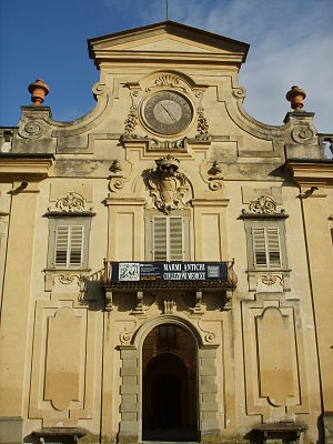
The Villa La Zambra', also known as Villa Bianchini is a Baroque style rural mansion, located on via Antonio Gramsci #522, just east of the center of Sesto Fiorentino, a commune in the Metropolitan City of Florence, region of Tuscany, Italy.
CERM
Research facility at the Uni. of Florence
Distance: Approx. 1419 meters
Latitude and longitude: 43.8218,11.1937
CERM (European Center for Magnetic Resonance, Italian: Centro Europeo di Risonanze Magnetiche) is a research facility at the University of Florence specialized in the application of NMR studies to biomolecules. It is a leading research center in Tuscany. The center was founded by Ivano Bertini and it is located at the Polo Scientifico (Scientific Campus) in Sesto Fiorentino.
Weather in this IP's area
fog
9 Celsius
9 Celsius
8 Celsius
11 Celsius
1018 hPa
94 %
1018 hPa
992 hPa
800 meters
1.03 m/s
40 %


